Table of Contents
1. Official Casualty Figures and District Breakdown
The death toll in the current wave of floods in Assam has risen to 97 following the confirmation of two more fatalities on 6 August 2026. According to the daily flood bulletin issued by the Assam State Disaster Management Authority (ASDMA), the fresh deaths were reported from Dhubri and Goalpara districts, taking the total loss of life since the onset of the monsoon season to nearly one hundred.
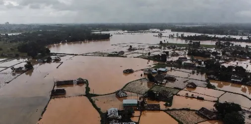
Inundated Brahmaputra Floodplain
Aerial view of flooded villages and submerged agricultural land across the Brahmaputra basin in Assam.
Goalpara & Dhubri Districts · Brahmaputra River Basin
2. Human and Agricultural Impact Across Affected Regions
The ASDMA report indicated that 1,68,200 people across 15 districts remain affected by floodwaters. The affected districts include Cachar, Chirang, Darrang, Dhemaji, Dhubri, Dibrugarh, Goalpara, Golaghat, Jorhat, Kamrup Metropolitan, Lakhimpur, Morigaon, Nagaon, Sivasagar and Tinsukia. Dhubri remains the worst-hit district with over 52,000 people affected, followed by Goalpara with around 34,000 and Cachar with over 21,000 affected residents.
The floodwaters have submerged 345 villages under 28 revenue circles. Large swathes of agricultural land also remain under water, with the ASDMA estimating that 8,420 hectares of crop area are currently inundated. Water levels in major rivers, including the Brahmaputra at Neamatighat in Jorhat and the Disang at Nanglamuraghat in Sivasagar, continue to flow above the danger mark, although a slow receding trend has been observed in some upper reach tributaries.
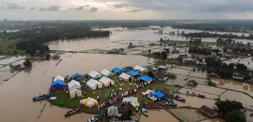
ASDMA Emergency Relief Camp Operations
Temporary relief shelters and food distribution camps operational in flood-affected districts of Assam.
Relief Camp Operations · ASDMA Emergency Response
3. Relief Measures and Institutional Response
In response to the situation, the state government has operationalised 83 relief camps and distribution centres across eight districts. Over 14,000 displaced persons are currently taking shelter in these camps, where food rations, drinking water, baby food and essential medical supplies are being provided by district administrations. National Disaster Response Force (NDRF), State Disaster Response Force (SDRF) and local administration teams remain deployed in vulnerable pockets to carry out rescue operations and distribute relief material.
4. Key Takeaways for Competitive Examination Aspirants
For competitive examination aspirants the developments are relevant under disaster management, geography of India, and current affairs. Questions frequently cover the causes of floods in the North-East, the role of the Assam State Disaster Management Authority, the impact on agriculture and infrastructure, and the institutional response in the form of relief camps and central assistance. The specific figures — death toll, number of districts, affected population, crop area submerged and number of relief camps — are useful for precise factual answers.
Verified Exam Data Points
- • Official Death Toll: 97 confirmed casualties.
- • Total Affected Population: Over 1,68,200 people across 15 districts.
- • Worst Affected District: Dhubri (52,000+ affected population).
- • Submerged Agricultural Land: 8,420 hectares of crop area.
- • Operational Relief Centers: 83 relief camps supporting over 14,000 displaced persons.