Home › Blog › Environment & Disasters › Assam Floods 2026
Assam Floods 2026: Rising Toll, Systemic Failure and What Lies Ahead
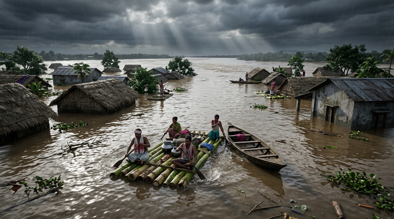
Every monsoon, Assam braces itself. The Brahmaputra and its tributaries swell, embankments strain, and lakhs of people watch their homes and fields disappear under muddy water. In 2026 the story has been particularly harsh. By late July the death toll had climbed to 68. Over five lakh people remained affected across several Upper Assam districts even as waters began to recede. Charaideo, Sivasagar and Jorhat bore the heaviest burden. Crop land running into tens of thousands of hectares lay submerged. Relief camps filled with the displaced.
This is not a new tragedy. It is a recurring one. The question that keeps returning is simple and uncomfortable: why does a state that has lived with floods for generations still face such scale of loss year after year? What exactly went wrong this time? What is the government, especially the Chief Minister, doing on the ground? And more importantly, what does the pattern of failure tell us about governance, ecology and our preparedness?
This piece tries to unpack the 2026 floods in full. It looks at the facts, the immediate triggers, the deeper structural problems, the political and economic fallout, the social cost, and the road that still remains open. The aim is not to assign blame for its own sake but to understand why the system continues to fall short and what serious solutions might look like.
Table of Contents
- 1. Background and Historical Context
- 2. What Exactly Happened in the 2026 Floods
- 3. Why It Happened: Immediate Causes and Triggers
- 4. The Political Dimension
- 5. Economic Costs and Livelihood Shock
- 6. Social and Cultural Impact
- 7. Environmental and Ecological Factors
- 8. Government Response and the Chief Minister’s Stand
- 9. Criticism, Counter-Arguments and Systemic Failures
- 10. Way Forward and Lessons for Competitive Exams
- 11. Aspect Comparison & Must-Remember Points
1. Background and Historical Context
Assam’s relationship with floods is older than modern India. The Brahmaputra, one of the world’s most sediment-heavy rivers, has always shaped the valley’s geography, agriculture and settlement patterns. For centuries communities practised a form of living with the river rather than against it. Seasonal flooding brought fertile silt. Farmers adjusted crop cycles. Villages shifted when needed.
The modern story changed after the Great Assam Earthquake of 1950. The quake raised the riverbed dramatically in many stretches and altered drainage patterns. Large-scale embankment construction followed in the 1950s and 1960s. The Assam Embankment and Drainage Act of 1953-54 provided the legal framework. Thousands of kilometres of embankments were built. The intention was protection. The unintended consequence was a raised riverbed, trapped silt, and a false sense of security that encouraged denser settlement behind the embankments.
By the 1980s and 1990s the pattern of “levee effect” had become clear. When embankments held, people felt safe and invested more. When they breached, the damage was catastrophic. Official data over decades show that while the length of embankments grew, the economic damage from floods did not steadily decline. Major flood years—1954, 1962, 1988, 1998, 2004, 2012, 2022—kept returning with heavy human and material cost.
Climate change has added a new layer. Rainfall intensity has increased in short bursts. Upstream land-use changes in the hills of Arunachal and Nagaland have altered runoff. Wetlands that once acted as natural sponges have shrunk under pressure of agriculture, settlement and infrastructure. The result is a system that is both more fragile and more exposed.
2. What Exactly Happened in the 2026 Floods
According to successive bulletins of the Assam State Disaster Management Authority (ASDMA) in the last week of July 2026, the death toll from this year’s floods reached 68. Two more fatalities were reported from Charaideo on 26-27 July, taking the number from 66 to 68. No fresh deaths were recorded in the following 24 hours in some later updates, yet the figure stood at 68.
At the peak, more than seven lakh people across multiple districts were affected. By 27 July the number had come down to over 5.24 lakh people across five districts—Charaideo, Golaghat, Jorhat, Nagaon and Sivasagar. Charaideo remained the worst-hit with nearly 1.9 lakh people affected, followed by Sivasagar (over 1.5 lakh) and Jorhat (around 1.4 lakh). On 28 July the affected population further declined to approximately 4.45 lakh across six districts.
Around 763 villages were under water at one stage. Crop area damaged stood at roughly 48,742 hectares in late July reports, later revised downward as waters receded. Thousands of animals were washed away. Embankments, roads, bridges and power infrastructure suffered extensive damage.
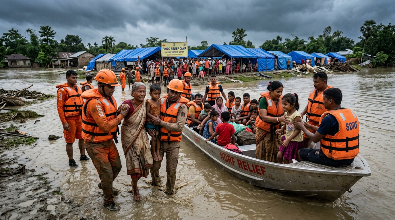
Relief operations involved the Army, NDRF, SDRF, Fire & Emergency Services and local administration. Hundreds of relief camps and distribution centres were opened. At one point over 37,000 people were staying in camps. The Indian Air Force conducted multiple sorties to drop relief packets in cut-off areas.
The floods were concentrated in Upper Assam, especially districts bordering Nagaland. Rivers such as the Dikhow, Disang and Dhansiri rose sharply. The Dhansiri (South) at Numaligarh remained above danger level even as other rivers began to fall.
3. Why It Happened: Immediate Causes and Triggers
The immediate trigger was extreme rainfall over a short period in mid-to-late July. Data cited by the Chief Minister and meteorological sources showed that parts of Nagaland recorded rainfall far above normal—Mokokchung as high as 493 per cent above normal, other districts also in triple-digit excess. Charaideo in Assam itself recorded around 436 per cent excess rainfall in the critical window.
The India Meteorological Department clarified that the event did not meet the strict technical definition of a cloudburst (more than 100 mm in one hour). It was, however, an extremely intense and concentrated spell of rain falling on already saturated soil. Three to four earlier rainfall episodes had left little absorption capacity. Almost all the new rain turned into rapid surface runoff.
Upstream factors amplified the impact. Large-scale deforestation and both legal and illegal mining in the Naga hills have reduced the land’s ability to hold water. River beds in several tributaries have risen due to silt and debris. Embankments designed decades ago faced pressure they were not always maintained to withstand. Drainage sluices meant to let water out of protected areas were either inadequate or blocked.
In short, an intense natural event met a landscape that had lost much of its natural resilience. The result was rapid, widespread inundation in districts that do not always face the worst of Brahmaputra flooding.
4. The Political Dimension
Floods in Assam are never only a natural disaster. They quickly become a political test. The ruling BJP government under Chief Minister Himanta Biswa Sarma faced the dual pressure of delivering immediate relief and explaining why the scale of damage remained high despite years of claims of better preparedness.
Opposition voices, including local MLAs from other parties, pointed to illegal mining along the Assam-Nagaland border, lack of timely inter-state coordination, and the condition of embankments. The Chief Minister rejected suggestions of water release from hydro projects and stuck to the excess rainfall explanation, backed by IMD clarification on the absence of a technical cloudburst.
At the same time the state BJP launched a visible relief initiative. The party aimed to collect Rs 12 crore from workers and supporters to provide traditional attire (mekhela-chador) to two lakh women and clothes to two lakh children in the worst-hit districts. The move was presented as solidarity. Critics saw it as an attempt to fill gaps in state capacity through party machinery.
Centrally, Union Home Minister Amit Shah had earlier reviewed the situation and assured support. A central team was reported to be assessing damage. The political narrative therefore moved between claims of efficient response and accusations of systemic neglect.
5. Economic Costs and Livelihood Shock
The economic impact is severe and multi-layered. Standing crops—mainly paddy—over tens of thousands of hectares were destroyed at a critical stage. For small and marginal farmers this means loss of the main seasonal income and the need for fresh seeds and credit. Livestock losses add another blow.
Infrastructure damage—roads, bridges, embankments, power lines, schools and health centres—will require substantial reconstruction spending. Power restoration itself became a major post-flood exercise, with teams conducting safety checks before phased restoration.
In the short term, daily wage labourers, small traders and those dependent on river transport face disrupted livelihoods. Relief kits (rice, dal, oil, salt) and later free seeds help, but they cannot fully replace lost assets. Longer-term, repeated floods discourage private investment in agriculture and small industry in vulnerable zones and push migration.
Nationally, Assam’s floods add to the growing bill of climate-related disasters. They also affect tea gardens and other commercial crops in some years, though the 2026 impact was more concentrated on food crops and rural households in Upper Assam.
6. Social and Cultural Impact
Floods disrupt more than economics. Schools and anganwadis remain closed or damaged, interrupting education. Health risks rise—water-borne diseases, snake bites, and mental stress among the displaced. Women and children in relief camps face particular challenges of privacy, safety and nutrition.
Culturally, the Assamese relationship with the river is deep. Many communities still speak of the Brahmaputra with a mix of reverence and fear. Repeated displacement erodes that traditional knowledge of living with the river and replaces it with dependence on state relief. Social networks that once helped families recover are stretched thin when entire villages are affected simultaneously.
In districts like Sivasagar and Charaideo, which are not always the worst-hit, the suddenness of the 2026 flooding left many unprepared. The psychological impact of watching homes and ancestral land disappear under water in a matter of hours is hard to quantify but real.
7. Environmental and Ecological Factors
The environmental story is central. Wetlands and beels that once stored excess water have shrunk. Forest cover in the catchment areas has declined. Unscientific mining creates pits that fill and then overflow. River channels are constrained by embankments and encroachment, so water has fewer places to spread safely.
Climate change is increasing the frequency of extreme rainfall events. The 2026 episode fits this pattern of short-duration, high-intensity rain. At the same time, the long-term silt load of the Brahmaputra system continues to raise bed levels in many stretches, reducing the carrying capacity of the river.
Any lasting solution must therefore combine structural measures with ecological restoration—protecting remaining wetlands, regulating mining, restoring degraded catchments, and designing embankments that work with rather than against natural drainage.
8. Government Response and the Chief Minister’s Stand
Chief Minister Himanta Biswa Sarma has been highly visible. He has conducted reviews, directed ministers to specific districts, and publicly updated the numbers. Once the peak passed, the emphasis shifted from rescue to rehabilitation. Ministers were to fan out after the Assembly session for sector-wise restoration—schools, health centres, rural infrastructure.
Family relief kits containing rice, dal, oil, salt and candles were distributed. The Agriculture department announced free paddy seeds and seedlings for affected farmers in the worst districts. Power restoration was prioritised with safety protocols. The Indian Air Force and Army remained engaged.
The Chief Minister also acknowledged that the death toll could still rise modestly but expressed confidence it would stay well below earlier worst-case fears of 100. He repeatedly stressed that every death is a loss and that the government was working day and night.
On the party side, the Rs 12 crore clothing drive was presented as additional support from the organisation. Whether this is seen as effective mobilisation or as an admission of state limitations depends on the political lens one uses.
9. Criticism, Counter-Arguments and Systemic Failures
Critics argue that the same problems recur because the underlying approach has not changed. Embankments receive attention after breaches rather than systematic, science-based maintenance and redesign. Inter-state coordination with Nagaland on catchment management remains weak. Early warning systems, despite satellite capability, still struggle to translate alerts into timely local action in remote areas.
Some point to the absence of a comprehensive basin-level plan that treats the Brahmaputra and its tributaries as one system rather than a collection of district problems. Others note that large sums spent over years on flood control have not produced matching reduction in vulnerability.
The counter-argument from the government side is that no state can fully control extreme rainfall events of the magnitude seen in 2026, that rescue and relief this time were faster and better coordinated than in the past, and that long-term projects (dredging, stronger embankments, better forecasting) are under way but take time.
Both sides contain elements of truth. The intensity of rainfall was exceptional. Yet the landscape’s reduced capacity to absorb and convey that water is the product of decades of decisions—or lack of them. Continuous failure is less about any single government’s intent and more about an institutional inability to move from reactive relief to proactive resilience.
10. Way Forward and Lessons for Competitive Exams
A realistic way forward has several layers.
First, strengthen real-time, location-specific early warning that reaches the last village through multiple channels, not only administrative hierarchies. Second, shift from pure embankment thinking to a mix of structural and non-structural measures—wetland restoration, regulated mining, community-based flood shelters, and livelihood diversification. Third, create genuine inter-state mechanisms with Nagaland and Arunachal on catchment management. Fourth, treat flood management as a continuous scientific exercise rather than an annual emergency.
Lessons for Aspirants (UPSC, State PCS, SSC & Banking):
Questions appear under disaster management, physical geography of India, environment, and current affairs. Key points to remember:
- 1950 Great Earthquake Impact: Raised Brahmaputra riverbeds and altered natural drainage.
- Assam Embankment & Drainage Act (1953-54): Provided legal framework for embankment construction.
- The Levee Effect: False sense of security driving settlement behind embankments, leading to catastrophic breach losses.
- Cloudburst vs. Intense Rain: Cloudburst requires >100 mm/hr rainfall in a localized area; 2026 event was high-volume concentrated rain on saturated soil.
- Institutional Bodies: Roles of ASDMA, NDRF, SDRF, and IAF in flood disaster relief.
11. Aspect Comparison & Must-Remember Points
| Aspect | Short-term Impact (2026) | Longer-term Structural Issue |
|---|---|---|
| Human cost | 68 deaths, 5+ lakh affected | Repeated displacement, loss of confidence |
| Agriculture | Tens of thousands of ha damaged | Rising risk, reduced investment |
| Infrastructure | Roads, power, embankments hit | Ageing network, maintenance gaps |
| Governance response | Active relief, party mobilisation | Reactive rather than preventive culture |
| Ecology | Rapid runoff, siltation | Degraded catchments, shrinking wetlands |
Quick Revision / Must Remember Points
- Death toll in Assam floods 2026: 68 (as of late July).
- Worst-hit districts: Charaideo, Sivasagar, Jorhat.
- Peak affected population: Over 7 lakh; later 5.24 lakh then ~4.45 lakh.
- Trigger: Extreme excess rainfall in Nagaland and Upper Assam (not technical cloudburst).
- CM response: Coordinated relief, minister-led rehabilitation, Rs 12 crore BJP clothing drive, free seeds.
- Core systemic problem: Embankment-centric approach + degraded catchments + weak inter-state coordination.
- Exam relevance: Disaster management, Brahmaputra geography, climate change, ASDMA role.
The 2026 floods have once again shown both the resilience of Assamese people and the limits of the systems meant to protect them. Waters will recede. Camps will empty. Fields will be replanted. Yet unless the deeper failures—ecological, institutional and inter-governmental—are addressed with honesty and continuity, the same story will return with the next heavy monsoon.
The river will keep flowing. The real test is whether the state and society can learn to live with it more wisely.
Stay Updated with Exam Notes & Current Affairs on RRBCONTENTS
Get comprehensive disaster management notes, geography maps, and daily current affairs updates.
Daily Current Affairs → Geography & Environment Notes →Join our official Telegram channel: @rrbcontents