DISASTER MANAGEMENT IN INDIA: DM ACT 2005, THREE-TIER STRUCTURE (NDMA, SDMA, DDMA), NDRF, BIS SEISMIC ZONES, CYCLONE EARLY WARNINGS & SENDAI FRAMEWORK (COMPLETE EXAM GUIDE)
Chapter 1
INTRODUCTION: WHY INDIA IS ONE OF THE MOST DISASTER-PRONE NATIONS
India occupies only 2.4% of the world's land area but is home to 18% of the world's population — and nearly every part of this population lives under the shadow of at least one natural hazard:
- 59% of India's land area is prone to moderate-to-severe earthquakes.
- 12% of land area (40 million hectares) is flood-prone.
- 68% of cultivable land is vulnerable to drought.
- 7,516 km coastline is exposed to tropical cyclones, storm surges, and tsunamis.
- 15% of land area is vulnerable to landslides.
Before 2005, India had no dedicated disaster management law. Relief operations were governed by the Bengal Relief Manual (colonial era) and fragmented state-level Acts. Disaster management was purely reactive — centered on post-disaster cash relief and ex-gratia payments. The catastrophic 2001 Bhuj Earthquake (Gujarat) — 20,000+ deaths and the 2004 Indian Ocean Tsunami — 10,000+ deaths in India alone forced a fundamental shift in national policy.
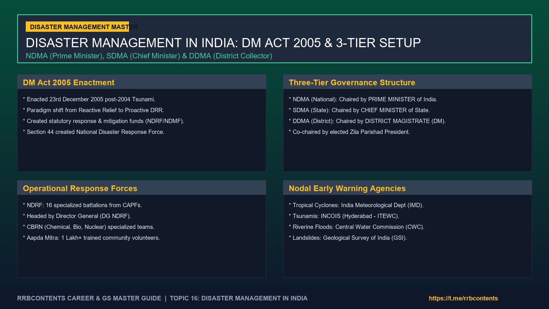
The result: the landmark Disaster Management Act, 2005 — enacted on 23rd December 2005 — which transformed India's approach from reactive relief to proactive Disaster Risk Reduction (DRR) through a statutory three-tier governance structure backed by dedicated funds and a trained professional force (NDRF).
---
Chapter 2
THE DISASTER MANAGEMENT ACT, 2005: KEY PROVISIONS
The DM Act 2005 has 79 Sections divided across XI Chapters. Key provisions include:
| Section | Provision |
|---|---|
| Section 3 | Establishes National Disaster Management Authority (NDMA) |
| Section 14 | Establishes State Disaster Management Authority (SDMA) |
| Section 25 | Establishes District Disaster Management Authority (DDMA) |
| Section 35 | Mandates National Disaster Management Plan (NDMP) preparation by NEC |
| Section 44 | Creates National Disaster Response Force (NDRF) |
| Section 46 | Establishes National Disaster Response Fund (NDRF Fund) |
| Section 47 | Establishes National Disaster Mitigation Fund (NDMF) |
| Section 48 | Mandates State Disaster Response Fund (SDRF) and State Disaster Mitigation Fund (SDMF) |
---
Chapter 3
THREE-TIER GOVERNANCE ARCHITECTURE
Chapter 4
# TIER 1 — National Level: National Disaster Management Authority (NDMA)
| Feature | Detail |
|---|---|
| Chairperson | Prime Minister of India (ex-officio) |
| Vice Chairperson | A person nominated by PM (usually Cabinet rank) |
| Members | Up to 9 members nominated by PM |
| Tenure | 5 years, or until age 72 (whichever earlier) |
| Functions | Lay down national policies & guidelines; approve NDMP; coordinate & monitor national DM across all 27 central ministries |
| Key Executive Organ | National Executive Committee (NEC) — chaired by Union Home Secretary — assists NDMA in discharge of its functions and prepares the NDMP |
---
Chapter 5
# TIER 2 — State Level: State Disaster Management Authority (SDMA)
| Feature | Detail |
|---|---|
| Chairperson | Chief Minister of the State (ex-officio) |
| Vice Chairperson | Nominated by CM |
| Members | Up to 9 members nominated by CM |
| Functions | Approve State DM Plan; coordinate all DM activities within state; recommend SDRF allocation; lay down guidelines for state agencies |
| Executive Organ | State Executive Committee (SEC) — chaired by Chief Secretary of the State |
---
Chapter 6
# TIER 3 — District Level: District Disaster Management Authority (DDMA)
| Feature | Detail |
|---|---|
| Chairperson | District Magistrate (DM) / Collector (ex-officio) |
| Co-Chairperson | Elected Zila Parishad President (key democratic element — ensures community representation) |
| Members | Superintendent of Police (SP), Chief Medical Officer (CMO), District Planning Officer |
| Functions | Primary field-level execution; prepare District Disaster Management Plan (DDMP); maintain disaster resource inventories; conduct community mock drills |
Critical Exam Distinction: DDMA is unique because it has a statutory elected representative (Zila Parishad President) as Co-Chair — linking professional administration with democratic local governance.
---
Chapter 7
NATIONAL DISASTER RESPONSE FORCE (NDRF): INDIA'S SPECIALIZED RESCUE FORCE
Chapter 8
# Legal Basis & Structure:
- Created under: Section 44 of DM Act 2005.
- Headed by: Director General (DG) — an IPS officer of DGP rank.
- Composition: 16 Battalions (expanded from original 8) drawn from Central Armed Police Forces:
- 4 battalions each from BSF and CRPF
- 2 battalions each from CISF, ITBP, and SSB
- Specialization: NDRF battalions are trained in:
Chapter 9
1. Urban Search & Rescue (USAR) — collapse structure rescue with acoustic victims locators
Chapter 10
2. Flood rescue with motorized rubber boats and flood rescue suits
Chapter 11
3. CBRN (Chemical, Biological, Radiological, Nuclear) emergency response with Hazmat suits
Chapter 12
4. Medical first response and community triage
Chapter 13
5. Canine (dog) search squads for locating buried survivors under rubble
Chapter 14
# NDRF International Humanitarian Operations:
- Operation Maitri (2015): Nepal Earthquake — largest HADR operation in NDRF history.
- Operation Dost (2023): Turkey-Syria Earthquake — NDRF teams deployed within 24 hours of earthquake.
- Japan Tsunami Assistance (2011): Early international capacity building cooperation.
Chapter 15
# Aapda Mitra Scheme:
NDMA's community volunteer program training 1 Lakh+ Aapda Mitras across 350+ disaster-prone districts. Each volunteer receives a standardized Emergency Kit (life jacket, torch, first aid, ropes) and personal accident insurance.
---
Chapter 16
DISASTER RISK FINANCING: NDRF FUND & SDRF FUND
Understanding the financial architecture is critical for exams:
Disaster Financing Architecture Under DM Act 2005
├── National Level Response: National Disaster Response Fund (NDRF Fund) — Section 46
├── National Level Mitigation: National Disaster Mitigation Fund (NDMF) — Section 47
├── State Level Response: State Disaster Response Fund (SDRF) — Section 48(1)(a)
└── State Level Mitigation: State Disaster Mitigation Fund (SDMF) — Section 48(1)(b)
Chapter 17
# SDRF Funding Pattern (Central:State Share):
- General Category States: 75% Central : 25% State
- Himalayan & North-Eastern States: 90% Central : 10% State
Chapter 18
# NDRF Fund Source:
Financed through the National Calamity Contingency Duty (NCCD) — a cess levied on tobacco, mobile phones, motor vehicles, and coal.
Chapter 19
# Subhash Chandra Bose Aapda Prabandhan Puraskar:
Annual national disaster management award announced on 23rd January (Netaji's birth anniversary):
- Institution: ₹51 Lakhs + Certificate
- Individual: ₹5 Lakhs + Certificate
---
Chapter 20
MAJOR NATURAL HAZARD PROFILES: CAUSES, PATTERNS & MANAGEMENT
Chapter 21
# 1. EARTHQUAKES — BIS SEISMIC ZONING MAP
The Bureau of Indian Standards (BIS) classifies India into 4 Seismic Zones based on Modified Mercalli Scale (MSK) intensity:
| Zone | Risk Level | MSK Intensity | States/Regions | Exam-Critical Feature |
|---|---|---|---|---|
| Zone V | Very High | IX and above | Entire North-East, J&K, Ladakh, Himachal Pradesh, Uttarakhand, Rann of Kutch (Gujarat), North Bihar, Andaman & Nicobar | Highest risk — Entire NE India |
| Zone IV | High | VIII | Delhi-NCR, Jammu, Sikkim, North UP, North Bihar, Koyna (Maharashtra), West Bengal hills | Delhi is Zone IV — not Zone V |
| Zone III | Moderate | VII | Kerala, Goa, Lakshadweep, Chennai, Mumbai, Kolkata, Central India plateau | Major metros in Zone III |
| Zone II | Low | VI and below | Stable Deccan Plateau (Remaining South India) | Most stable zone |
Mnemonic for Zone V: NE-JLH-KB-AN = North-East + J&K + Ladakh + Himachal + Uttarakhand + Kutch + Bihar (North) + Andaman & Nicobar
Why Koyna (Maharashtra) is in Zone IV: The 1967 Koyna Earthquake (M 6.3) — one of India's worst reservoir-induced seismicity events — killed 177 people. The region remains seismically sensitive.
Chapter 22
# National Building Code (NBC 2016) & Earthquake Resistance:
Under BIS IS 1893 specifications, buildings in Zones IV and V must incorporate:
- Base isolation systems (rubber/lead isolators absorb seismic energy)
- Ductile detailing in reinforced concrete columns and beams
- Shear walls to resist lateral earthquake loads
---
Chapter 23
# 2. TROPICAL CYCLONES — IMD & INCOIS EARLY WARNING NETWORK
Bay of Bengal vs Arabian Sea Cyclone Statistics:
- The Bay of Bengal generates approximately 4 times more cyclones than the Arabian Sea because:
Chapter 24
1. Bay of Bengal maintains higher sustained Sea Surface Temperatures (SST >27°C) over a longer period.
Chapter 25
2. Shallow, enclosed geometry of Bay amplifies storm surge height.
Chapter 26
3. Greater frequency of low-pressure depressions moving from the Pacific.
India Meteorological Department (IMD) 7-Stage Cyclone Warning System:
| Stage | Bulletin Name | Time Before Landfall | Flag Color |
|---|---|---|---|
| 1 | Pre-Cyclone Watch | 72 hours | Yellow |
| 2 | Cyclone Alert | 48 hours | Orange |
| 3 | Cyclone Warning | 24 hours | Red |
| 4 | Post-Landfall Outlook | After landfall | - |
INCOIS (Indian National Centre for Ocean Information Services), Hyderabad:
- Operates Indian Tsunami Early Warning Centre (ITEWC) — issues tsunami warnings within 10 minutes of an undersea earthquake using Bottom Pressure Recorders (BPR) and tide gauge networks.
- Also provides daily Ocean State Forecasts (wave height, sea surface temperature) used by Indian fishermen.
National Cyclone Risk Mitigation Project (NCRMP):
World Bank-assisted project constructing multipurpose cyclone shelters, coastal embankments, and early warning towers along East and West coasts. Odisha's model of Zero Casualty Mission during Cyclone Fani (2019) — evacuating 1.2 million people in 48 hours — was internationally recognized.
Doppler Weather Radars (DWR):
IMD operates 35+ Doppler Weather Radars along India's coastline providing 400 km radius real-time precipitation and wind speed monitoring.
---
Chapter 27
# 3. FLOODS — CENTRAL WATER COMMISSION & URBAN FLOODING
Flood-Prone River Basins:
- Brahmaputra Basin (Assam): Annual flooding affecting over 3 lakh hectares due to high silt load and glacial meltwater.
- Kosi River ("Sorrow of Bihar"): Notorious for frequent course changes, flooding the North Bihar plains annually.
- Damodar River: Historically called "River of Sorrow" for West Bengal floods before Damodar Valley Corporation.
Central Water Commission (CWC):
- Nodal agency for flood forecasting under Ministry of Jal Shakti.
- Operates CWC FloodWatch App — provides 7-day advance flood forecasts from 300+ river monitoring stations using satellite telemetry.
- IFLOWS-Mumbai and IFLOWS-Chennai: Urban flood inundation decision support systems providing 3-day advance localized waterlogging warnings.
Urban Flooding Causes:
Urban flooding (Mumbai 2005, Chennai 2015, Bengaluru 2022) results from:
Chapter 28
1. Encroachment and concretization of natural drainage channels and lakes.
Chapter 29
2. Insufficient storm-water drain capacity for extreme rainfall events.
Chapter 30
3. Unsustainable solid waste disposal blocking drains.
---
Chapter 31
# 4. LANDSLIDES & GLACIAL LAKE OUTBURST FLOODS (GLOF)
Geological Survey of India (GSI) — Nodal Agency:
- GSI completed National Landslide Susceptibility Mapping (NLSM) at 1:50,000 scale across 4.3 lakh sq km.
- Piloted Landslide Early Warning System (LEWS) in Darjeeling (West Bengal) and Nilgiris (Tamil Nadu) — integrating rainfall threshold sensors with SMS-based public alerts.
GLOF (Glacial Lake Outburst Flood):
Rapid global warming is accelerating Himalayan glacier retreat, forming unstable moraine-dammed glacial lakes. When the moraine dam fails suddenly (triggered by ice-fall, earthquake, or heavy rain), catastrophic volumes of water are released causing downstream flash floods.
- Chamoli Disaster (2021): A rock/glacier avalanche triggered a massive GLOF in Uttarakhand's Rishiganga-Dhauliganga valley, destroying two hydro projects and killing 200+ people.
- Sikkim GLOF (2023): South Lhonak Lake outburst flooded the Teesta River valley, destroying the Teesta-III dam and killing 50+ people.
DRDO DGRE (Defence Geoinformatics Research Establishment):
Issues daily avalanche warnings and conducts artificial avalanche triggering (using explosives or artillery shells) for strategic high-altitude passes in J&K, Ladakh, and Himachal Pradesh.
---
Chapter 32
# 5. DROUGHTS & HEATWAVES
Drought Classification:
The India Meteorological Department (IMD) classifies droughts based on rainfall deficiency:
- Moderate Drought: Rainfall deficiency of 26–50% below normal.
- Severe Drought: Rainfall deficiency of >50% below normal.
National Heat Wave Action Plan (NDMA Guidelines):
- NDMA guidelines mandate state Heat Action Plans (HAPs) with color-coded alert thresholds (Yellow/Orange/Red based on temperature).
- Ahmedabad Heat Action Plan (HAP, 2013): South Asia's first city-level heat action plan — credited with reducing heat-mortality by 30%. Uses cool-roof reflective coatings on informal housing.
Damini Lightning App (IITM Pune):
Developed by Indian Institute of Tropical Meteorology, Pune — provides 15-minute advance lightning strike location alerts within 20 km radius, protecting farmers in lightning-prone districts.
---
Chapter 33
THE SENDAI FRAMEWORK FOR DISASTER RISK REDUCTION (2015–2030)
Adopted at the 3rd UN World Conference on DRR in Sendai, Japan (18–22 March 2015), replacing the Hyogo Framework for Action (HFA 2005–2015):
Chapter 34
# 4 Priorities for Action:
1. Understanding Disaster Risk — investing in data, research, and early warning.
2. Strengthening Disaster Risk Governance — integrating DRR into all sectors (health, education, finance, urban planning).
3. Investing in DRR for Resilience — financing structural mitigation projects.
4. Enhancing Disaster Preparedness — applying "Build Back Better" (BBB) in post-disaster recovery.
Chapter 35
# 7 Global Targets (by 2030 vs 2005–2015 baseline):
Chapter 36
1. Substantially reduce global disaster mortality.
Chapter 37
2. Reduce affected population numbers.
Chapter 38
3. Reduce direct economic losses relative to GDP.
Chapter 39
4. Reduce damage to critical infrastructure (health, education).
Chapter 40
5. Increase number of countries with national/local DRR strategies.
Chapter 41
6. Substantially enhance international cooperation.
Chapter 42
7. Increase availability of early warning systems to people.
Chapter 43
# Key Paradigm Shift:
- Hyogo Framework (2005–2015): Focused on disaster response.
- Sendai Framework (2015–2030): Focused on disaster risk reduction, resilience, and Build Back Better.
---
Chapter 44
INDIA'S GLOBAL LEADERSHIP IN DISASTER RISK REDUCTION
Chapter 45
# Coalition for Disaster Resilient Infrastructure (CDRI):
- Launched: September 2019 at UN Climate Action Summit by PM Narendra Modi.
- Headquarters: New Delhi.
- Mission: Promote resilience of new and existing infrastructure systems to climate and disaster risks.
- Membership: 40+ countries (G20, G7 nations, Pacific Island states).
- IRIS Initiative: Infrastructure for Resilient Island States — provides dedicated technical and financial support to Small Island Developing States (SIDS) facing existential climate threats.
Chapter 46
# PM Narendra Modi's 10-Point Agenda on DRR (2016):
Announced at the Asian Ministerial Conference on DRR (AMCDRR, New Delhi, 2016), emphasizing:
- Integrating DRR into development planning
- Women leadership in disaster management
- Leveraging traditional and local knowledge
- School curriculum on risk management
---
Chapter 47
IMPORTANT INSTITUTIONAL TECH TOOLS & SYSTEMS
| Tool / System | Implementing Agency | Purpose |
|---|---|---|
| India Disaster Resource Network (IDRN) | NDMA | Web portal for real-time inventory of emergency equipment, machinery, and trained personnel across all districts |
| Dam Safety Act 2021 | Central Water Commission | Statutory framework for surveillance of 5,300+ large dams to prevent dam break floods |
| MODIS/VIIRS Forest Fire Alerts | Forest Survey of India (FSI) | Real-time satellite fire detection SMS alerts to forest range officers |
| FloodWatch App | Central Water Commission (CWC) | 7-day advance flood forecast from 300+ monitoring stations |
| Damini App | IITM Pune | 15-minute advance lightning strike location alerts |
| Common Alerting Protocol (CAP) Cell Broadcast | DoT & NDMA | Geo-targeted emergency audio-visual alert directly to citizens' mobile phones |
---
Chapter 48
ADDITIONAL DISASTER RISK REDUCTION INSIGHTS & CASE STUDIES
---
Chapter 49
# 1. RECENT MAJOR DISASTER CASE STUDIES & LESSONS LEARNED
Exam questions frequently ask for specific Indian disaster case studies and operational responses:
| Event | Year | Region | Cause & Impact | Governance & Response Mechanism |
|---|---|---|---|---|
| Cyclone Fani | 2019 | Odisha Coast | Category 4 Extremely Severe Cyclonic Storm; 180 km/h winds | Zero Casualty Mission: Evacuated 1.2 million people in 48 hours into 800+ multipurpose cyclone shelters. Internationally praised by UN-ISDR as a benchmark in early warning and evacuation. |
| Chamoli Disaster | 2021 | Uttarakhand | Rock and ice avalanche triggering Glacial Lake Outburst Flood (GLOF) in Rishiganga valley | Destroyed Rishiganga and Tapovan-Vishnugad hydro projects. NDRF deployed USAR and thermal camera locators. Highlighted need for real-time monitoring of high-altitude Himalayan glacial lakes. |
| Sikkim Teesta GLOF | 2023 | Sikkim | South Lhonak Lake burst releasing 70 million cubic meters of water | Breached Teesta III Dam at Chungthang, destroying downstream bridges and NH-10. Prompted CWC and ISRO to expand satellite lake level telemetry. |
| Kerala Floods | 2018 | Western Ghats (Kerala) | Extremely heavy monsoon rainfall (30% above normal) causing 35 major dams to open simultaneously | Community Fishermen Response ("Army of Kerala"): Local fishermen deployed 600+ motor boats, saving 65,000+ marooned citizens alongside NDRF and Armed Forces. |
| Wayanad Landslides | 2024 | Kerala (Wayanad) | Triggered by 572 mm rainfall in 48 hours on steep degraded slopes | Debris flows destroyed Meppadi region villages. Army's Madras Sappers constructed a 190-ft Bailey Bridge at Chooralmala within 31 hours to enable heavy rescue machinery movement. |
---
Chapter 50
# 2. DISASTER MITIGATION SCHEMES & NATIONAL POLICY INITIATIVES
| Policy / Scheme | Nodal Ministry / Agency | Key Provisions & Targets |
|---|---|---|
| National Disaster Mitigation Fund (NDMF) | Ministry of Home Affairs | Created under Section 47 of DM Act 2005. Provides dedicated funding for non-structural and structural mitigation projects (e.g., river embankment stabilization, seismic retrofitting of public hospitals). |
| National Cyclone Risk Mitigation Project (NCRMP) | NDMA & World Bank | Phase I & II project covering 13 coastal States/UTs. Constructed 1,200+ Multipurpose Cyclone Shelters (MPCS), 2,000 km of underground cabling, and early warning towers. |
| National Building Code (NBC 2016) | Bureau of Indian Standards (BIS) | Mandates structural safety guidelines for wind loads (IS 875) and earthquake loads (IS 1893). Enforces compulsory structural safety certification for high-rise buildings before occupancy permit issuance. |
| School Disaster Management Plan (SDMP) | Ministry of Education & NDMA | Mandates biannual evacuation mock drills, structural fire audits, and student safety committees across all government and private schools in India. |
---
Chapter 51
# 3. INDUSTRIAL & TECHNOLOGICAL DISASTER RISKS IN INDIA
Apart from natural hazards, India faces significant chemical, biological, radiological, and nuclear (CBRN) hazards:
- Bhopal Gas Tragedy (1984): Lethal release of Methyl Isocyanate (MIC) gas from Union Carbide plant. Triggered the enactment of the Environment Protection Act, 1986 and the Public Liability Insurance Act, 1991.
- Vizag LG Polymers Styrene Gas Leak (2020): Tank temperature failure released hazardous styrene gas in Andhra Pradesh, causing 12 fatalities. Emphasized statutory compliance with Manufacture, Storage and Import of Hazardous Chemical (MSIHC) Rules 1989.
- Radiological Preparedness: BARC (Bhabha Atomic Research Centre) and AERB (Atomic Energy Regulatory Board) maintain Off-site Emergency Response Plans around all 7 operational nuclear power plants in India (e.g., Kudankulam, Tarapur, Rawatbhata).
---
Chapter 52
# 4. SUMMARY MATRIX OF TECHNICAL RESPONSIBILITIES FOR EXAMS
| Hazard | Primary Nodal Monitoring Agency | Early Warning / Tech Platform |
|---|---|---|
| Earthquakes | National Centre for Seismology (NCS), Ministry of Earth Sciences | Seismograph network & BIS IS 1893 zonation |
| Cyclones & Storm Surges | India Meteorological Department (IMD) | Doppler Weather Radars (35+) & Ocean State Forecasts |
| Tsunamis | Indian National Centre for Ocean Information Services (INCOIS) | Indian Tsunami Early Warning Centre (ITEWC), Hyderabad |
| River Floods | Central Water Commission (CWC) | CWC FloodWatch Mobile App (300+ stations) |
| Urban Floods | Ministry of Housing and Urban Affairs & IMD | IFLOWS-Mumbai & IFLOWS-Chennai systems |
| Landslides | Geological Survey of India (GSI) | National Landslide Susceptibility Mapping (NLSM) |
| Avalanches & GLOFs | Defence Geoinformatics Research Establishment (DGRE/DRDO) | Avalanche Warning Bulletins & ISRO Bhuvan satellite monitoring |
| Forest Fires | Forest Survey of India (FSI) | MODIS / VIIRS Real-time Fire Alert System |
---
---
Chapter 53
# 5. DISASTER RISK REDUCTION IN HIMALAYAN ECOSYSTEM: SPECIAL CHALLENGES
The Indian Himalayan Region (IHR) spanning 13 States and UTs (J&K, Ladakh, Himachal Pradesh, Uttarakhand, Sikkim, Arunachal Pradesh, etc.) faces unique vulnerability due to active tectonics and climate sensitivity:
Chapter 54
## Key Himalayan Hazard Drivers:
1. Young Fold Mountain Geology: High rates of tectonic uplift and active fault lines (Main Boundary Thrust - MBT, Main Central Thrust - MCT) create persistent slope instability.
2. Unplanned Slope Modification: Road widening projects without slope protection walls, heavy hydro-electric tunneling blasting, and rapid urbanization in fragile river terraces (e.g., Joshimath land subsidence 2023).
3. Extreme Micro-Climate Events: Cloudbursts defined by IMD as >100 mm rainfall per hour over a localized area of ~20–30 sq km, causing catastrophic debris flows in narrow valleys.
Chapter 55
## Strategic Mitigation Steps for Himalayan Region:
- Enforcement of Carrying Capacity Studies: Mandating scientific assessment of tourist and construction carrying capacity for mountain towns (Shimla, Manali, Mussoorie, Nainital, Gangtok).
- Bio-Engineering for Slope Stabilization: Combining geotextiles with deep-rooting native vegetation (Vetiver grass, Alder trees) to retain soil on unstable road cuts.
- Micro-Zonation of Landslide Hazard: Detailed 1:10,000 scale landslide mapping for high-risk mountain corridors.
---
Chapter 56
# 6. COMMUNITY-BASED DISASTER MANAGEMENT (CBDM) & TRADITIONAL KNOWLEDGE
Modern disaster mitigation increasingly integrates centuries-old indigenous wisdom:
- Kath-Kuni Architecture (Himachal Pradesh): Traditional alternate timber-and-stone wall construction technique that absorbs seismic shocks, allowing buildings to flex during earthquakes without catastrophic collapse.
- Dhajji-Diwari System (Kashmir): Timber framework filled with brick-rubble and mud mortar, preventing structural failure during high-intensity earthquakes.
- Apatani Valley Water Management (Arunachal Pradesh): Integrated agriculture-cum-fish farming network that regulates floodwaters while conserving water for dry spells.
- Traditional Bamboo Drip Irrigation (Meghalaya): Diverts hill stream water using bamboo pipes, preventing slope erosion and soil oversaturation.
---
---
Chapter 57
# 7. DISASTER RISK FINANCING: DETAILED SDRF & NDRF FORMULA
Understanding the statutory financial mechanism created under Chapter IX (Sections 46–48) of DM Act 2005:
Chapter 58
## A. State Disaster Response Fund (SDRF):
- Statutory Provision: Section 48(1)(a) of DM Act 2005.
- Purpose: Primary fund available with State Governments for immediate response and relief for notified disasters.
- Notified Disasters under SDRF (12 Hazards): Cyclone, drought, earthquake, fire, flood, tsunami, hailstorm, landslide, avalanche, cloudburst, pest attack, and frost/cold wave.
- State-Specific Local Disasters: State Governments can utilize up to 10% of their annual SDRF allocation for state-specific local natural disasters not included in the central notified list (e.g., lightning strikes, heatwaves, river erosion).
Chapter 59
## B. National Disaster Response Fund (NDRF Fund):
- Statutory Provision: Section 46 of DM Act 2005.
- Purpose: Supplements SDRF when a disaster is of "severe nature" and financial requirements exceed the balance available in the State's SDRF.
- Assessment Procedure: State submits a Memorandum of Assistance $
ightarrow$ Central Government dispatches an Inter-Ministerial Central Team (IMCT) for field damage assessment $
ightarrow$ Sub-Committee of National Executive Committee (SC-NEC) reviews $
ightarrow$ High-Level Committee (HLC) chaired by Union Home Minister approves final allocation.
---
Chapter 60
# 8. INTERNATIONAL HADR OPERATIONS BY INDIA (OPERATION MATRIX)
India has emerged as a major First Responder and provider of Humanitarian Assistance and Disaster Relief (HADR) in the Indo-Pacific and global south:
| Operation Name | Year | Destination / Event | Key Operational Relief Deployment |
|---|---|---|---|
| Operation Rainbow | 2004 | Sri Lanka (Tsunami) | Indian Navy deployed hospital ships, helicopter relief flights, and diving units within hours of the Indian Ocean Tsunami. |
| Operation Castor | 2004 | Maldives (Tsunami) | Naval ships delivered emergency water purification plants and medical teams to submerged island atolls. |
| Operation Maitri | 2015 | Nepal (Earthquake) | Largest international HADR operation by IAF and NDRF. Deployed 16 NDRF teams, evacuated 5,000+ foreign nationals, delivered 500+ tonnes of relief supplies. |
| Operation Insaniyat | 2017 | Bangladesh | Relief assistance for displaced Rohingya populations in Cox's Bazar camps. |
| Operation Samudra Maitri | 2018 | Indonesia (Palu Tsunami) | Deployed IAF C-130J aircraft and naval hospital ships for earthquake and tsunami relief in Sulawesi. |
| Operation Dost | 2023 | Turkey & Syria (Earthquake) | NDRF search & rescue units deployed USAR squads, canine locators, and a 60-bed Indian Army Field Hospital in Nurdagi within 24 hours of magnitude 7.8 earthquake. |
| Operation Karuna | 2023 | Myanmar (Cyclone Mocha) | Indian Navy ships delivered medical supplies, emergency generators, and food rations to storm-hit Sittwe port. |
---
Chapter 61
FREQUENTLY ASKED QUESTIONS (FAQS)
Chapter 62
# Q1: When was the Disaster Management Act, 2005 enacted?
Answer: 23rd December 2005, following the 2004 Indian Ocean Tsunami.
Chapter 63
# Q2: Who chairs the NDMA, SDMA, and DDMA?
Answer: NDMA → Prime Minister, SDMA → Chief Minister, DDMA → District Magistrate/Collector (Co-chaired by Zila Parishad President).
Chapter 64
# Q3: Under which section of DM Act 2005 was NDRF created?
Answer: Section 44.
Chapter 65
# Q4: What is the SDRF funding ratio?
Answer: General States: 75:25 (Centre:State). Himalayan/NE States: 90:10 (Centre:State).
Chapter 66
# Q5: Which BIS seismic zone has the highest earthquake risk in India?
Answer: Zone V (MSK Intensity IX+) — covers NE India, J&K, Ladakh, Himachal, Uttarakhand, Rann of Kutch, North Bihar, and Andaman & Nicobar Islands.
Chapter 67
# Q6: Why does the Bay of Bengal generate 4 times more cyclones than the Arabian Sea?
Answer: Higher sustained sea surface temperatures (SST >27°C), shallower depth amplifying storm surges, and greater frequency of low-pressure systems moving from the Pacific.
Chapter 68
# Q7: What is the Sendai Framework's core paradigm shift?
Answer: Shift from reactive disaster response (Hyogo Framework) to proactive disaster risk reduction and Build Back Better (BBB) resilience.
Chapter 69
# Q8: Who issues Tsunami Early Warnings in India, and from where?
Answer: INCOIS (Indian National Centre for Ocean Information Services) — located in Hyderabad — operates the Indian Tsunami Early Warning Centre (ITEWC) issuing warnings within 10 minutes.
Chapter 70
# Q9: What is a Glacial Lake Outburst Flood (GLOF)?
Answer: Sudden catastrophic release of large water volumes from a glacier-fed lake when a moraine dam fails — triggering downstream flash floods (e.g. Chamoli 2021, Sikkim 2023).
Chapter 71
# Q10: What is the Subhash Chandra Bose Aapda Prabandhan Puraskar?
Answer: Annual DM award announced on 23rd January. Institution: ₹51 Lakhs. Individual: ₹5 Lakhs.
Chapter 72
# Q11: What is CDRI, and when was it launched?
Answer: Coalition for Disaster Resilient Infrastructure, launched by PM Modi in September 2019, headquartered in New Delhi, promoting infrastructure resilience globally.
Chapter 73
# Q12: What is the Dam Safety Act 2021?
Answer: Statutory framework mandating regular inspection, surveillance, and emergency action plans for India's 5,300+ large dams to prevent catastrophic dam-break floods.
---
Chapter 74
QUICK REVISION — NDRF KEY FACTS TABLE
| Feature | Data |
|---|---|
| Legal Basis | Section 44, DM Act 2005 |
| Number of Battalions | 16 battalions (drawn from BSF, CRPF, CISF, ITBP, SSB) |
| Head | Director General (DG) |
| Training Academy | NDRF Academy, Nagpur |
| Key Specializations | USAR, Flood Rescue, CBRN, Medical First Response |
| Notable International Ops | Op Maitri (Nepal 2015), Op Dost (Turkey 2023) |
| Community Program | Aapda Mitra — 1 Lakh+ trained volunteers |
---
Chapter 75
CONCLUSION
Disaster management in India has undergone a historic evolution — from colonial-era reactive relief operations to a modern, multi-tier statutory governance architecture enshrined in the DM Act 2005. By deploying 16 specialized NDRF battalions, empowering 1 Lakh+ Aapda Mitra community volunteers, operating 35+ Doppler weather radars, issuing 10-minute tsunami warnings via INCOIS/ITEWC, and aligning national policy with the Sendai Framework's "Build Back Better" mandate, India now protects millions of vulnerable lives with scientific precision.
CDRI positions India as a global thought-leader in disaster-resilient infrastructure — a role built on the hard lessons of Bhuj (2001), the 2004 Tsunami, Kedarnath (2013), Chamoli (2021), and the ongoing battle against cyclones, floods, and heatwaves.
For competitive exam aspirants — master DM Act 2005 sections, NDMA/SDMA/DDMA chairpersons, BIS Seismic Zones II–V table, SDRF funding ratios, Sendai Framework 4 priorities and 7 targets, and NDRF structure for guaranteed high scores.
For real-time GS study material, exam updates, and mock tests, join our official community:
👉 Official Career Portal: https://rrbcontents.com
👉 Telegram Channel: https://t.me/rrbcontents (@rrbcontents)
Prepare with RRBCONTENTS
Free mock tests, previous year papers, and daily current affairs for UPSC, SSC & Railway exams.
Start Free Mock Tests →Continue Reading
Explore More Articles
Knowledge Hub
More Blog Articles
In-depth articles on Polity, Economy, Environment and Current Affairs.
Study Material
Exam Study Notes
Subject-wise notes and digests for Railway, SSC, Banking and State PSC exams.
Current Affairs
Daily Current Affairs & GK
Daily updates and static GK bank with active-recall quizzes.