Home › Blog › Geography & Climate › El Niño 2026 in India
El Niño 2026 in India: Why It’s Back & What It Means
Aspirants, every few years the same question comes up in classrooms and current affairs classes. Why is the monsoon suddenly looking weak? Why are farmers worried about sowing? The short answer this year is El Niño. As of late July 2026, weak to moderate El Niño conditions are already present over the equatorial Pacific, and almost every major forecast agency says it is going to strengthen further through the rest of the southwest monsoon and into early 2027.
I have taught this topic enough times to know that students either treat El Niño as some distant ocean phenomenon or panic as if every El Niño automatically means full drought. Neither is correct. The real picture is more nuanced. According to the India Meteorological Department’s latest ENSO-IOD bulletin, sea surface temperatures in the central and eastern Pacific have already crossed the threshold, and models including the Monsoon Mission Coupled Forecast System point to further strengthening. The same bulletin notes that the Indian Ocean Dipole remains neutral, which means it is not helping to offset the drying effect.
For those preparing for RRB, SSC, Banking or UPSC, this is not just weather news. It directly affects agriculture, inflation, rural demand, reservoir levels and even power generation. So let’s understand properly what is happening, why it is happening now, and what it means for India.
Table of Contents
- 1. Background & Historical Context
- 2. What Exactly Is Happening in 2026 – Current Facts
- 3. Why It Is Happening – Causes and Triggering Factors
- 4. Political Dimension
- 5. Economic Dimension
- 6. Social & Cultural Dimension
- 7. International / Geopolitical Dimension
- 8. Environmental Dimension
- 9. Impact on India – Short-term and Long-term
- 10. Government Response & Official Stand
- 11. Criticism & Counter-arguments
- 12. Way Forward and Relevance for Competitive Exams
- 13. Comparison Table & Quick Revision Points
1. Background & Historical Context
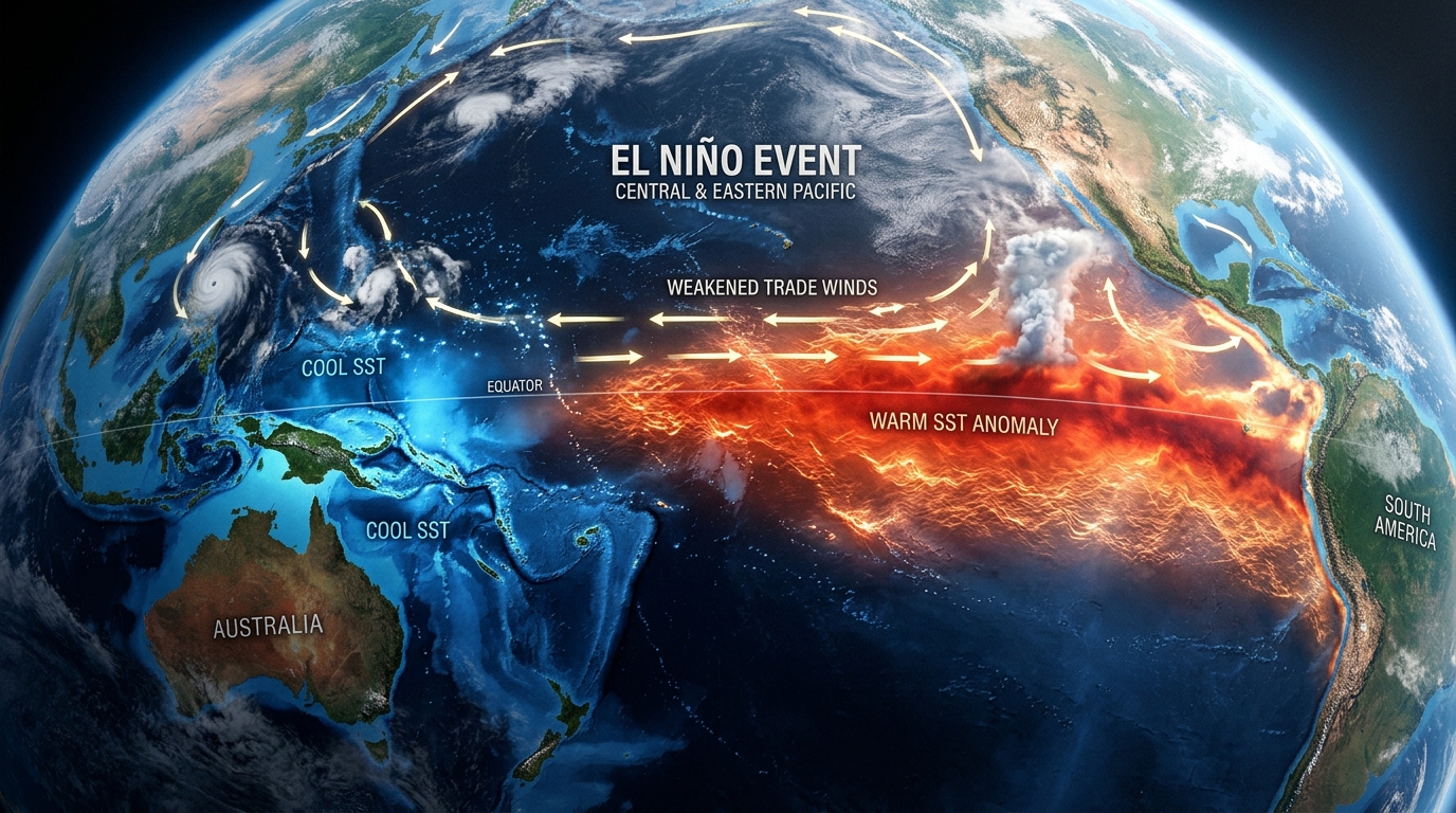
El Niño is the warm phase of a natural climate cycle called the El Niño-Southern Oscillation, or ENSO. In simple classroom language, the Pacific Ocean has a seesaw. Normally the trade winds blow from east to west, pushing warm surface water towards Indonesia and Australia and allowing cooler water to rise off the coast of South America. Every few years those winds weaken or reverse. Warm water then spreads eastward, the cooler upwelling slows down, and the entire atmosphere above the Pacific changes.
India has lived with this cycle for centuries. Strong El Niño years such as 1982-83, 1997-98 and 2015-16 were associated with weaker monsoons and, in some cases, drought. Not every El Niño produces drought, and not every drought is caused by El Niño, but the statistical link is clear. The India Meteorological Department and global agencies monitor the Niño 3.4 region (a stretch of the central Pacific) as the key indicator. When the three-month running average sea surface temperature anomaly stays 0.5°C or more above normal for several overlapping periods, and the atmosphere responds, El Niño is declared.
The cycle usually lasts 9 to 12 months, sometimes longer. After a strong event the system often swings the other way into La Niña. Understanding this background helps us avoid treating every weak monsoon as a permanent climate disaster.
2. What Exactly Is Happening in 2026 – Current Facts
As of the IMD’s ENSO-IOD Update Bulletin issued around late July 2026, weak El Niño conditions are prevailing over the equatorial Pacific. Sea surface temperature anomalies are above normal across the central and eastern Pacific. The Niño 3.4 anomaly had reached around +1.0°C by June and has continued to rise. Forecasts from the Monsoon Mission Coupled Forecast System and other global models indicate further strengthening during the remaining southwest monsoon season, with a good chance of moderate to strong conditions.
Several international assessments, including those from NOAA and multi-model ensembles, have raised the possibility that this event could become one of the stronger ones on record, with some model medians pointing towards peak anomalies well above previous major events by the winter of 2026-27. The Indian National Centre for Ocean Information Services has also noted that the event is likely to continue into early 2027.
On the Indian side, the monsoon started weakly. June 2026 recorded one of the lowest rainfall totals in more than a century. The seasonal forecast from IMD has been for around 90 per cent of the Long Period Average, with July expected to remain below normal (less than 94 per cent of LPA). The Indian Ocean Dipole is currently neutral, so it is not providing the usual counter-balance that a positive IOD sometimes offers.
Interestingly, there have been periods of widespread cloud cover and heavy rain in pockets even while the overall seasonal picture remains subdued. Local systems over the Bay of Bengal and Arabian Sea can still produce active spells, which is why 95 per cent cloud cover on some days does not automatically mean the seasonal deficit has vanished.
3. Why It Is Happening – Causes and Triggering Factors
El Niño is not “caused” by any single human action in the short term. It is a natural oscillation. The immediate trigger is a weakening of the easterly trade winds across the tropical Pacific. When those winds ease, the warm water that is normally piled up in the western Pacific begins to move eastward in the form of Kelvin waves. Cooler water stops rising as strongly off Peru and Ecuador. The ocean surface warms, the atmosphere responds by shifting rainfall patterns eastward, and a self-reinforcing loop begins.
In 2026 the transition happened relatively quickly. After neutral conditions in early 2026, the system crossed the El Niño threshold in May and intensified through June and July. Subsurface heat content in the Pacific was already elevated, providing fuel for rapid surface warming once the atmospheric conditions aligned.
Climate change does not create El Niño, but it changes the background in which El Niño occurs. The oceans have absorbed the vast majority of the excess heat trapped by greenhouse gases. A warmer baseline ocean means that when an El Niño develops, the absolute temperatures and the amount of heat released into the atmosphere can be higher. That is why some scientists describe the current event as occurring on top of a record-warm ocean. The intensity and the impacts can therefore feel stronger even if the basic mechanism remains natural.
4. Political Dimension
Weather events of this scale quickly become political. When the monsoon is weak, questions are raised about preparedness, contingency plans for agriculture, and the adequacy of reservoir management. State governments in rainfed regions press the Centre for early release of funds and flexibility in crop insurance and input subsidies. Opposition parties often highlight any delay in sowing data or any rise in food prices as evidence of poor planning.
The central government, through the Ministry of Agriculture and the IMD, has been issuing regular updates and has identified vulnerable districts for focused attention. The political challenge is to communicate risk without creating panic, and to ensure that contingency measures actually reach the ground before the damage becomes irreversible. In an election-sensitive environment, a weak monsoon can also influence rural sentiment, so both ruling and opposition parties watch the rainfall maps closely.
5. Economic Dimension
Agriculture still employs a large share of India’s workforce and remains sensitive to monsoon performance. A below-normal monsoon typically slows kharif sowing, especially of rainfed crops such as pulses, oilseeds, maize and cotton. Lower production can push up food prices later in the year, affecting inflation numbers that the RBI watches carefully.
Power generation is another channel. Hydropower output can fall when reservoir inflows are weak, increasing reliance on thermal power and raising costs. Rural demand for consumer goods and two-wheelers often softens after a poor monsoon because farm incomes are hit. On the positive side, India enters this season with relatively better reservoir storage than in some previous El Niño years, which provides a buffer for a few months.
Insurance claims under schemes such as the Pradhan Mantri Fasal Bima Yojana are also likely to rise in deficit districts, increasing the fiscal outgo for both Centre and states.
6. Social & Cultural Dimension
For millions of small and marginal farmers, the monsoon is not an abstract climate index. It decides whether the family eats well, whether children stay in school, and whether debt remains manageable. In rainfed districts the anxiety is already visible. Delayed sowing, higher input costs if farmers have to re-sow, and uncertainty about the second half of the season create stress.
Culturally, many farming communities still read the rains through traditional knowledge systems. When the scientific forecast and the traditional signs diverge, confusion increases. Women in agriculture, who often manage the household water and the kitchen garden, feel the pressure first when wells start running low or when fodder becomes scarce.
7. International / Geopolitical Dimension
El Niño is a global event. A strong episode can bring drought to Australia and parts of Southeast Asia, heavier rain and flooding to parts of South America, and shifts in hurricane patterns in the Atlantic and Pacific. Food production in major exporting countries can be affected, which matters for India’s import bills if edible oils or pulses become expensive.
From a diplomatic angle, shared climate information through the World Meteorological Organization and bilateral meteorological cooperation becomes more important. India also watches how neighbouring countries in South Asia manage the same monsoon risks, because river flows and food markets are interlinked.
8. Environmental Dimension
A strong El Niño releases large amounts of heat from the ocean into the atmosphere. That can amplify global temperature spikes and contribute to extreme heat events in various regions. In the Indian Ocean, warmer sea surface temperatures can stress marine ecosystems, affect fish stocks, and change cyclone behaviour.
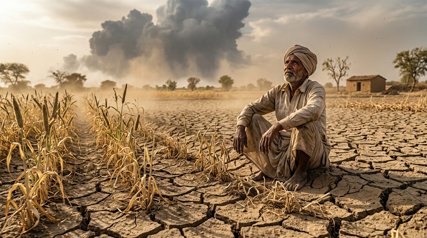
On land, prolonged dry spells increase the risk of forest fires in some regions and put pressure on already stressed groundwater. The neutral Indian Ocean Dipole this year means the usual moderating influence is missing, leaving the full drying effect of El Niño more visible over the Indian landmass.
9. Impact on India – Short-term and Long-term
In the short term the main concerns are delayed and deficient rainfall in key agricultural regions, slower kharif progress, and stress on drinking water and irrigation in rainfed districts. Reservoir levels will need careful management through the remaining monsoon months. Power and food inflation could face upward pressure if the deficit persists into August and September.
Longer term, repeated strong El Niño events on a warming planet raise questions about the reliability of traditional monsoon patterns. Planning for agriculture, water resources and urban supply will have to assume greater year-to-year variability. The experience of 2026 will also feed into future contingency planning and the design of climate-resilient crop varieties and insurance products.
10. Government Response & Official Stand
The India Meteorological Department has been transparent with its forecasts, clearly stating the below-normal outlook and the role of the developing El Niño. The Ministry of Agriculture has identified vulnerable districts and has been advising states on contingency crop plans, promotion of less water-intensive crops, and efficient water use. The Indian National Centre for Ocean Information Services has issued specialised bulletins on the marine and coastal implications.
Reservoir management authorities are monitoring live storage closely. The overall official position is one of heightened preparedness rather than panic — acknowledging the risk while pointing to better early-warning systems and higher reservoir buffers compared with some previous El Niño years.
11. Criticism & Counter-arguments
Some critics argue that the communication of risk still comes too late for farmers to fully adjust sowing decisions. Others point out that contingency plans on paper do not always translate into timely seed and input availability on the ground. There is also debate about how much of the current monsoon weakness is purely El Niño and how much is influenced by the broader warming of the Indian Ocean.
On the other side, meteorologists note that forecasting ENSO impacts has improved significantly, and that local weather systems can still produce useful rainfall even in an El Niño year. The presence of active spells in July 2026 despite the large-scale signal is evidence of that complexity.
12. Way Forward and Relevance for Competitive Exams
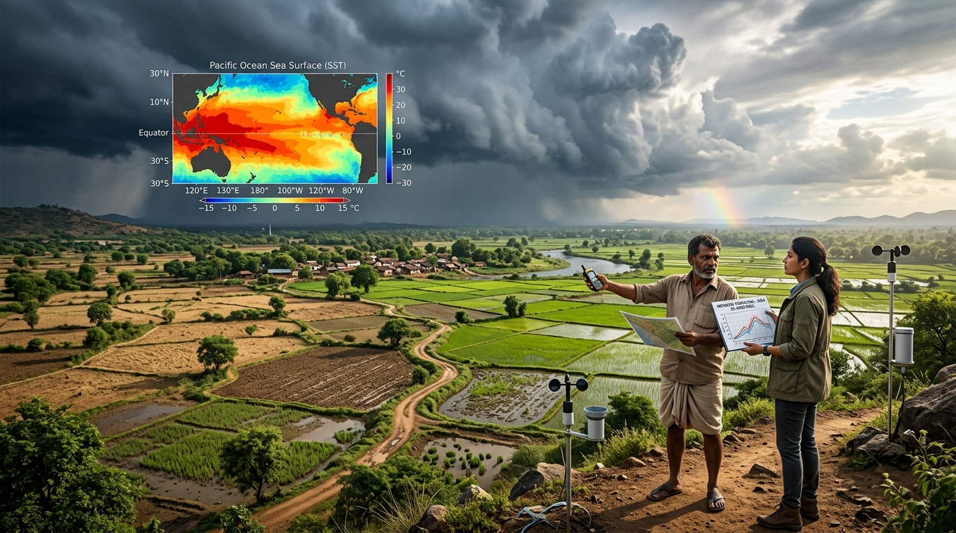
The practical way forward is better integration of forecasts with last-mile advisories, faster activation of contingency measures in the most vulnerable districts, and continued investment in climate-resilient agriculture. Expanding the reach of crop insurance, promoting millets and other less water-intensive crops, and improving groundwater recharge are all part of the longer response.
Relevance for Competitive Examinations:
For competitive exams this topic is pure gold. In RRB and SSC you can expect questions on the definition of El Niño, the role of the Niño 3.4 region, the difference between El Niño and La Niña, and the typical impact on the Indian monsoon. Banking exams often link it to inflation, rural demand and agricultural credit. UPSC Prelims tests factual clarity; Mains expects you to discuss the interaction of ENSO with the monsoon, the role of the Indian Ocean Dipole, and the implications for food security and climate adaptation.
13. Comparison Table & Quick Revision Points
| Aspect | Typical El Niño Year | 2026 Situation (as of July) | Key Difference |
|---|---|---|---|
| Niño 3.4 Anomaly | +0.5°C or higher | Already around +1.0°C and rising | Rapid intensification |
| Indian Ocean Dipole | Can be positive (offsetting) | Neutral | Limited offset |
| IMD Seasonal Forecast | Often below normal | ~90% of LPA | Clear below-normal signal |
| June Rainfall | Variable | Among lowest since 1901 | Very weak start |
| Reservoir Buffer | Often stressed | Relatively better than past events | Some cushion available |
| Expected Peak | Usually winter | Possible strong peak in late 2026/early 2027 | Models suggest high intensity |
Quick Revision / Must Remember Points
- Current status (July 2026): Weak to moderate El Niño present; expected to strengthen
- Key indicator: Niño 3.4 sea surface temperature anomaly (≥ +0.5°C)
- IMD seasonal forecast: Around 90% of Long Period Average (LPA)
- Indian Ocean Dipole (IOD): Neutral
- Typical impact on India: Weaker southwest monsoon, higher chance of deficient rainfall
- Nuance: Not every El Niño causes drought; local systems can still produce rain
- Climate change link: Amplifies impacts by warming the background ocean
- Monitoring agencies: IMD, NOAA, INCOIS, WMO
Conclusion
El Niño has returned in 2026 and is strengthening at a noticeable pace. The basic mechanism is the same natural Pacific oscillation that India has dealt with for generations. What is different this time is the speed of development and the warmer ocean background against which it is unfolding. The monsoon has already shown the strain, especially in June, and the outlook for the remaining season remains below normal according to the IMD.
For aspirants the lesson is straightforward. Understand the science without exaggeration, know the official numbers from IMD and related agencies, and be ready to discuss both the immediate agricultural risks and the longer climate-adaptation questions. Weather will keep surprising us, but preparedness and clear understanding reduce the damage.
Stay updated with the monthly IMD bulletins. That habit alone will keep your current affairs sharp.
Master Physical Geography & Climate Science on RRBCONTENTS
Get complete climatology notes, ENSO diagrams, and daily current affairs updates.
Daily Current Affairs → Geography Study Notes →Join our official Telegram channel: @rrbcontents