Table of Contents
1. Key Overview and Primary Developments
Heavy rainfall in the higher reaches of Uttarakhand has led to a rise in water levels in major rivers. On 7 August 2026, the Ganga crossed the warning level in Haridwar, prompting authorities to intensify monitoring along the river.
According to reports based on official updates, the Ganga was flowing at or above the warning mark of 293 metres at the Bhimgoda Barrage in Haridwar. The danger level stands at 294 metres. Several other rivers, including the Alaknanda and Bhagirathi, had also swollen following incessant rain.
Landslides and debris blocked 132 roads across the State, including four national highways. Key routes such as sections of the Gangotri and Yamunotri highways were affected. Restoration work was underway in several places. Schools in some districts were closed as a precautionary measure.
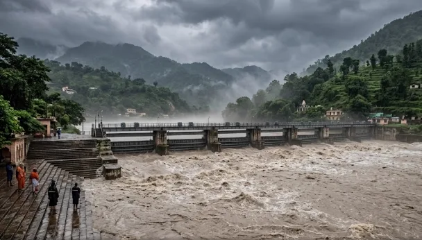
Heavy Rain in Uttarakhand: Ganga Crosses Warning Level in Haridwar; 132 Roads Blocked
Heavy rainfall in Uttarakhand has caused the Ganga to cross the warning level in Haridwar. At least 132 roads, including...
Disaster Management · Official Visual Reporting
2. Statutory Provisions and Official Statements
The India Meteorological Department (IMD) issued alerts for heavy rainfall, thunderstorms and lightning in parts of Uttarakhand. An orange alert was in force for certain districts, while a yellow alert covered other areas. Further spells of heavy to very heavy rain were forecast for the following week.
Authorities advised residents and travellers to remain cautious, especially near riverbanks and in landslide-prone zones. Teams from the State Disaster Response Force and other agencies were engaged in monitoring, evacuation awareness and road-clearing operations.
Uttarakhand is prone to heavy monsoon rainfall, which frequently triggers landslides, flash floods and rising river levels in the Himalayan terrain. The current spell has once again highlighted the vulnerability of road connectivity and the need for continuous monitoring of river systems.
For competitive examination aspirants the development is relevant under disaster management, geography of the Himalayas, and the monsoon pattern in northern India. Questions may cover the causes of landslides in Uttarakhand, the significance of warning and danger levels on major rivers, the role of the IMD in issuing alerts, and the impact of heavy rain on infrastructure and pilgrimage routes such as the Char Dham highways.
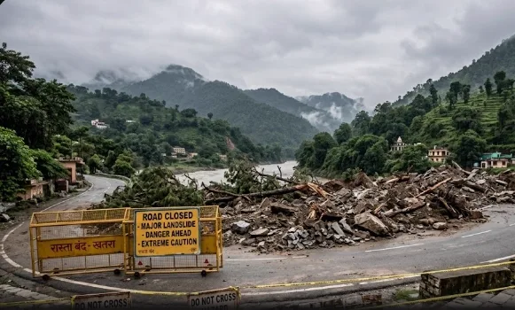
Disaster Management Statutary Framework
Disaster Management · Statutory Reporting
3. Socio-Economic & Strategic Implications
Key verified figures and facts are:
Ganga crossed the warning level in Haridwar.
132 roads blocked, including four national highways.
Major rivers including Alaknanda and Bhagirathi in spate.
IMD alerts for heavy rain, thunderstorms and lightning.
Precautionary measures including school closures in affected areas and monitoring by disaster response teams.
These details enable aspirants to provide accurate and updated information in both objective and descriptive answers.
The situation remains under close watch. Local administrations continue to clear blocked roads and advise people to avoid vulnerable areas until conditions improve. Further updates from the State emergency operations centre and the IMD will determine the scale of disruption in the coming days.
Verified Exam Reference Points
- • River Water Levels: Ganga crossed warning mark in Haridwar following torrential Himalayan rains.
- • Infrastructure Disruption: 132 roads including 4 national highways blocked due to landslides.
- • Disaster Preparedness: SDRF and district teams deployed along Char Dham highways and low-lying zones.