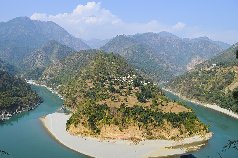
Heavy rainfall continues to batter large parts of Uttarakhand, pushing the Alaknanda and Mandakini rivers into a state of high alert in Rudraprayag district. As of 6 August 2026, continuous downpours in the higher Himalayan regions of Chamoli and around Kedarnath have caused a sharp rise in water levels downstream. District authorities have placed vulnerable areas along the riverbanks under close watch and advised residents to stay away from the water’s edge.
The India Meteorological Department has issued a combination of red, orange and yellow alerts across several districts. Orange alerts cover Dehradun, Chamoli and Bageshwar for heavy to very heavy rainfall, while yellow alerts remain in force for Haridwar, Tehri, Uttarkashi, Pauri, Pithoragarh, Champawat, Nainital and Rudraprayag. Officials have warned of the possibility of flash floods, landslides, rockfalls and waterlogging in low-lying zones.
River Levels and Immediate Concerns
In Rudraprayag, the Alaknanda has been recorded close to or above the danger mark at key monitoring points, while the Mandakini has hovered near or crossed the warning level at several locations. District Disaster Management Officer Nandan Singh Rajwar noted that heavy precipitation in the upper catchment is directly feeding the surge. Continuous monitoring of both rivers is under way, and municipal authorities, police and disaster teams have been instructed to issue immediate alerts if levels cross critical thresholds.
The rapid rise has raised concerns for settlements located close to the riverbanks. In previous monsoon seasons, similar conditions have led to inundation of low-lying areas and disruption of local connectivity. Authorities have therefore maintained a high state of readiness and are conducting regular assessments of vulnerable stretches.
Landslides and Road Disruptions
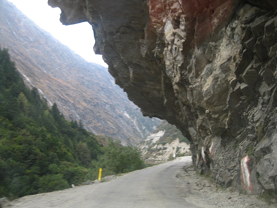
Landslides and debris falls have disrupted several stretches of the Char Dham routes and other important roads. In Uttarkashi, the Gangotri and Yamunotri National Highways faced blockages due to continuous rockfall and road obstruction at multiple points. In Rudraprayag and Chamoli, debris and boulder slides have affected sections of National Highway 107 and other link roads, temporarily suspending or restricting vehicular movement.
A large boulder crash into a government residential unit in Mussoorie earlier in the week injured one person and highlighted the instability of saturated hill slopes. Similar incidents of rockfall and slope failure have been reported from Tehri and other hill districts. Border Roads Organisation and state public works teams are engaged in clearing debris and restoring traffic wherever conditions permit.
These disruptions have a direct impact on the ongoing Char Dham Yatra. Pilgrims and local residents have been advised to check the latest road status before travelling and to avoid unnecessary journeys in the affected corridors until the weather stabilises.
School Closures and Precautionary Measures
As a precautionary step, district administrations have ordered the closure of schools and Anganwadi centres in several areas. Closures covering Classes 1 to 12 have been declared in Dehradun, Rudraprayag, Chamoli, Bageshwar, Pauri and other districts under heavy rainfall warnings. The decision aims to keep children away from roads that may become unsafe due to landslides or sudden waterlogging.
Chief Minister Pushkar Singh Dhami has been reviewing the situation with the Secretary of Disaster Management and Rehabilitation. He has directed the State Disaster Response Force, National Disaster Response Force and all district administrations to remain on full alert and ensure rapid response capability. Local officials have been asked to maintain communication with villages located in high-risk zones and to keep relief materials ready.
Geographical and Hydrological Context
The Alaknanda and Mandakini are two of the principal headstreams of the Ganga system in the Garhwal Himalaya. The Alaknanda originates from the Satopanth and Bhagirath Kharak glaciers and flows through Chamoli and Rudraprayag before meeting the Bhagirathi at Devprayag. The Mandakini rises near the Chorabari glacier close to Kedarnath and joins the Alaknanda at Rudraprayag. Both rivers drain steep, high-rainfall catchments. When intense monsoon showers occur in the upper reaches, the discharge rises rapidly within a short time, creating downstream pressure.
Uttarakhand’s mountainous terrain, young geological formations and high seismic activity make the region particularly susceptible to landslides during prolonged or intense rainfall. Saturated soil, steep slopes and existing road cuts further increase the risk of slope failure. The combination of these factors turns episodes of heavy rain into multi-hazard events involving riverine flooding, flash floods and mass movements.
Climate and Monsoon Patterns
The current spell is part of the broader 2026 monsoon pattern that has already produced extreme rainfall events in several parts of the Himalayan belt. Meteorologists note that short-duration, high-intensity rainfall episodes have become more frequent in the region. Such events overwhelm the natural drainage capacity of steep Himalayan streams and raise the probability of simultaneous landslides across multiple catchments.
While the monsoon remains essential for the state’s water resources and agriculture, the increasing intensity of individual rain events is stretching the capacity of both natural systems and man-made infrastructure. Continuous monitoring of river gauges, rainfall stations and slope conditions has therefore become a critical component of disaster preparedness in Uttarakhand.
Impact on Daily Life and Pilgrimage
Beyond the immediate safety concerns, the rains have disrupted daily life in the affected districts. Road blockages have delayed the movement of essential supplies in some remote areas. Local markets and transport services have faced interruptions. For the Char Dham Yatra, which is a major seasonal activity, the combination of high river levels and landslide-prone roads creates logistical challenges for both pilgrims and the administration.
Authorities have emphasised that the priority remains the safety of residents and travellers. Advisories urge people living near rivers and unstable slopes to remain vigilant, follow official instructions, and avoid venturing into restricted zones. Disaster response teams are positioned to carry out evacuations if required.
Administrative Preparedness and Response
The state machinery has activated its standard operating procedures for monsoon emergencies. District emergency operation centres are functioning round the clock. Coordination between the meteorological department, disaster management authorities, police, and local bodies is being maintained through regular briefings. The Chief Minister’s direct review of the situation underscores the seriousness with which the administration is treating the current spell of heavy rain.
In Dehradun, the Asan Barrage authorities released floodwater after a sharp rise in discharge and accumulation of debris, illustrating the downstream effects of heavy rainfall even in the Doon valley. Similar proactive measures are being taken at other monitoring points across the state.
Exam Relevance
UPSC GS Paper 1 (Geography)
- Drainage system of the Ganga in the Garhwal Himalaya
- Characteristics of the Alaknanda and Mandakini rivers
- Causes of landslides in the Himalayan region
- Impact of intense monsoon rainfall on mountain hydrology
GS Paper 3 (Disaster Management)
- Multi-hazard nature of Himalayan monsoons (floods + landslides)
- Role of IMD alerts (red, orange, yellow) in administrative response
- School closures and public advisories as non-structural measures
- Coordination between state disaster management authorities, NDRF and SDRF
GS Paper 2 / Governance
- State-level disaster response mechanisms in Uttarakhand
- Role of the Chief Minister’s office in real-time monitoring
State PSC / SSC / Bank
- Current status of Alaknanda and Mandakini rivers (August 2026)
- Districts under orange and yellow alerts
- Impact on Char Dham Yatra routes
- Precautionary school closures as a standard monsoon response measure
Aspirants should note the distinction between warning level and danger level for river gauges, the geographical relationship between the two rivers, and the recurring pattern of monsoon-related disruptions in the Char Dham corridor. The episode also provides a contemporary example of how climate-influenced rainfall intensity interacts with Himalayan geomorphology.
As of 6 August 2026 the situation remains dynamic. Further rainfall in the upper catchments will determine whether river levels continue to rise or begin to stabilise. Residents and travellers are advised to follow the latest bulletins issued by the India Meteorological Department and the Uttarakhand State Disaster Management Authority.
Frequently Asked Questions (FAQ)
Q1. Why are the Alaknanda and Mandakini rivers rising sharply in August 2026?
Heavy rainfall in the upper Himalayan catchments of Chamoli and the Kedarnath region is feeding large volumes of water into both rivers, causing rapid downstream rises in Rudraprayag.
Q2. Which districts have seen school closures?
Schools and Anganwadi centres have been closed in Dehradun, Rudraprayag, Chamoli, Bageshwar, Pauri and other districts under heavy rainfall warnings as a precautionary measure.
Q3. How are Char Dham routes affected?
Landslides and debris falls have blocked or restricted sections of the Gangotri, Yamunotri and Kedarnath approach roads, particularly in Uttarkashi, Chamoli and Rudraprayag districts.
Q4. What alerts has the IMD issued?
Orange alerts are in force for Dehradun, Chamoli and Bageshwar. Yellow alerts cover several other districts including Rudraprayag, Tehri, Uttarkashi and Pauri.