 RRB
RRB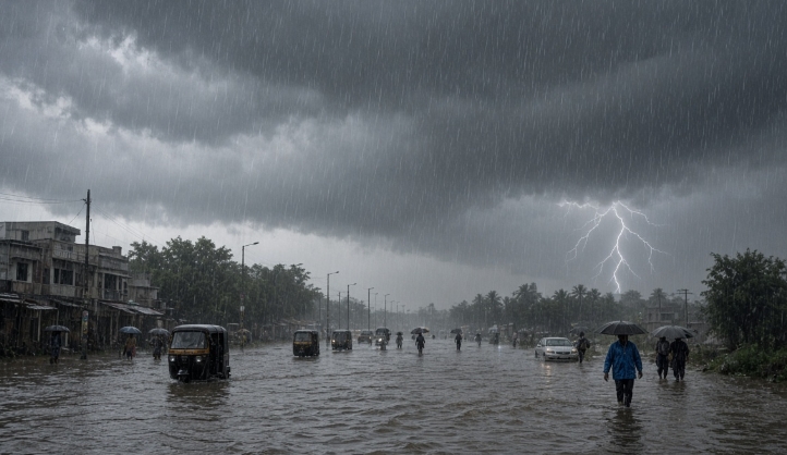
The India Meteorological Department has put a large part of the country on alert for 19 August 2026. A depression that has been sitting over Jharkhand and the adjoining northern parts of Gangetic West Bengal is the main reason behind the unsettled weather. Under its influence, heavy to extremely heavy rainfall, thunderstorms and strong winds are expected across many states.
This is not a routine monsoon shower. The system is organised enough to produce intense rainfall in short periods, which can quickly lead to waterlogging in cities and swelling of rivers in the plains and hills. People in the affected regions need to stay updated through the day.
What the Weather System Looks Like
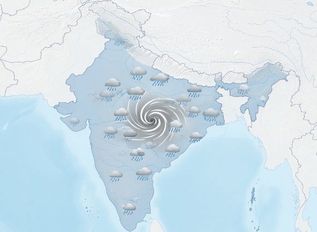
As of the evening of 18 August, the depression was centred over Jharkhand, close to Hazaribagh and Ranchi. It has been moving slowly west-northwestwards. The associated cyclonic circulation extends high into the atmosphere, which is why the rainfall is expected to be widespread rather than limited to one or two districts.
IMD has indicated that isolated extremely heavy rainfall is possible over southeast Uttar Pradesh on 19 August. Heavy to very heavy rain is also likely over parts of East Madhya Pradesh, Jharkhand, Bihar, Odisha and Chhattisgarh. Fairly widespread to widespread rain is forecast over several other states in the north, east and central parts of the country.
Thunderstorms accompanied by lightning and gusty winds are expected in many places. Wind speeds may reach 50–60 kmph in open areas, and in some pockets they could go higher. Hilly regions have been warned about the possibility of landslides.
States and Regions Under Alert
The list of states and union territories that are likely to see significant weather on 19 August is long. It includes Uttar Pradesh, Bihar, Delhi, Haryana, Punjab, Rajasthan, Uttarakhand, Himachal Pradesh, Jammu and Kashmir, Jharkhand, West Bengal, Odisha, Madhya Pradesh, Chhattisgarh, Gujarat, Maharashtra, Assam, Sikkim, Meghalaya, Tripura, Kerala, Tamil Nadu and Telangana.
In Uttar Pradesh, the focus is particularly on the southern and eastern districts. Places such as Prayagraj, Mirzapur, Sonbhadra, Banda, Chitrakoot and surrounding areas may receive very heavy to extremely heavy rain. Several other districts in the state are also expected to see thunderstorms and heavy showers.
Bihar remains under the influence of the same system. Districts across north and south Bihar, including Patna, Gaya, Darbhanga and Bhagalpur, are likely to experience heavy rain and strong winds. Jharkhand, which has been close to the centre of the depression, will continue to see active weather.
In the hills, Uttarakhand and Himachal Pradesh are under watch for heavy rain that could trigger landslides in vulnerable stretches. Delhi and the National Capital Region are expected to see cloudy skies with the possibility of rain and thunderstorms during the day.
Parts of eastern and central India, including Odisha, Chhattisgarh and East Madhya Pradesh, are also in the active rainfall zone. The northeast states continue to receive rain as is usual during this phase of the monsoon.
Impact on Daily Life
Heavy rain of this intensity usually brings a set of familiar problems. Low-lying areas in cities can get waterlogged within a short time. Traffic slows down or comes to a standstill on major roads. Local trains and buses may run late. In some places, power supply can be interrupted if trees fall on lines or if substations are affected.
Farmers who have standing crops need to be careful. Excess water in the fields can damage paddy and other monsoon crops if the rain continues for long. Drainage systems in both rural and urban areas will be under pressure.
In the hills, the combination of heavy rain and already saturated slopes raises the risk of landslides. People living near steep slopes or travelling on hill roads should remain extra cautious. Tourists and pilgrims in Uttarakhand and Himachal Pradesh are being advised to check local conditions before starting journeys.
Fishermen along the affected coasts have already been advised to stay away from the sea in some stretches because of rough conditions.
What Authorities Are Doing
State governments and district administrations in the high-risk areas have been asked to remain on alert. Control rooms are expected to function through the day. Local officials usually open temporary shelters if waterlogging becomes severe or if people need to be moved from low-lying colonies.
The National Disaster Response Force and State Disaster Response Forces keep teams ready during such spells. Road and railway authorities monitor critical sections, especially in the hills and near major rivers.
IMD will continue to issue updates through the day. The situation can change depending on the exact movement of the depression and the intensity of rainfall in different pockets. People are advised to follow the official bulletins rather than unverified messages on social media.
Safety Advice for the Day
If you are in an area under heavy rain warning, avoid unnecessary travel, especially in the evening and night when visibility drops. Stay away from rivers, canals and waterlogged stretches. Do not take shelter under trees during thunderstorms because of the lightning risk.
Keep basic emergency numbers handy. Charge mobile phones and power banks in advance in case of power cuts. Those living in low-lying houses should be prepared to move important documents and belongings to higher places if water starts entering.
Parents should keep children indoors during intense spells of rain and lightning. Schools in some districts may announce changes in timings or holidays depending on the local situation. It is better to check official school or district administration notices.
Drivers should reduce speed on wet roads and maintain greater distance from the vehicle in front. Two-wheeler riders need to be particularly careful.
Looking Ahead
The current system is expected to keep the weather active over the next couple of days in parts of north, east and central India. Rainfall activity may continue in the broader region even after the peak intensity passes. The depression is likely to weaken gradually as it moves further inland, but the moisture it has brought will take time to clear.
Monsoon 2026 has already shown several spells of intense rain in different parts of the country. Each such spell tests the preparedness of cities and the resilience of rural areas. Accurate forecasts and timely warnings remain the most useful tools available to reduce the damage.
For now, the message from the weather department is clear. Several parts of the country are likely to see heavy rain and thunderstorms on 19 August. People in the affected states should stay alert, follow official updates, and avoid risks during the peak hours of rainfall.
Weather systems like this are part of the monsoon season, but their impact depends on how prepared communities and administrations are. Listening to the warnings and taking simple precautions can make a real difference.