Home › Blog › Weather & Disaster Management › IMD Heavy Rain High Alert
Active Monsoon Deluge: Comprehensive IMD Heavy Rain Forecast, State-by-State High Alert Directory, and Disaster Preparedness Guide
Track Ministry of Earth Sciences, IMD Scientific Assistant & Disaster Management openings on RRBCONTENTS Jobs Portal.
Key Takeaways & Summary
- Multi-State High Alert: IMD has issued Orange and Red alerts across Gujarat, Madhya Maharashtra, Konkan & Goa, Gangetic West Bengal, Odisha, and Western Himalayan states.
- Key Weather Drivers: Low-Pressure Area over Northwest Bay of Bengal, active monsoon trough stretching across Central India, and mid-tropospheric East-West Shear Zone (3.1 km to 5.8 km).
- Disaster Risks: High vulnerability to urban waterlogging, river flooding, and mountain landslides along major national highways (NH-21, NH-58, NH-44).
- IMD Alert Scale: Red Alert means "Take Action" (execute immediate emergency protocols), not merely passive observation.
Table of Contents
- 1. Active Synoptic Drivers: Why the Monsoon Is Raging
- 2. State-by-State Weather Warning & Impact Breakdown
- 3. Demystifying the IMD Color-Coded Alert System
- 4. Meteorological Science: What Makes Rainfall "Heavy" or "Extremely Heavy"?
- 5. Master Data Table for Key Cities and Regions
- 6. Disaster Management Protocols: NDRF & SDRF Deployments
- 7. High-Yield Academic Corner (For Competitive Examinations)
- 8. Essential Citizen Safety Protocols & Emergency Guidelines
- 9. Frequently Asked Questions (FAQ)
Active Monsoon Deluge: Comprehensive IMD Heavy Rain Forecast, State-by-State High Alert Directory, and Disaster Preparedness Guide
The India Meteorological Department (IMD) has issued critical, multi-regional weather warnings calling for heavy to very heavy rainfall—with isolated extremely heavy downpours—across multiple states. Driven by a well-marked low-pressure area over the Northwest Bay of Bengal (adjoining Gangetic West Bengal and North Odisha), alongside an active monsoon trough stretching across Central India and an East-West shear zone in the mid-troposphere, the Southwest Monsoon has entered its most intense surge of the season.
If you reside in or are traveling through high-risk sub-divisions—including Gujarat, Madhya Maharashtra (Ghat areas), Gangetic West Bengal, Odisha, Konkan & Goa, Himachal Pradesh, Uttarakhand, and the North Eastern states—disaster management agencies strongly advise exercising extreme caution. Heavy precipitation poses immediate threats of flash floods, urban waterlogging, riverbank overflow, landslide events, and transport line disruptions.
This exhaustive, verified news analysis provides a comprehensive state-by-state breakdown of the IMD forecast, the atmospheric physics driving the deluge, an operational alert directory, disaster management protocols, and high-yield notes for competitive examination candidates.
1. Active Synoptic Drivers: Why the Monsoon Is Raging
The current weather surge across India is caused by the convergence of multiple large-scale atmospheric phenomena. When low-pressure systems over oceanic bodies align with upper-air cyclonic circulations and jet stream dynamics, the atmosphere transports immense volumes of moisture inland.
A. The Bay of Bengal Engine
The primary trigger for the current weather event is a low-pressure system over the Northwest Bay of Bengal. As warm sea surface temperatures feed thermal energy into the lower atmosphere, air rises rapidly, creating a pressure vacuum. This vacuum pulls moisture-laden air masses from the tropical Bay of Bengal into coastal Odisha, West Bengal, Jharkhand, and Chhattisgarh.
B. The East-West Shear Zone
At mid-tropospheric altitudes (3.1 km to 5.8 km above mean sea level), atmospheric winds from the Arabian Sea (westerlies) and the Bay of Bengal (easterlies) meet along a narrow latitude belt known as the East-West Shear Zone. This shear zone destabilizes the atmosphere, encouraging the vertical growth of massive cumulonimbus cloud structures that dump intense rainfall over localized areas within short timeframes.
2. State-by-State Weather Warning & Impact Breakdown
To help citizens, travelers, and local authorities assess their immediate risk, below is a detailed breakdown of the weather outlook across key regions:

A. Western India: Gujarat, Konkan & Goa, Madhya Maharashtra
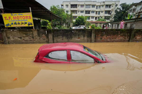
Gujarat State (Saurashtra, Kutch & Gujarat Region): Alert Status: Orange / Red Watch for heavy to very heavy rainfall, with isolated extremely heavy spells (≥ 20.4 cm). Affected Districts: Surat, Navsari, Valsad, Junagadh, Jamnagar, Rajkot, Anand, and Ahmedabad. Ground Impact: Low-lying urban sectors face severe waterlogging risks. Inundation of agricultural fields in Saurashtra threatens standing cotton and groundnut crops.
Madhya Maharashtra (Ghat Areas): Alert Status: Orange / Red Alert for extremely heavy rainfall over isolated mountain passes. Affected Belts: Ghat regions of Pune, Satara, Nashik (Trimbakeshwar, Igatpuri), and Kolhapur. Ground Impact: Catchment areas feeding major dams (such as Gangapur, Darna, Koyna, and Khadakwasla) are experiencing rapid water inflows. Controlled dam releases are likely, creating flood risks for downstream urban centers like Nashik and Pune.
Konkan & Goa (including Mumbai Metropolitan Region): Alert Status: Orange Alert for heavy to very heavy rainfall at isolated places. Affected Districts: Mumbai, Thane, Palghar, Raigad, Ratnagiri, Sindhudurg, and Goa. Ground Impact: High astronomical tides coinciding with heavy rainfall spells increase urban flooding risks in low-lying subways across Mumbai, Thane, and Navi Mumbai. Squally winds up to 45–55 kmph gusting to 65 kmph make sea conditions hazardous.
B. Eastern India: West Bengal, Odisha, Jharkhand, Bihar
Gangetic West Bengal: Alert Status: Orange Alert for heavy to very heavy rainfall accompanied by thunderstorms, lightning, and gusty winds (40–50 kmph). Affected Districts: Kolkata, Howrah, Hooghly, North & South 24 Parganas, Paschim Medinipur, Purba Medinipur, and Jhargram. Ground Impact: Waterlogging along key urban arterial roads in Kolkata and Howrah.
Odisha: Alert Status: Orange Alert for widespread heavy to very heavy rainfall. Affected Districts: Cuttack, Puri, Khordha, Balasore, Bhadrak, Mayurbhanj, Jajpur, Ganjam, and Sambalpur. Ground Impact: Swelling of coastal rivers (Mahanadi, Baitarani, Brahmani system tributaries). Fishermen are strictly warned against venturing into the North Bay of Bengal.
Jharkhand & Bihar: Alert Status: Yellow / Orange Alert for heavy rainfall spells with active lightning. Affected Districts (Jharkhand): Ranchi, East & West Singhbhum, Dhanbad, Bokaro, and Hazaribagh. Affected Districts (Bihar): Patna, Gaya, Bhagalpur, Purnea, Rohtas, and Bhojpur.
C. Western Himalayan Region: Himachal Pradesh, Uttarakhand, J&K
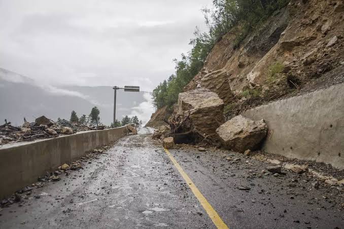
Himachal Pradesh & Uttarakhand: Alert Status: Orange Watch for heavy to very heavy rainfall spells. Affected Districts (Himachal): Shimla, Kullu, Kangra, Mandi, Solan, Sirmaur, and Chamba. Affected Districts (Uttarakhand): Dehradun, Nainital, Tehri, Pauri, Chamoli, Rudraprayag, and Pithoragarh. Ground Impact: High vulnerability to landslides, mudslides, and shooting stones along major national highways (NH-21 and NH-58).
Jammu & Kashmir & Ladakh: Alert Status: Yellow / Orange Alert for scattered heavy rainfall. Affected Belts: Jammu, Kathua, Poonch, Rajouri, Doda, Ramban, and Kishtwar. Ground Impact: Risk of landslips along the Jammu-Srinagar National Highway (NH-44).
D. Central & North Plains: Madhya Pradesh, Rajasthan, UP, Delhi-NCR
Madhya Pradesh & Chhattisgarh: Alert Status: Yellow / Orange Alert. Inundation of low-level causeways along Narmada, Betwa, and Indravati river systems.
Delhi / NCR, Punjab & Haryana: Alert Status: Yellow Alert for scattered light-to-moderate rain with isolated heavy spells and gusty winds (30–50 kmph).
E. North East India: Assam, Meghalaya, Arunachal, Nagaland, Tripura
Widespread heavy rainfall across Assam, Meghalaya, Nagaland, Manipur, Mizoram, Tripura, and Arunachal Pradesh. The Brahmaputra and Barak river systems remain in high spate.
3. Demystifying the IMD Color-Coded Alert System
Understanding the precise meaning of IMD weather alerts is essential for effective disaster preparedness and public safety:
Important Clarification from IMD: A "Red Color Warning" does not merely signify a passive "Red Alert." In official meteorological terminology, Red signifies "Take Action"—meaning emergency management authorities, civic services, and citizens must execute immediate safety measures to protect life and property.
4. Meteorological Science: What Makes Rainfall "Heavy" or "Extremely Heavy"?
In Indian meteorology, rainfall intensity is measured quantitatively over a 24-hour cycle ending at 08:30 AM IST. The standardized categories established by the IMD are defined as follows:
- Light Rainfall: 0.1 mm to 15.5 mm in 24 hours.
- Moderate Rainfall: 15.6 mm to 64.4 mm in 24 hours.
- Heavy Rainfall: 64.5 mm to 115.5 mm in 24 hours.
- Very Heavy Rainfall: 115.6 mm to 204.4 mm in 24 hours.
- Extremely Heavy Rainfall: ≥ 204.5 mm (20.45 cm) in 24 hours.
- Exceptionally Heavy Rainfall: When recorded rainfall approaches or exceeds historical local station records, often reaching ≥ 30.0 cm within a single day.
The Physics of Orographic Amplification
When moisture-laden monsoon winds blowing from the warm ocean hit physical land barriers—such as the Western Ghats in Maharashtra/Karnataka or the Himalayan mountain front in Himachal and Uttarakhand—the air is forced to climb rapidly upwards. As the air rises, it expands and cools adiabatically. Moisture condenses into cloud droplets at an accelerated rate, causing torrential downpours along the windward slopes of the mountains.
5. Master Data Table for Key Cities and Regions
| City / Region | Expected Weather Condition | Temperature Range (°C) | IMD Alert Status | Primary Hazard Risk |
|---|---|---|---|---|
| Kolkata | Heavy to Very Heavy Rain, Gusty Winds (40–50 kmph) | 26 °C − 31 °C | Orange Alert | Urban waterlogging, transport delays |
| Mumbai MMR | Moderate to Heavy Rain, High Coastal Waves | 26 °C − 30 °C | Yellow / Orange Alert | High tide waterlogging in subways |
| New Delhi / NCR | Light-to-Moderate Rain, Gusty Winds | 25 °C − 34 °C | Yellow Alert | Traffic slow-downs, high humidity |
| Surat & S. Gujarat | Very Heavy to Extremely Heavy Rain | 25 °C − 30 °C | Orange / Red Watch | Low-lying area inundation |
| Bhubaneswar | Heavy to Very Heavy Rain, Lightning | 24 °C − 30 °C | Orange Alert | Riverbank swelling, lightning strikes |
| Shimla & Kullu | Heavy Mountain Rain, Landslide Risk | 20 °C − 25 °C | Orange Alert | Highway blockages, mudslides |
| Dehradun & Nainital | Heavy to Very Heavy Rain, Flash Floods | 21 °C − 26 °C | Orange Alert | Shooting stones, river surges |
| Patna & C. Bihar | Moderate to Heavy Rain, Lightning | 28 °C − 34 °C | Yellow Alert | Rural electrical lightning risk |
| Ranchi & Singhbhum | Heavy Rainfall, Strong Winds (70 kmph) | 23 °C − 29 °C | Orange Alert | Tree falls, structural damage |
| Guwahati & Assam | Heavy Rainfall, River Spate | 25 °C − 32 °C | Orange Watch | Agrarian flood inundation |
| Bengaluru | Passing Light Showers, Breezy | 20 °C − 28 °C | Green Alert | Low risk; pleasant weather |
| Chennai | Strong Surface Winds, Light Showers | 28 °C − 36 °C | Green / Wind Watch | Rough sea conditions |
6. Disaster Management Protocols: NDRF & SDRF Deployments
🎓 High-Yield Academic Corner (For Competitive Examinations)
For candidates preparing for civil services and academic examinations (UPSC GS Paper 1: Physical Geography & GS Paper 3: Disaster Management & Climatology), current monsoon dynamics provide key study points:
GS Paper 1: Physical Geography (Monsoon Climatology)
- Active vs. Break Monsoon Phases: Active Phase occurs when the monsoon trough moves south of its normal position, aligned with low-pressure formations over the Bay of Bengal. Break Phase occurs when the monsoon trough shifts north toward the Himalayan foothills.
- Low-Level Jet Stream (Findlater Jet): A strong southwesterly wind current in the lower atmosphere (850 hPa level) carrying moisture from the Arabian Sea directly across the Peninsular shield toward the Bay of Bengal.
GS Paper 3: Disaster Management & Urban Flood Risk
- Urban Heat Island (UHI) & Convective Rainfall: Concrete structures retain heat, creating localized updrafts that intensify short-duration rainfall over cities.
- Sponge City Framework: An urban planning approach advocating for permeable pavements, rain gardens, wetland restoration, and underground retention vaults.
8. Essential Citizen Safety Protocols & Emergency Guidelines
If you are located in an area designated under an IMD Orange or Red Alert, following these practical safety guidelines can mitigate risk:
A. Outdoor & Travel Safety Rules
- Never Cross Flooded Underpasses or Causeways: Water depth can be deceiving, and swift currents can sweep away heavy motor vehicles in under 30 cm of moving water.
- Avoid Hill Roads During Active Spells: Postpone non-essential highway travel across Himachal Pradesh, Uttarakhand, and Western Ghat passes.
- Stay Away from Electric Infrastructure: Avoid touching utility poles or submerged transformers.
B. Lightning Safety Protocols
- The 30-30 Rule: If you hear thunder within 30 seconds of seeing a lightning flash, seek immediate shelter indoors. Stay inside for at least 30 minutes after hearing the last thunder clap.
- Avoid Open Fields & Tall Trees: Never seek shelter under tall, isolated trees in open ground.
9. Frequently Asked Questions (FAQ)
Which states have received IMD Orange and Red alerts for heavy rain?
IMD has issued Orange and Red alerts for Gujarat, Madhya Maharashtra (Ghat areas), Konkan & Goa, Gangetic West Bengal, Odisha, Himachal Pradesh, Uttarakhand, and North Eastern states.
What is an East-West Shear Zone in meteorology?
An East-West Shear Zone is a mid-tropospheric layer (3.1 to 5.8 km altitude) where opposing easterly and westerly winds clash, generating intense convective clouds and localized heavy rainfall.
What is the difference between Heavy and Extremely Heavy rainfall in India?
IMD classifies 64.5 mm to 115.5 mm as Heavy Rainfall, 115.6 mm to 204.4 mm as Very Heavy Rainfall, and 204.5 mm (20.45 cm) or more in 24 hours as Extremely Heavy Rainfall.
🚀 Master Physical Geography & Disaster Notes!
Get full notes on Climatology, Disaster Management, and latest IMD & Central Govt Job alerts on RRBCONTENTS.
Explore Met Jobs Portal Join @rrbcontents on Telegram