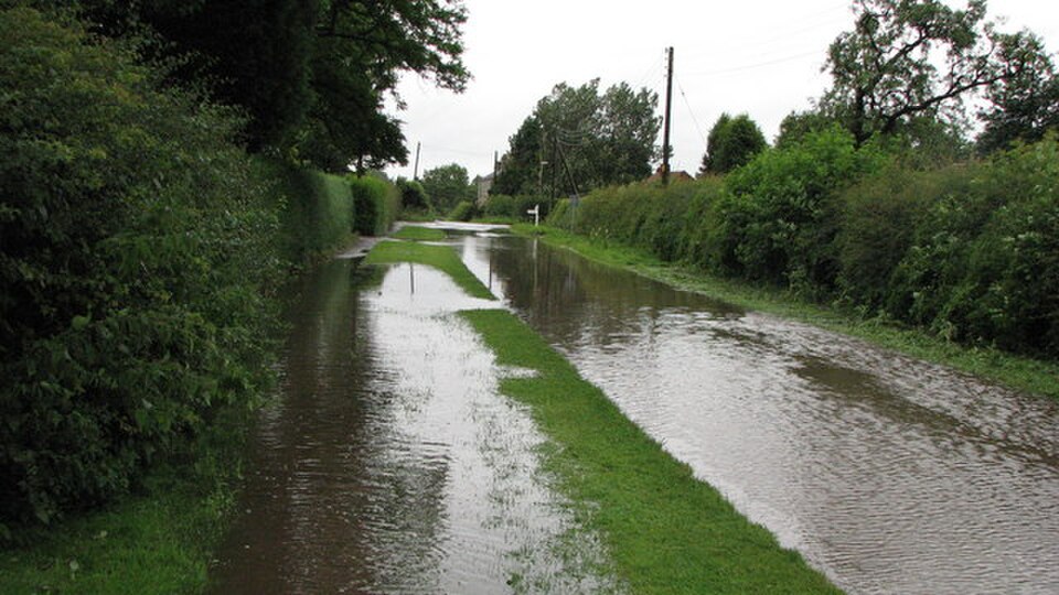
Several districts in Gangetic West Bengal and Odisha are on a red alert due to a weather system. The India Meteorological Department has predicted isolated extremely heavy rains over the area on 17 August 2026. With the low-pressure area forming over the northwest Bay of Bengal, some areas might see rainfall over 20 cm in 24 hours.
This is no ordinary monsoon rains. Whenever the IMD uses terms like "extremely heavy," the prediction refers to rainfall above 20 cm at a particular place. Such rainfall causes the water to run off the soil surface and gather in low-lying areas, and life slows down or stops altogether. Fishing communities along the coasts of West Bengal, Odisha and north Andhra have been told to remain ashore until at least 18 August 2026.
How the Weather System Behaves
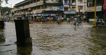
According to the latest bulletin, a low-pressure area has formed over the northwest Bay of Bengal near the West Bengal-north Odisha coast. The system has intensified further and is well-marked. The associated cyclonic circulation has reached a good height above the surface. There are chances that the system would move northwest and consolidate further in the next few hours.
Odisha is expected to receive fairly widespread to widespread rains during 16 to 20 August 2026. Isolated heavy showers will occur on 16 and 17 August with the possibility of isolated extremely heavy showers on both the days. Similarly, Gangetic West Bengal will experience a similar spell of rain till about 22 August 2026. The highest rainfall will be experienced on 17 August 2026 with heavy rains likely on 18 August 2026.
Among the districts, Mayurbhanj of Odisha and Jhargram and Paschim Medinipur of West Bengal are the most likely to receive rains. Several other coastal and northern districts of Odisha are also likely to see rains. Winds up to 40-50 kmph, gusting to 60 kmph are likely over the sea. There is also a low to moderate risk of flash floods in several districts of both the states till midday of 17 August 2026.
Why It Causes Problems
Rainfall along the east coast of India is associated with low-pressure areas that develop over the Bay of Bengal. Moisture-laden low-pressure systems cause rainfall on moving inland or interacting with the monsoon trough. The current low-pressure system is following the same dangerous pattern.
When the rainfall exceeds 20 cm at a place in a day, it causes difficulties for the soil to absorb it properly. Especially when the ground is already wet due to earlier rains, the rain causes trouble in absorbing the water. Odisha has recently witnessed floods in several districts following the earlier formation of low-pressure areas that have turned into a depression in 12 August 2026. Many people have been made to live in relief camps after evacuation from the low-lying areas.
The colour code system followed by the IMD is simple. When a red alert is issued, it means that the situation is grave enough to take actions by people and officials. Red alert holds a special place at the top of the code system. Orange and yellow alerts lie next to them and represent relatively less critical situations.
Forecasts use data collected from satellite images, radar observations, and numerical models. In recent times, the IMD has begun to issue impact-based weather warnings as an addition to the normal forecasts. They talk about waterlogging, damage to poorly built houses, transportation problems, and crop loss.
The Impact on People
The affected families will be worried about the practical problems that the rain will cause to their lives. Road will be flooded and make travel hard. Fields of crops will be flooded in the countryside. Efforts to remove water from the field will become necessary. The IMD's agromet advisories specifically direct the farmers of Odisha to drain out excess water from kharif paddy, cotton, pigeon pea, and vegetable fields. Similar advice has been given for Gangetic West Bengal for aman rice, jute, and vegetables.
Coastal fishermen communities experience the problem directly because of strong winds in the sea. They are advised to keep boats in harbors due to expected rough sea and strong winds. Small coastal fishermen communities that depend on their daily catches for livelihood will find it hard to manage without going out in the sea for two or three days.
In towns and cities, roads become waterlogged, trains delayed, and temporary power cuts are expected due to the heavy rain. Offices may change their timing or switch online in case of severe conditions.
The Administrative Response
Administrations of both Odisha and West Bengal are on high alert due to the current rain prediction. More than two lakh people had been evacuated after the earlier round of rain and floods in Odisha. District collectors are on high alert and are keeping control rooms functional. Relief materials, medical teams, and boats are being kept ready in vulnerable blocks.
Teams of National Disaster Response Force and State Disaster Response Force are normally kept on standby in flood-prone districts in case of such alerts. Local authorities keep an eye on river levels and embankments. West Bengal administration has also followed similar preparations for the southern districts under high alerts.
At the national level, the IMD is issuing frequent alerts through its website, applications, and social media. The Ministry of Earth Sciences and National Disaster Management Authority remains in contact with the state administrations. Advanced impact-based forecasting helps local authorities decide on which villages to evacuate and which road to close.
Farmers receive agromet advisories from the Gramin Krishi Mausam Sewa and state agriculture departments in their local languages advising them to protect standing crops and nursery beds.
The Repeated Problem of the Season
Bay of Bengal is known as a favorable region for the formation of monsoon low-pressure areas due to warm sea temperature, moist winds and location of monsoon trough. Studies have shown that rainfall events are becoming more intense even when there is no significant change in total rainfall in the monsoon season. The increase in intensity means that heavy rainfall is occurring over shorter periods.
This makes it a continuous problem for the states in the eastern and coastal belts as it requires constant flood management and warning system preparations. Odisha has prepared cyclone shelters and improved forecasting capacity due to previous disasters. West Bengal also has its own plans for the southern districts facing risks from both rivers and coast.
When the new low-pressure area develops while the ground remains saturated due to earlier rains, the margin of error reduces. This makes the current red alert more serious.
Simple Measures to Follow
Families in affected districts are advised to monitor the IMD and their state administration weather alerts. Avoid traveling when roads are waterlogged. Keep emergency numbers handy. Livestock and belongings are to be shifted to higher grounds in villages as advised by local authorities. The farmers are to follow the drainage and protection measures of standing crops from the state agriculture department.
Fishermen should take sea advisories seriously and avoid going to sea with strong winds. Coastal communities usually understand the risks, but reminders from local authorities will also be useful.
Schools, transport facilities, and local industries are expected to adapt to the situation. Power and telecommunications companies will keep backup lines ready for quick restoration.
What's Next?
The current weather system is expected to remain active in the next couple of days. Rainfall may continue in the wider region even after the peak period of the current rain ends. The IMD will continue updating the situation as the low-pressure area moves and intensifies.
Currently, the forecast message is simple. The likelihood of extremely heavy rains is likely in parts of Odisha and Gangetic West Bengal on 17 August 2026. Together with an active weather system and wet ground, the chances of local floods and disruptions increases. The officials will be monitoring the situation carefully. People in the affected areas will have to stay alert and follow local instructions.
Each year brings such weather spells during monsoon. But clear forecasts, timely warnings, and coordination on the ground will reduce problems.
 RRB
RRB