Home › Blog › IMD Weather Forecast August 1, 2026: City Reports & Gujarat Rain
IMD Weather Forecast August 1, 2026: City Reports & Gujarat Rain
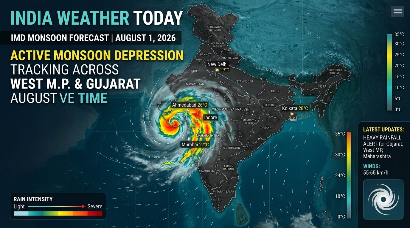
The India Meteorological Department (IMD) has issued a major national weather bulletin for Saturday, August 1, 2026, placing several states on high alert as an intense atmospheric low-pressure system accelerates monsoon precipitation. The IMD weather forecast August 1 2026 highlights a powerful Monsoon Depression moving directly over West Madhya Pradesh and East Rajasthan, steering massive maritime moisture from the Arabian Sea straight into Gujarat, Konkan, and Madhya Maharashtra.
Extremely heavy to torrential rainfall is forecast across Gujarat on August 1, with isolated pockets in Saurashtra and South Gujarat expecting rainfall accumulation exceeding 200 mm to 250 mm within 24 hours. Concurrently, the active offshore trough running along the Western Ghats continues to batter Maharashtra, Goa, and Kerala, while monsoon easterlies interact with mountain topography across Uttarakhand and Himachal Pradesh.
This comprehensive report delivers an exhaustive city-by-city weather breakdown across India for August 1, 2026, featuring a dedicated deep-dive into Gujarat's urban centers, synoptic analyses, river catchment statuses, and public safety advisories.
┌────────────────────────────────────────────────────────────────────────┐
│             SYNOPTIC METEOROLOGICAL DRIVERS (AUGUST 1, 2026)           │
├────────────────────────────────────────────────────────────────────────┤
│ • Primary System: Monsoon Depression centered over West MP and East    │
│   Rajasthan, tracking slowly west-southwestward toward Gujarat.        │
│                                  │                                     │
│                                  ▼                                     │
│ • Arabian Sea Moisture Surge: Strong southwesterly surface winds       │
│   (45–55 km/h) feeding directly into South Gujarat & Saurashtra.       │
│                                  │                                     │
│                                  ▼                                     │
│ • Offshore Trough: Persists from the South Gujarat coastline down to   │
│   the North Kerala maritime boundary at mean sea level.                │
│                                  │                                     │
│                                  ▼                                     │
│ • Shear Zone: East-West shear zone runs roughly along 20°N latitude,   │
│   concentrating convective storm bands over West-Central India.        │
└────────────────────────────────────────────────────────────────────────┘
Synoptic Atmospheric Overview: August 1, 2026
The Southwest Monsoon regime on August 1, 2026, is defined by an aligned low-pressure corridor connecting the Bay of Bengal, Central India, and the Arabian Sea.
                     [ Active Monsoon Depression ]
              (Centered over West MP / East Rajasthan)
                                 │
                                 ▼
         [ Pushing West-Southwestward Toward Gujarat Hub ]
                                 │
                                 ▼
      [ Intersecting Arabian Sea Strong Onshore Wind Current ]
                                 │
                                 ▼
     ┌───────────────────────────┴───────────────────────────┐
     ▼                                                       ▼
[ Torrential Rain Zone ]                            [ Orographic Uplift Zone ]
(Saurashtra, South & Central Gujarat)               (Konkan, Goa, Kerala & Ghats)
The primary engine driving widespread rainfall is the Monsoon Depression hovering near the border of West Madhya Pradesh, East Rajasthan, and North Gujarat. As this system moves slowly west-southwestward, it acts as a atmospheric vacuum, drawing deep tropical moisture from the Arabian Sea. When this moist air mass collides with the land surface and regional hills, it triggers convective cloud clusters capable of producing extreme rainfall rates (30 mm to 50 mm per hour during peak thunderstorms).
In addition, an active offshore trough along the West Coast keeps sea conditions rough, maintaining high wave activity and heavy precipitation along the coastal belts of Maharashtra, Goa, Karnataka, and Kerala.
1. Special In-Depth Report: Gujarat Rainfall & City-by-City Forecast
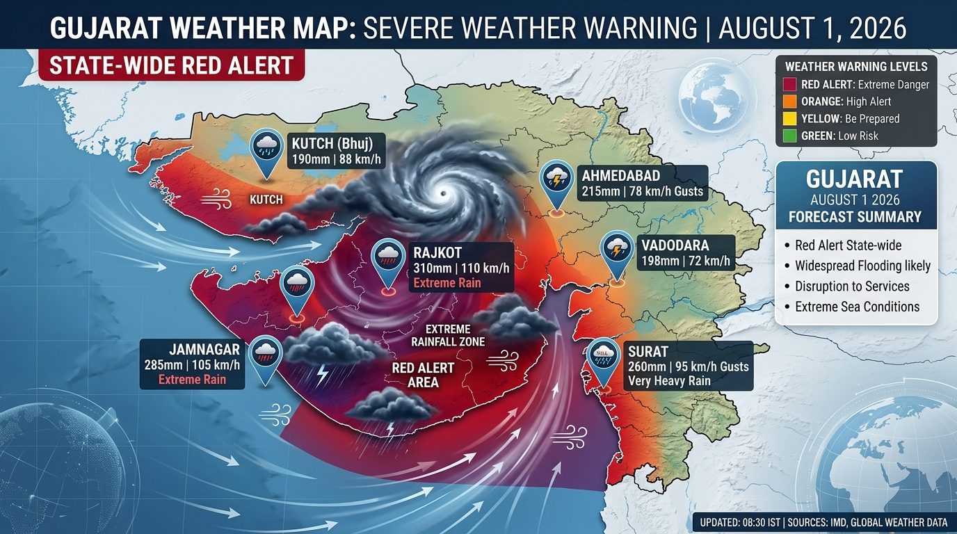
Gujarat is the focal point of India's weather pattern on August 1, 2026. With the IMD activating Red Alerts for multiple districts across Saurashtra, Kutch, and South Gujarat, urban centers and agricultural plains are preparing for significant water inflow.
| GUJARAT REGIONAL RAIN PROFILE (AUG 1) | |
|---|---|
| Highest Warning Level | RED ALERT (Saurashtra & South GUJ) |
| Peak Expected Rainfall Totals | 150 mm to 250+ mm in isolated pockets |
| Prevailing Wind Speeds | 40 to 55 km/h, gusting to 65 km/h |
| Coastal Marine Conditions | Very Rough; Wave heights 3.5 to 4.2m |
| Primary Rivers Under Watch | Vishwamitri, Narmada, Tapi, Shetrunji |
Ahmedabad & Gandhinagar (Central Gujarat)
Maximum Temperature: 29.5°C | Minimum Temperature: 24.0°C
Relative Humidity: 88% – 98% | Wind Speed: 22 to 35 km/h (Southwesterly)
Expected 24-Hour Rainfall Volume: 80 mm to 140 mm (Heavy to Very Heavy Rain)
IMD Alert Status: Orange / Red Alert
Detailed Urban Outlook: Ahmedabad and the capital city of Gandhinagar will experience continuous overcast conditions accompanied by persistent light-to-moderate rain, punctuated by intense spells of heavy downpours during the afternoon and evening. Accumulating rain volumes between 80 mm and 140 mm will test municipal stormwater systems. Classic low-lying urban sectors—including Akhbarnagar underpass, Usmanpura, Mithakhali underpass, Vejalpur, and Prahladnagar—face severe waterlogging risks. Traffic movement along the SG Highway and Ashram Road will likely experience delays. The Sabarmati Riverfront intake gates are being monitored as upstream discharges increase.
Surat, Navsari & Valsad (South Gujarat Belt)
Maximum Temperature: 28.0°C | Minimum Temperature: 23.5°C
Relative Humidity: 92% – 98% | Wind Speed: 35 to 50 km/h, gusting to 65 km/h (Westerly)
Expected 24-Hour Rainfall Volume: 150 mm to 230 mm (Extremely Heavy Rain)
IMD Alert Status: RED ALERT
Detailed Urban Outlook: South Gujarat represents one of the most intense rain zones in the country on August 1. Surat, Navsari, Valsad, and Vapi will be battered by continuous heavy downpours driven by strong onshore winds from the Gulf of Khambhat. Rainfall totals reaching up to 230 mm in isolated areas raise the risk of localized flooding in low-lying industrial and residential sectors. The Tapi River basin and UKAI dam discharge schedules are under continuous hydrometeorological review. Coastal townships in Valsad and Navsari should prepare for high tides colliding with inland runoff, making river mouths slow to drain.
Vadodara, Anand & Bharuch (Central Agricultural Belt)
Maximum Temperature: 28.5°C | Minimum Temperature: 24.0°C
Relative Humidity: 90% – 96% | Wind Speed: 25 to 40 km/h (Southwesterly)
Expected 24-Hour Rainfall Volume: 100 mm to 170 mm (Very Heavy Rain)
IMD Alert Status: Orange / Red Alert
Detailed Urban Outlook: Vadodara, Anand, and Bharuch will witness heavy, sustained rainfall throughout Saturday. In Vadodara, municipal teams are closely monitoring the Vishwamitri River levels as catchment areas in Panchmahal record heavy precipitation. Low-lying streets in Raopura, Sayajigunj, and Alkapuri face urban runoff issues. In Anand and Bharuch, standing crops of tobacco, cotton, and paddy could experience waterlogging if short-duration rainfall rates exceed 40 mm/hour.
Rajkot & Central Saurashtra
Maximum Temperature: 28.5°C | Minimum Temperature: 24.2°C
Relative Humidity: 90% – 98% | Wind Speed: 30 to 45 km/h (Southwesterly)
Expected 24-Hour Rainfall Volume: 120 mm to 200 mm (Extremely Heavy Spells)
IMD Alert Status: RED ALERT
Detailed Urban Outlook: Rajkot and surrounding central Saurashtra districts (Gondal, Jasdan) are under a strict Red Alert. Strong low-level wind convergence will fuel intense thunderstorm bands capable of dropping over 150 mm of rain within 12 hours. Inflows into the Aji-1, Nyari-1, and Bhadar-1 dams are projected to rise sharply. Urban areas such as Kalawad Road, Yagnik Road, and the Aji riverbed settlements face localized inundation. Rural roads connecting Rajkot to Morbi and Jamnagar may see temporary disruptions.
Jamnagar, Devbhumi Dwarka & Porbandar (Coastal Saurashtra)
Maximum Temperature: 28.0°C | Minimum Temperature: 24.0°C
Relative Humidity: 92% – 98% | Wind Speed: 40 to 55 km/h, gusting to 70 km/h (Westerly)
Expected 24-Hour Rainfall Volume: 140 mm to 250 mm (Extremely Heavy Rain)
IMD Alert Status: RED ALERT
Detailed Urban Outlook: The coastal belt of Jamnagar, Devbhumi Dwarka, and Porbandar faces severe weather on August 1. Strong squalls blowing off the Arabian Sea will bring widespread torrential downpours. Accumulated rain exceeding 200 mm is expected in isolated coastal pockets, accompanied by sea waves reaching 3.5 to 4.2 meters. Fishermen are strictly prohibited from entering the sea. Low-lying coastal infrastructure and port operations at Sikka, Okha, and Porbandar should prepare for high winds and heavy rainfall.
Junagadh & Gir Somnath (Southern Saurashtra)
Maximum Temperature: 28.2°C | Minimum Temperature: 23.8°C
Relative Humidity: 90% – 96% | Wind Speed: 30 to 48 km/h (Southwesterly)
Expected 24-Hour Rainfall Volume: 130 mm to 210 mm (Extremely Heavy Spells)
IMD Alert Status: RED ALERT
Detailed Urban Outlook: The Gir region, including Junagadh city and Veraval/Gir Somnath, will see heavy downpours driven by moisture lifting over the Girnar hills. Flash runoff down the slopes of Mount Girnar will swell the Willingdon dam and local river streams. Precautionary advisories have been issued for the Gir Forest national park corridors to safeguard wildlife from swollen forest rivulets.
Bhuj, Gandhidham & Kutch Region
Maximum Temperature: 30.0°C | Minimum Temperature: 25.0°C
Relative Humidity: 82% – 94% | Wind Speed: 25 to 40 km/h (Southwesterly)
Expected 24-Hour Rainfall Volume: 90 mm to 160 mm (Heavy to Very Heavy Rain)
IMD Alert Status: Orange Alert
Detailed Urban Outlook: The arid Kutch district will experience a major rainfall event on August 1. Bhuj, Anjar, Gandhidham, and Mundra will see overcast skies with frequent heavy rain passes. While dry soils will initially absorb early moisture, high-intensity spells could lead to flash runoff across desert causeways and low-lying salt flat peripheries. Transport routes connecting Kutch to mainland Gujarat via Maliya should be navigated with caution.
Bhavnagar & Amreli (Eastern Saurashtra)
Maximum Temperature: 29.0°C | Minimum Temperature: 24.5°C
Relative Humidity: 88% – 95% | Wind Speed: 28 to 42 km/h (Southwesterly)
Expected 24-Hour Rainfall Volume: 80 mm to 140 mm (Heavy to Very Heavy Rain)
IMD Alert Status: Orange Alert
Detailed Urban Outlook: Bhavnagar, Amreli, and Palitana will see consistent rain activity on Saturday. River basins such as the Shetrunji and Shatrunjaya will receive steady inflows. Coastal fishing villages along the Gulf of Khambhat face squally surface winds.
North Gujarat (Mehsana, Patan, Banaskantha, Sabarkantha)
Maximum Temperature: 31.0°C | Minimum Temperature: 25.0°C
Relative Humidity: 80% – 92% | Wind Speed: 20 to 32 km/h (Southwesterly)
Expected 24-Hour Rainfall Volume: 60 mm to 110 mm (Moderate to Heavy Rain)
IMD Alert Status: Yellow / Orange Alert
Detailed Urban Outlook: North Gujarat districts—including Mehsana, Patan, Palanpur (Banaskantha), and Himmatnagar—will see moderate to heavy rainfall. While precipitation levels will be slightly lower than in South Gujarat and Saurashtra, steady downpours will help recharge groundwater and local farm ponds.
| City / Hub | Expected Rain (mm) | Max Wind Speed | IMD Alert Code |
|---|---|---|---|
| Ahmedabad | 80 – 140 mm | 35 km/h | Orange / Red |
| Surat | 150 – 230 mm | 65 km/h (Gusts) | RED ALERT |
| Vadodara | 100 – 170 mm | 40 km/h | Orange / Red |
| Rajkot | 120 – 200 mm | 45 km/h | RED ALERT |
| Jamnagar | 140 – 250 mm | 70 km/h (Gusts) | RED ALERT |
| Junagadh | 130 – 210 mm | 48 km/h | RED ALERT |
| Bhuj (Kutch) | 90 – 160 mm | 40 km/h | Orange |
| Bhavnagar | 80 – 140 mm | 42 km/h | Orange |
| Mehsana | 60 – 110 mm | 32 km/h | Yellow / Orange |
2. Western India Forecast: Maharashtra, Goa & Rajasthan
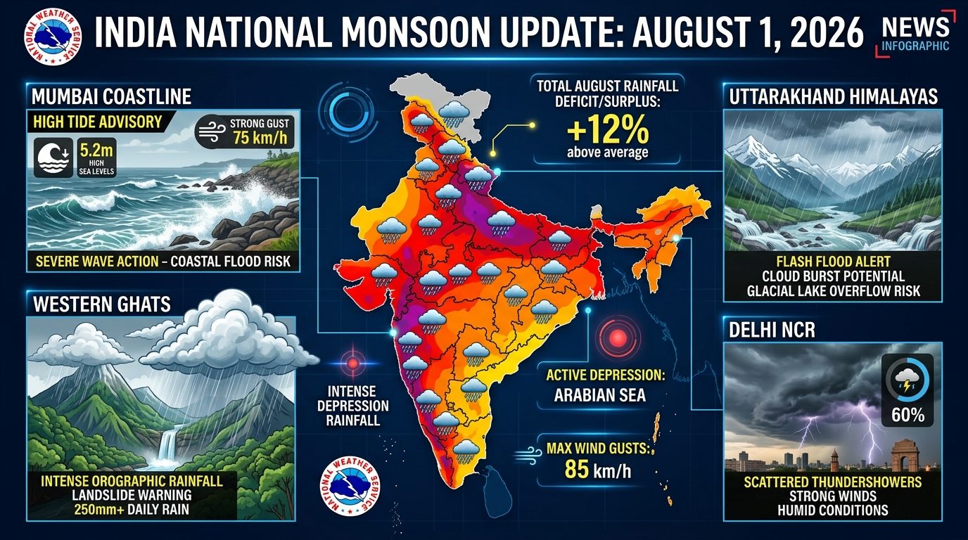
Western India outside Gujarat remains under active monsoon conditions, driven by the offshore trough and the proximity of the West MP depression.
| WESTERN INDIA REGIONAL SUMMARY | |
|---|---|
| Primary System Impact | Offshore Trough & Rajasthan Depression |
| Temperature Profile | Max: 25°C to 32°C | Min: 20°C to 25°C |
| Humidity Range | 82% to 98% |
| Dominant Warning Level | ORANGE ALERT (Konkan, Goa & Ghats) |
Mumbai Metropolitan Region (MMR)
Maximum Temperature: 28.2°C | Minimum Temperature: 24.0°C
Relative Humidity: 88% – 96% | Wind Speed: 25 to 38 km/h, gusting to 52 km/h (Westerly)
Expected 24-Hour Rainfall Volume: 90 mm to 160 mm (Heavy to Very Heavy Rain)
IMD Alert Status: Orange Alert
Detailed Outlook: Mumbai, Thane, Palghar, and Navi Mumbai face active monsoon conditions on August 1. Widespread heavy rainfall interspersed with fierce, gusty winds will prevail throughout Saturday. A high astronomical tide of 4.12 meters at 14:15 IST means that peak rain passes occurring around early afternoon could slow storm-water drainage into the sea. Low-lying transit points—such as Hindmata, Sion, Kurla, King's Circle, and the Andheri and Milan subways—face waterlogging risks. Suburban local train networks may experience speed restrictions.
Pune & Western Ghats (Maharashtra)
Maximum Temperature: 25.0°C | Minimum Temperature: 21.2°C
Relative Humidity: 86% – 95% | Wind Speed: 20 to 32 km/h (Westerly)
Expected 24-Hour Rainfall Volume: 40 mm in City / 160 mm+ in Ghat Sections
IMD Alert Status: Orange Alert (Ghat Areas)
Detailed Outlook: Pune city will experience overcast skies, cool breezes, and continuous light-to-moderate showers. However, the surrounding Western Ghats (Lonavala, Khandala, Tamhini Pass, Varandha Pass, Lavasa) are under an Orange Alert for very heavy to extremely heavy rainfall. Mountain streams and waterfalls will carry high discharge, increasing the risk of landslides along ghat roads.
Panaji (Goa)
Maximum Temperature: 27.5°C | Minimum Temperature: 23.2°C
Relative Humidity: 90% – 98% | Wind Speed: 30 to 45 km/h (Westerly)
Expected 24-Hour Rainfall Volume: 110 mm to 180 mm (Heavy to Very Heavy Rain)
IMD Alert Status: Orange / Red Alert
Detailed Outlook: Goa will experience heavy monsoonal rain on August 1. Widespread heavy downpours will be accompanied by strong onshore winds blowing at 40 km/h. High swell waves (up to 3.8 meters) make sea conditions hazardous, and beach activities remain suspended statewide.
Jaipur & Udaipur (Rajasthan)
Maximum Temperature: 33.0°C (Jaipur) / 28.5°C (Udaipur) | Minimum Temperature: 24.5°C
Relative Humidity: 75% – 92% | Wind Speed: 15 to 28 km/h (Southwesterly)
Expected 24-Hour Rainfall Volume: Jaipur: 30–60 mm | Udaipur: 70–130 mm
IMD Alert Status: Yellow Alert (Jaipur) / Orange Alert (Udaipur & Southern Raj)
Detailed Outlook: Southern and Southeastern Rajasthan (Udaipur, Banswara, Dungarpur, Chittorgarh) will see heavy to very heavy rainfall due to the proximity of the Monsoon Depression. Jaipur and central Rajasthan will see generally cloudy skies with intermittent moderate thundershowers.
3. Northern India Forecast: Delhi-NCR, UP, Punjab, Haryana & Hills
Northern India will experience warm, humid weather with scattered light-to-moderate rain, while foothill regions face localized heavy downpours.
| NORTHERN INDIA REGIONAL SUMMARY | |
|---|---|
| Primary System Impact | Low-level Easterlies + Weak Upper WD |
| Temperature Profile | Max: 22°C to 34°C | Min: 16°C to 26°C |
| Humidity Range | 75% to 95% |
| Dominant Warning Level | YELLOW / ORANGE ALERT (Hills) |
Delhi-NCR (Delhi, Noida, Gurugram, Faridabad, Ghaziabad)
Maximum Temperature: 33.0°C | Minimum Temperature: 25.8°C
Relative Humidity: 76% – 92% | Wind Speed: 12 to 18 km/h (Southeasterly)
Expected 24-Hour Rainfall Volume: 25 mm to 55 mm (Light to Moderate Rain)
IMD Alert Status: Yellow Alert
Detailed Outlook: Delhi-NCR will see generally cloudy skies on August 1. Light to moderate rainfall accompanied by isolated thunder and lightning is expected during early morning and late afternoon hours. High humidity will keep the heat index (real-feel temperature) near 40°C during dry intervals. Localized waterlogging may cause minor traffic delays near usual underpass vulnerability points.
Lucknow & Kanpur (Uttar Pradesh)
Maximum Temperature: 32.0°C | Minimum Temperature: 25.5°C
Relative Humidity: 80% – 94% | Wind Speed: 10 to 16 km/h (Easterly)
Expected 24-Hour Rainfall Volume: 35 mm to 70 mm (Moderate to Heavy Spells)
IMD Alert Status: Yellow Alert
Detailed Outlook: Lucknow, Kanpur, and central Uttar Pradesh will see overcast skies with periodic thundershowers. One or two intense rain passes are likely during the afternoon, bringing temporary relief from high humidity.
Chandigarh & Tricity (Punjab & Haryana)
Maximum Temperature: 31.5°C | Minimum Temperature: 24.8°C
Relative Humidity: 80% – 94% | Wind Speed: 10 to 15 km/h (Easterly)
Expected 24-Hour Rainfall Volume: 30 mm to 60 mm (Moderate Rain)
IMD Alert Status: Yellow Alert
Detailed Outlook: Chandigarh, Mohali, and Panchkula will experience cloudy conditions with light to moderate rainfall. Morning showers will keep early temperatures comfortable, though daytime humidity will remain high.
Dehradun & Hill Districts (Uttarakhand)
Maximum Temperature: 27.5°C | Minimum Temperature: 21.0°C
Relative Humidity: 88% – 98% | Wind Speed: 8 to 14 km/h (Northeasterly)
Expected 24-Hour Rainfall Volume: 90 mm to 170 mm (Heavy to Very Heavy Rain)
IMD Alert Status: Orange Alert
Detailed Outlook: Uttarakhand faces persistent rainfall on Saturday. Dehradun, Haridwar, Rishikesh, and the foothills are under an Orange Alert for heavy downpours. Landslide risks remain high along mountain highway corridors, including the Rishikesh-Badrinath (NH-58) and Rudraprayag-Kedarnath routes.
Shimla & Dharamshala (Himachal Pradesh)
Maximum Temperature: 22.0°C (Shimla) / 24.5°C (Dharamshala) | Minimum Temperature: 15.5°C
Relative Humidity: 86% – 98% | Wind Speed: 8 to 14 km/h (Southeasterly)
Expected 24-Hour Rainfall Volume: 50 mm to 90 mm (Moderate to Heavy Rain)
IMD Alert Status: Yellow / Orange Alert
Detailed Outlook: Fog, low cloud cover, and intermittent moderate-to-heavy rain will prevail across Shimla, Solan, Kullu, and Dharamshala. Reduced visibility will affect mountain driving along the Kalka-Shimla highway (NH-5).
Srinagar & Jammu (Jammu & Kashmir)
Maximum Temperature: 28.0°C (Srinagar) / 31.5°C (Jammu) | Minimum Temperature: 18.5°C
Relative Humidity: 65% – 80% | Wind Speed: 8 to 12 km/h (Variable)
Expected 24-Hour Rainfall Volume: 10 mm to 25 mm (Light Scattered Rain)
IMD Alert Status: Green Watch / Light Rain
Detailed Outlook: The Kashmir Valley will see pleasant weather with partly cloudy skies and light scattered showers over higher reaches. Jammu will see humid conditions with afternoon thundershowers.
4. Southern India Forecast: Peninsular Contrast
Southern India shows a clear weather contrast: heavy rainfall along the windward Malabar and Kanara coasts versus warm, drier weather across Tamil Nadu's rain-shadow region.
| SOUTHERN INDIA REGIONAL SUMMARY | |
|---|---|
| Primary System Impact | Arabian Sea Onshore Flow & Offshore Trough |
| Temperature Profile | Max: 26°C to 36°C | Min: 19°C to 27°C |
| Humidity Range | 58% to 98% |
| Dominant Warning Level | ORANGE ALERT (Kerala & Coastal KA) |
Thiruvananthapuram & Kochi (Kerala)
Maximum Temperature: 28.0°C (Trivandrum) / 27.0°C (Kochi) | Minimum Temperature: 23.2°C
Relative Humidity: 88% – 98% | Wind Speed: 20 to 32 km/h (Westerly)
Expected 24-Hour Rainfall Volume: 80 mm to 140 mm (Heavy to Very Heavy Rain)
IMD Alert Status: Orange Alert (10 Districts)
Detailed Outlook: Kerala continues to experience active monsoon weather on August 1. An Orange Alert is active across 10 districts—including Pathanamthitta, Alappuzha, Kottayam, Ernakulam, Idukki, Thrissur, Malappuram, Kozhikode, Kannur, and Kasaragod—for heavy to very heavy rainfall. High coastal waves (3.0 to 3.6 meters) and squally winds make sea conditions unsafe for navigation.
Bengaluru (Karnataka)
Maximum Temperature: 26.2°C | Minimum Temperature: 19.5°C
Relative Humidity: 78% – 90% | Wind Speed: 18 to 28 km/h (Westerly)
Expected 24-Hour Rainfall Volume: 15 mm to 35 mm (Light to Moderate Showers)
IMD Alert Status: Yellow Watch
Detailed Outlook: Bengaluru will enjoy pleasant, overcast, and breezy conditions on Saturday. Intermittent light-to-moderate showers will drift across the city during the afternoon and evening. Cool westerly breezes will keep daytime temperatures near 26°C.
Chennai & Tamil Nadu
Maximum Temperature: 35.8°C | Minimum Temperature: 27.0°C
Relative Humidity: 58% – 75% | Wind Speed: 12 to 20 km/h (Southwesterly)
Expected 24-Hour Rainfall Volume: 5 mm to 15 mm (Isolated Evening Showers)
IMD Alert Status: Green Watch / Hot & Humid
Detailed Outlook: Positioned in the rain-shadow of the Western Ghats, Chennai will remain warm, dry, and humid. Skies will be partly cloudy, with a minor chance of isolated evening convective thundershowers. High humidity will drive real-feel temperatures above 40°C during early afternoon.
Hyderabad (Telangana)
Maximum Temperature: 29.0°C | Minimum Temperature: 22.8°C
Relative Humidity: 78% – 92% | Wind Speed: 15 to 25 km/h (Westerly)
Expected 24-Hour Rainfall Volume: 25 mm to 50 mm (Light to Moderate Rain)
IMD Alert Status: Yellow Alert
Detailed Outlook: Hyderabad will see cloudy skies with intermittent light to moderate rain. Gusty winds (up to 35 km/h) and cloud cover will keep daytime maximum temperatures capped near 29°C.
5. Eastern & Northeastern India Forecast
Eastern and Northeastern states will see steady monsoonal rainfall, supported by regional cyclonic circulations and ongoing flood conditions in the Brahmaputra basin.
| EASTERN & NORTHEAST REGIONAL SUMMARY | |
|---|---|
| Primary System Impact | Bay Moisture & Upper Cyclonic Features |
| Temperature Profile | Max: 21°C to 32°C | Min: 15°C to 26°C |
| Humidity Range | 82% to 98% |
| Dominant Warning Level | ORANGE ALERT (Assam & Meghalaya) |
Kolkata (West Bengal)
Maximum Temperature: 31.5°C | Minimum Temperature: 26.0°C
Relative Humidity: 84% – 95% | Wind Speed: 14 to 20 km/h (Southeasterly)
Expected 24-Hour Rainfall Volume: 40 mm to 80 mm (Moderate to Heavy Rain Spells)
IMD Alert Status: Yellow / Orange Alert
Detailed Outlook: Kolkata, Howrah, and nearby South 24 Parganas will see overcast, humid weather. Spells of moderate rain with lightning and thundersqualls are expected during afternoon hours, which may cause temporary waterlogging in low-lying city streets.
Patna (Bihar)
Maximum Temperature: 32.0°C | Minimum Temperature: 25.8°C
Relative Humidity: 80% – 92% | Wind Speed: 12 to 18 km/h (Easterly)
Expected 24-Hour Rainfall Volume: 25 mm to 50 mm (Moderate Thundershowers)
IMD Alert Status: Yellow Alert
Detailed Outlook: Patna and North Bihar districts will see cloudy skies with scattered light-to-moderate rainfall. The IMD highlights a localized lightning hazard during afternoon convective storms across rural sectors.
Guwahati & Assam Flood Corridor
Maximum Temperature: 29.5°C | Minimum Temperature: 24.5°C
Relative Humidity: 85% – 98% | Wind Speed: 10 to 15 km/h (Southeasterly)
Expected 24-Hour Rainfall Volume: 50 mm to 90 mm (Heavy Rainfall)
IMD Alert Status: Orange Alert
Detailed Outlook: Widespread light-to-moderate rain with heavy spells will affect Guwahati, Dibrugarh, Lakhimpur, and Silchar. Elevated river levels along the Brahmaputra and Kopili continue to sustain flood conditions across rural lowlands, with local urban flooding likely in Guwahati.
Shillong & Cherrapunji (Meghalaya)
Maximum Temperature: 20.5°C (Shillong) / 19.0°C (Sohra) | Minimum Temperature: 15.0°C
Relative Humidity: 92% – 98% | Wind Speed: 12 to 18 km/h (Southeasterly)
Expected 24-Hour Rainfall Volume: 120 mm to 210 mm (Heavy to Very Heavy Rain)
IMD Alert Status: Orange Alert
Detailed Outlook: Heavy orographic downpours, low cloud bases, and dense fog will cover the Khasi Hills. Driving visibility along the Guwahati-Shillong expressway (NH-40) will be severely limited.
Master National City-Wise Weather Data Matrix (August 1, 2026)
The reference table below consolidates official forecast metrics across 25 major Indian cities for Saturday, August 1, 2026:
| City Name | State / UT | Max Temp (°C) | Min Temp (°C) | Expected Rain (mm) | Humidity (%) | Wind Speed (km/h) | IMD Alert Code |
|---|---|---|---|---|---|---|---|
| Ahmedabad | Gujarat | 29.5°C | 24.0°C | 80 – 140 mm | 88–98% | 35 km/h | Orange/Red |
| Surat | Gujarat | 28.0°C | 23.5°C | 150 – 230 mm | 92–98% | 65 km/h | RED ALERT |
| Vadodara | Gujarat | 28.5°C | 24.0°C | 100 – 170 mm | 90–96% | 40 km/h | Orange/Red |
| Rajkot | Gujarat | 28.5°C | 24.2°C | 120 – 200 mm | 90–98% | 45 km/h | RED ALERT |
| Jamnagar | Gujarat | 28.0°C | 24.0°C | 140 – 250 mm | 92–98% | 70 km/h | RED ALERT |
| Bhuj (Kutch) | Gujarat | 30.0°C | 25.0°C | 90 – 160 mm | 82–94% | 40 km/h | Orange |
| Mumbai | Maharashtra | 28.2°C | 24.0°C | 90 – 160 mm | 88–96% | 52 km/h | Orange |
| Pune | Maharashtra | 25.0°C | 21.2°C | 40 mm (160+ Ghats) | 86–95% | 32 km/h | Orange (Ghats) |
| Panaji | Goa | 27.5°C | 23.2°C | 110 – 180 mm | 90–98% | 45 km/h | Orange/Red |
| Delhi-NCR | Delhi UT | 33.0°C | 25.8°C | 25 – 55 mm | 76–92% | 18 km/h | Yellow |
| Lucknow | Uttar Pradesh | 32.0°C | 25.5°C | 35 – 70 mm | 80–94% | 16 km/h | Yellow |
| Jaipur | Rajasthan | 33.0°C | 24.5°C | 30 – 60 mm | 75–92% | 28 km/h | Yellow |
| Udaipur | Rajasthan | 28.5°C | 23.5°C | 70 – 130 mm | 85–96% | 30 km/h | Orange |
| Dehradun | Uttarakhand | 27.5°C | 21.0°C | 90 – 170 mm | 88–98% | 14 km/h | Orange |
| Shimla | Himachal Pradesh | 22.0°C | 15.5°C | 50 – 90 mm | 86–98% | 14 km/h | Yellow/Orange |
| Chandigarh | Punjab/Haryana | 31.5°C | 24.8°C | 30 – 60 mm | 80–94% | 15 km/h | Yellow |
| Bengaluru | Karnataka | 26.2°C | 19.5°C | 15 – 35 mm | 78–90% | 28 km/h | Yellow |
| Chennai | Tamil Nadu | 35.8°C | 27.0°C | 5 – 15 mm | 58–75% | 20 km/h | Green |
| Hyderabad | Telangana | 29.0°C | 22.8°C | 25 – 50 mm | 78–92% | 35 km/h | Yellow |
| Kochi | Kerala | 27.0°C | 23.2°C | 80 – 140 mm | 88–98% | 32 km/h | Orange |
| Kolkata | West Bengal | 31.5°C | 26.0°C | 40 – 80 mm | 84–95% | 20 km/h | Yellow/Orange |
| Patna | Bihar | 32.0°C | 25.8°C | 25 – 50 mm | 80–92% | 18 km/h | Yellow |
| Bhubaneswar | Odisha | 30.2°C | 24.5°C | 35 – 70 mm | 82–94% | 22 km/h | Yellow |
| Guwahati | Assam | 29.5°C | 24.5°C | 50 – 90 mm | 85–98% | 15 km/h | Orange |
| Shillong | Meghalaya | 20.5°C | 15.0°C | 120 – 210 mm | 92–98% | 18 km/h | Orange |
Public Safety Directives and Actionable Guidelines
Given the severe weather warnings issued for August 1, 2026, the IMD and National Disaster Management Authority (NDMA) recommend the following safety protocols:
| Disaster Risk Zone | Mandated Public Action |
|---|---|
| Red Alert Zones (Saurashtra, South Gujarat, Surat, Jamnagar) | Avoid non-essential travel; do not drive through flooded underpasses. |
| Urban Flood Corridors (Mumbai, Ahmedabad, Vadodara) | Park vehicles on elevated ground; keep emergency power banks charged. |
| Mountainous Slope Corridors (Uttarakhand, HP, Ghats) | Avoid travel on landslide routes during heavy rain spells. |
| Coastal Maritime Belt (Gujarat, Konkan, Goa, Kerala) | Fishermen prohibited from entering sea due to 45–65 km/h squalls and high waves. |
- Avoid Waterlogged Underpasses: In cities under high alerts (Surat, Rajkot, Jamnagar, Ahmedabad, Vadodara, Mumbai), never attempt to drive or walk through submerged underpasses or roads where water depth is unknown.
- Dam & Riverbed Caution: Residents living along the riverbanks of the Vishwamitri, Tapi, Sabarmati, Aji, and Bhadar should monitor official municipal discharge alerts and move to higher ground if advised.
- High Tide Awareness: In coastal cities like Mumbai and Surat, avoid visiting beaches or coastal promenades during high tide windows, as heavy rain combined with tidal surges can cause rapid shoreline flooding.
- Himalayan Travel Warnings: Travelers along Uttarakhand and Himachal Pradesh hill highways should monitor local administration updates before traveling, as rain-saturated slopes carry rockfall risks.
What You Need to Know (Key Takeaways)
- Gujarat Red Alert: A Monsoon Depression over West MP and East Rajasthan will bring torrential, extremely heavy rainfall (150 mm to 250+ mm) across Surat, Rajkot, Jamnagar, Devbhumi Dwarka, Junagadh, and South Gujarat on August 1, 2026.
- Ahmedabad & Central Gujarat: Ahmedabad, Vadodara, and Anand are under an Orange/Red Alert for heavy downpours (80 mm to 170 mm), with high runoff expected in low-lying city sectors and the Vishwamitri river basin.
- Mumbai Monsoon Impact: Mumbai, Thane, and Palghar are under an Orange Alert for heavy to very heavy rainfall (90 mm to 160 mm), with a 4.12m high tide at 14:15 IST increasing waterlogging risks.
- Kerala & Western Ghats: An Orange Alert covers 10 districts in Kerala and the Maharashtra/Goa Ghat sections (Lonavala, Tamhini), warning of very heavy rainfall.
- Northern & Eastern Cities: Delhi-NCR, Lucknow, and Chandigarh will see light-to-moderate rain (25 mm to 60 mm), while Uttarakhand and Meghalaya face heavy downpours and landslide risks.
- Maritime Safety: Fishermen along the Arabian Sea coastline from Gujarat down to Kerala are strictly prohibited from entering deep waters due to squally winds (45 to 65 km/h) and rough sea swells.
Suggested Categories: Weather News / India News / IMD Bulletins / Disaster Management
Suggested Tags: IMD weather forecast August 1 2026, Gujarat rain forecast today, Ahmedabad weather August 1 2026, Surat heavy rain alert, Rajkot Jamnagar red alert, Mumbai monsoon update, India weather forecast city wise, Gujarat district rain totals
Stay Updated & Receive Weather Alerts
Get real-time monsoon updates, IMD bulletins, and live disaster management advisories on RRBCONTENTS.
Explore Daily Current Affairs → Join Telegram Channel →Official Telegram: @rrbcontents