Home › Blog › Weather & Climate Affairs
IMD Weather Forecast for 10 August 2026: Heavy to Very Heavy Rainfall Alerts, Orange Warnings Across Key Regions, and Full Monsoon Outlook
Key Takeaways & Article Highlights
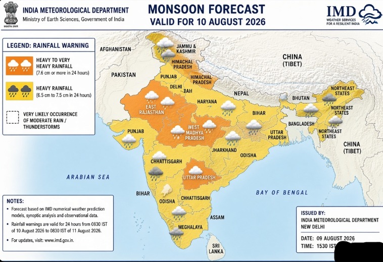
- Forecast Window: Valid primarily from 0830 IST on 10 August 2026 to 0830 IST on 11 August 2026 issued by IMD, Ministry of Earth Sciences.
- Orange Alerts (Heavy to Very Heavy Rain): Isolated places over East Rajasthan, Himachal Pradesh, Uttarakhand, and West Madhya Pradesh.
- Heavy Rainfall Warnings: Assam & Meghalaya, Bihar, Chhattisgarh, East MP, Haryana-Delhi, J&K, Northeast states, Odisha, Punjab, UP, and Vidarbha.
- Synoptic Systems: Driven by low-pressure area over southwest UP and associated cyclonic circulation extending into mid-troposphere.
The India Meteorological Department (IMD), Ministry of Earth Sciences, issued its latest All India Weather Summary and Forecast Bulletin on the evening of 9 August 2026 (around 1630 IST). This forecast, valid primarily from 0830 IST on 10 August 2026 to 0830 IST on 11 August 2026, indicates continued active southwest monsoon conditions driven by a low-pressure area and associated cyclonic circulation that had persisted over southwest Uttar Pradesh and neighbourhood, with the circulation extending several kilometres above mean sea level.
Isolated heavy to very heavy rainfall is very likely over East Rajasthan, Himachal Pradesh, Uttarakhand and West Madhya Pradesh. Heavy rainfall is very likely at isolated places over Assam & Meghalaya, Bihar, Chhattisgarh, East Madhya Pradesh, Haryana, Chandigarh & Delhi, Jammu-Kashmir-Ladakh-Gilgit-Baltistan-Muzaffarabad, Nagaland, Manipur, Mizoram & Tripura, Odisha, Punjab, Uttar Pradesh and Vidarbha. Thunderstorms accompanied by lightning and gusty winds (30-50 kmph in many areas) are also forecast over multiple subdivisions.
No nationwide Red Alert (Take Action for extreme events) was highlighted for 10 August in the primary national bulletin, but Orange-level (Be Prepared) conditions apply to the heavy-to-very-heavy rainfall zones, particularly the western Himalayan region and selected central/northwestern districts. Meteorological Centre Shimla had specifically flagged Orange Alert for heavy to very heavy rain at isolated places over Kangra and Sirmaur districts, and heavy rain over Kullu and Mandi on 10 August, with Yellow for several other Himachal districts.
These predictions are based on real-time observations, numerical weather prediction models, and synoptic analysis as of 9 August 2026. All details below draw exclusively from IMD bulletins and press material dated 8–9 August 2026; older data have been excluded.
Synoptic Features and Monsoon Context
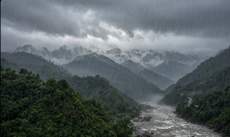
As of the morning and evening assessments around 8–9 August 2026, a low-pressure area over southwest Uttar Pradesh and adjoining areas, along with its associated upper-air cyclonic circulation, continued to influence rainfall distribution. This system, combined with active monsoon trough conditions and moisture influx from the Bay of Bengal and Arabian Sea, supported fairly widespread to widespread rainfall over large parts of the country. Western Himalayan regions remained particularly favourable for intense orographic rainfall.
Southwest monsoon remained active over several subdivisions. Fairly widespread to widespread rainfall was expected to continue over Himachal Pradesh and Uttarakhand through mid-August in the broader outlook. Isolated heavy rainfall was flagged for Jammu-Kashmir-Ladakh-Gilgit-Baltistan-Muzaffarabad during 10–12 August, and very heavy rainfall potential was noted over East Rajasthan and Himachal Pradesh around 10–11 August.
Temperatures across the plains of Northwest India showed no significant change expected in maximums over the subsequent days. Humidity remained elevated in rainy zones, supporting thunderstorm development.
Detailed Warnings for 10 August 2026
Heavy to Very Heavy Rainfall (Orange Alert category – Be Prepared):
Isolated places over East Rajasthan, Himachal Pradesh, Uttarakhand and West Madhya Pradesh. In practical terms this means 24-hour rainfall totals potentially exceeding 11.5 cm (very heavy) or 6.5–11.5 cm (heavy) at isolated stations, with risk of localised flooding, landslides in hilly terrain, and disruptions.
Heavy Rainfall:
Isolated places over Assam & Meghalaya, Bihar, Chhattisgarh, East Madhya Pradesh, Haryana, Chandigarh & Delhi, Jammu-Kashmir-Ladakh-Gilgit-Baltistan-Muzaffarabad, Nagaland, Manipur, Mizoram & Tripura, Odisha, Punjab, Uttar Pradesh and Vidarbha.
Thunderstorm, Lightning and Gusty Winds:
- 40–50 kmph gusts possible at isolated places over Andaman & Nicobar Islands, Kerala & Mahe, Lakshadweep, Rayalaseema, Tamil Nadu–Puducherry–Karaikal and Telangana.
- 30–40 kmph gusts over Bihar, Jammu-Kashmir-Ladakh-Gilgit-Baltistan-Muzaffarabad, Jharkhand, Madhya Pradesh, North Interior Karnataka, Odisha, Rajasthan and West Bengal & Sikkim.
- Lightning risk at isolated places over additional areas including Meghalaya, Chhattisgarh, Coastal Andhra Pradesh, Gujarat Region, Maharashtra, Northeast states and Uttarakhand.
Strong surface winds were also noted as possible over parts of South India.
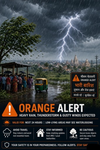
IMD colour coding clarification remains standard: Orange means “Be Prepared” (prepare for disruptions, monitor updates, secure property). Red would indicate “Take Action” for more extreme, widespread impacts. The heavy-to-very-heavy isolated forecasts fall into the Orange preparedness category for the named regions, especially the hills.
Regional Forecast Breakdown
Northwest India:
Fairly widespread to widespread rainfall continued likely over Himachal Pradesh and Uttarakhand. Isolated heavy rainfall expected over Jammu-Kashmir-Ladakh-Gilgit-Baltistan-Muzaffarabad (10–12 August window), West Uttar Pradesh on 10 August, and East Uttar Pradesh around 9–10 August. East Rajasthan carried very heavy potential. Thunderstorms with lightning and 30–40 kmph gusts possible at isolated places.
For Delhi and neighbourhood specifically (from the Regional Meteorological Centre, New Delhi bulletin valid around 9–10 August): Generally cloudy sky. A spell of very light to light rain at a few places during morning to forenoon on 10 August. Maximum temperature 33–35°C, minimum 24–26°C. No major warning for the capital itself beyond the broader Haryana–Delhi–Punjab heavy rainfall mention at isolated places.
Himachal Pradesh (Meteorological Centre Shimla): Orange Alert for heavy to very heavy rain at isolated places over Kangra and Sirmaur; heavy rain over Kullu and Mandi; Yellow for several other districts including Una, Bilaspur, Hamirpur, Chamba, Shimla and Solan. Risk of landslides, flash floods and rising river levels in vulnerable mid-hill and low-hill areas.
Uttarakhand: Fairly widespread to widespread rain with isolated heavy to very heavy spells. High risk of landslides in hilly districts and waterlogging in lower areas.
Central India:
Isolated heavy to very heavy rainfall over West Madhya Pradesh. Heavy rainfall at isolated places over East Madhya Pradesh, Chhattisgarh and Vidarbha. Fairly widespread activity expected in parts of Madhya Pradesh and Chhattisgarh. Thunderstorms with lightning possible. Localised flooding in low-lying and urban areas of Bhopal, Indore and surrounding districts possible under intense spells.
East India:
Heavy rainfall at isolated places over Bihar, Jharkhand, Odisha and Sub-Himalayan West Bengal & Sikkim. Fairly widespread to widespread rain likely over several of these subdivisions. Thunderstorms with gusty winds (30–40 kmph or higher) and lightning expected. Risk of temporary waterlogging in Kolkata and other urban centres, disruption to road and rail traffic, and impacts on standing crops.
Northeast India:
Heavy rainfall very likely at isolated places over Assam & Meghalaya and the Nagaland–Manipur–Mizoram–Tripura region. Fairly widespread activity over many of these areas. Thunderstorms and lightning possible. Continued vigilance for riverine flooding and landslides in vulnerable districts remains necessary given the active monsoon.
West India:
Fairly widespread to widespread rainfall over Konkan & Goa. Isolated to scattered activity elsewhere in Gujarat Region, Madhya Maharashtra, Marathwada and Saurashtra & Kutch. Thunderstorm and lightning risk at isolated places.
South India:
Isolated heavy rainfall had been flagged for Coastal Karnataka, Kerala & Mahe, Lakshadweep and South Interior Karnataka in the preceding days; residual activity and thunderstorms with gusty winds (40–50 kmph) continue possible over Tamil Nadu–Puducherry–Karaikal, Kerala & Mahe, Lakshadweep, Rayalaseema and Telangana. Strong surface winds also noted. Rain or thundershowers at many places over Kerala and Lakshadweep remained likely.
Temperature Outlook (Selected Cities, indicative from available regional data around 9–10 August):
Delhi: Max 33–35°C, Min 24–26°C.
Other major cities showed typical monsoon-range maxima generally in the upper 20s to mid-30s °C depending on cloud cover and rainfall, with minima remaining elevated due to high humidity.
Impacts Expected Under Orange-Level Heavy/Very Heavy Rainfall Zones
In the western Himalayan belt (Himachal Pradesh, Uttarakhand) and East Rajasthan / West Madhya Pradesh:
- Localised landslides, mudslides, landslips and debris flows on vulnerable slopes.
- Flash floods and rapid rises in stream and river levels.
- Waterlogging and inundation of low-lying areas and underpasses.
- Disruption to road and rail traffic; possible temporary closure of mountain highways.
- Damage to kutcha houses, walls and temporary structures.
- Breaking of tree branches and uprooting of shallow-rooted trees (banana, papaya, etc.).
- Impacts on horticulture, plantation crops and standing field crops.
- Reduced visibility during intense spells and risk of lightning strikes.
In plains areas under heavy rainfall (parts of Uttar Pradesh, Bihar, Haryana, Punjab, Chhattisgarh, Odisha, Northeast):
- Urban flooding and traffic disruption in cities.
- Localised flooding of agricultural fields.
- Power outages from lightning or wind damage.
- Health risks from waterborne diseases if stagnant water persists.
Fishermen and marine interests: No major fishermen warning was highlighted in the core national extract for 10 August, but strong winds and thunderstorms over coastal and island areas require normal monsoon caution.
Public Advisory and Safety Guidance
Residents in Orange-alert districts (especially Himachal, Uttarakhand, East Rajasthan, West Madhya Pradesh) should:
- Monitor official IMD updates, local administration alerts and Doordarshan/All India Radio bulletins.
- Avoid unnecessary travel in hilly or flood-prone areas.
- Stay away from riverbanks, streams and landslide-prone slopes.
- Secure loose outdoor objects.
- Keep emergency kits, torches, charged phones and important documents ready.
- Farmers should postpone outdoor operations during intense spells and ensure drainage in fields where possible.
- During thunderstorms: move indoors, avoid open fields, tall trees, metal structures and water bodies; unplug non-essential electrical appliances.
Agricultural and Sectoral Implications
The rainfall will benefit rainfed crops and reservoir levels in many areas but poses risks of waterlogging for paddy and other standing crops in low-lying fields of Bihar, eastern Uttar Pradesh, Chhattisgarh and Odisha. Horticultural crops in the hills face damage risk from heavy rain and winds. Transport, tourism (especially Himalayan circuits) and construction activity will face disruptions. Power distribution companies and disaster management authorities in the Orange zones are expected to remain on high alert.
Why This Forecast Matters for Current Affairs and Competitive Exams
Accurate understanding of IMD colour-coded warnings, the distinction between isolated heavy versus widespread rainfall, the role of low-pressure systems and cyclonic circulations, and the specific geography of monsoon impacts forms a core part of environment, geography and current affairs sections in SSC, RRB, UPSC and state PSC examinations. The active monsoon phase in early–mid August 2026, the persistence of a low-pressure area over the Gangetic plains, and the concentration of very heavy rainfall potential over the western Himalayas illustrate classic monsoon dynamics that candidates are expected to analyse.
Source Verification and Reliability
Every factual element in this forecast is drawn from IMD’s official All India Weather Summary and Forecast Bulletin (evening of 9 August 2026), Regional Meteorological Centre products (New Delhi, Shimla and others), and contemporaneous press material issued on 8–9 August 2026. Secondary news reports were cross-checked against primary IMD statements and used only for corroboration of public dissemination. No data predating 8 August 2026 has been incorporated into the day-specific forecast. Conditions remain dynamic; the public is advised to refer to the latest updates on mausam.imd.gov.in, the IMD mobile app, and official social media handles for any revisions.
Summary for 10 August 2026
Expect isolated heavy to very heavy rainfall (Orange preparedness level) over East Rajasthan, Himachal Pradesh, Uttarakhand and West Madhya Pradesh, with heavy rainfall at isolated places across a wide swathe of northern, central, eastern and northeastern India. Thunderstorms with lightning and gusty winds will accompany the rain in many regions. Western Himalayan districts require particular vigilance for landslides and flash floods. Delhi is likely to see generally cloudy skies with light rain spells and comfortable temperatures relative to peak summer. Stay updated, stay prepared, and prioritise safety.
This detailed outlook supports informed decision-making for citizens, farmers, travellers and examination aspirants tracking monsoon-related current affairs in real time. For the most current nowcasts and district-level warnings, visit the official IMD website or contact local meteorological centres.
Frequently Asked Questions (FAQ)
Which states have Orange Alerts for heavy to very heavy rainfall on 10 August 2026?
IMD has flagged Orange Category (Be Prepared) warnings for isolated heavy to very heavy rainfall over East Rajasthan, Himachal Pradesh, Uttarakhand, and West Madhya Pradesh.
What is the weather forecast for Delhi NCR on 10 August 2026?
Delhi NCR is expected to see a generally cloudy sky with spells of light to very light rain during morning to forenoon hours. Temperatures will range between 33-35°C (max) and 24-26°C (min).
What main synoptic features are driving the 10 August monsoon rain?
A low-pressure area over southwest Uttar Pradesh and neighbourhood with associated upper-air cyclonic circulation, combined with an active monsoon trough and moisture influx from the Bay of Bengal and Arabian Sea.
Join Official RRBCONTENTS Telegram Channel
Get instant updates on daily current affairs, government job alerts, and study notes.
Join Official Telegram (@rrbcontents) →