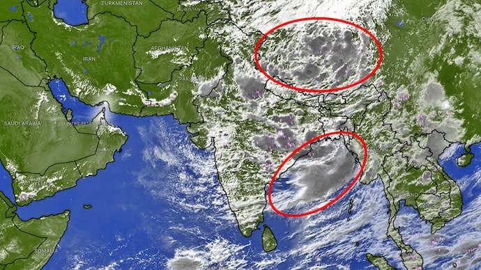
The India Meteorological Department (IMD) has issued a critical national weather bulletin for Wednesday, August 5, 2026, placing multiple regions across Eastern, Northeastern, Central, and Peninsular India under heightened meteorological vigil. The IMD weather forecast August 5 2026 highlights a severe RED ALERT (Extremely Heavy Rainfall ≥ 21 cm) for Meghalaya, alongside Orange and Yellow Alerts spanning 26 states and Union Territories.
The setup is driven by an asymmetric monsoon trough whose eastern end rests north of its normal position, combined with upper-air cyclonic circulations over North Haryana, Northeast Rajasthan, and Northwest Bihar. Deep moisture feeds from both the Bay of Bengal and the Arabian Sea are fuelling intense precipitation clusters over the Northeast while active monsoon showers continue across the Western Himalayas, the Gangetic plains, Central India, Konkan, Coastal Karnataka, and Kerala.
This report provides a state-by-state meteorological breakdown, an emergency deep-dive into the Meghalaya Red Alert zone, oceanographic marine warnings, and a city-by-city weather matrix for August 5, 2026.
Section 1
Synoptic Atmospheric Setup (August 5, 2026)
Asymmetric Monsoon Trough: Western end positioned south of normal over Central/Western India; eastern end positioned north of normal, funnelling moisture into the Northeast.
Western Disturbance: A trough in the middle and upper tropospheric westerlies along 68°E, north of Lat 32°N, interacting with J&K, Himachal and Uttarakhand.
Lower-Tropospheric Cyclonic Circulations: Embedded centres over North Haryana, Northeast Rajasthan, and Northwest Bihar driving convective showers and heavy rainbands.
Strong Marine Westerlies: 40-50 km/h winds gusting to 60 km/h streaming over Kerala, Lakshadweep and Karnataka.
A. Asymmetric Position of the Monsoon Trough
The main monsoon trough axis at mean sea level on August 5 exhibits an asymmetric tilt. The western segment lies south of its normal location over Central and Western India, maintaining steady moisture transport across Rajasthan and Madhya Pradesh, while the eastern segment has shifted north toward the Himalayan foothills and the Northeastern states — acting as an atmospheric funnel that drives moisture-laden Bay of Bengal winds directly into Sub-Himalayan West Bengal, Sikkim, Assam, and Meghalaya.
B. Low-Level Cyclonic Circulations
Three active upper-air cyclonic circulations are amplifying regional precipitation: over North Haryana (enhancing cloud development across Haryana, Punjab, Delhi-NCR and the Western Himalayan foothills), Northeast Rajasthan (maintaining convective showers over Rajasthan and West Madhya Pradesh), and Northwest Bihar (driving heavy rainbands across the Gangetic plains, North Bihar and East Uttar Pradesh).
C. Western Disturbance and Marine Westerlies
A Western Disturbance operating along roughly 68°E is interacting with monsoonal moisture over Jammu & Kashmir, Himachal Pradesh, and Uttarakhand. Concurrently, strong lower-tropospheric westerlies at 40-50 km/h, gusting to 60 km/h, continue to stream over the Arabian Sea, impacting the Kerala, Karnataka and Lakshadweep coasts.
Section 2
Emergency Red Alert Deep-Dive: Meghalaya & Northeast India
The primary focus of national weather monitoring on August 5, 2026, centres on Meghalaya, where the IMD has issued a RED WARNING for Extremely Heavy Rainfall (≥ 21 cm in 24 hours). Strong, moisture-saturated southwesterly winds from the Bay of Bengal travel across the flat plains of Bangladesh before striking the steep, southern-facing escarpments of the Khasi, Jaintia, and Garo hills, causing widespread orographic condensation.
| Parameter | Official Status / Metrics |
|---|---|
| Primary Warning Level | RED ALERT (Extremely Heavy Rain) |
| Threshold Category | Rainfall accumulation ≥ 21 cm (210 mm) |
| Primary High-Risk Districts | East Khasi Hills, West Khasi Hills, Jaintia Hills, Ri-Bhoi, South Garo Hills |
| Primary Hazards | Flash Floods, Slope Landslides, Soil Saturation Runoff, River Surges |
| High-Risk Catchments | Umngot, Umiam, Myntdu, Wahumkhrah |
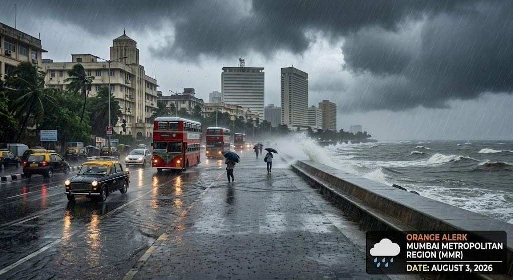
Meghalaya Red Alert & Northeast Flash Flood Risk Overview — August 5, 2026
East Khasi Hills (Cherrapunji / Sohra & Shillong)
Historical rain-magnets including Sohra (Cherrapunji), Mawsynram, and capital city Shillong are experiencing continuous, intense downpours, with short-duration rainfall rates exceeding 35-50 mm per hour during peak convective passes. Low-lying Shillong neighbourhoods (Polo, Pasteur Hills, Wahingdoh) face localized urban flooding, and landslides are highly likely along NH-6 (Shillong-Silchar).
West Khasi & Jaintia Hills
Heavy runoff is rapidly filling local river basins. Mountain streams feeding into the Umiam lake system and southern rivers flowing toward Bangladesh are experiencing sudden water level surges, with the IMD's Flash Flood Risk bulletin flagging near-100% runoff from saturated soils.
Assam, Arunachal Pradesh & Neighbouring NE States
Assam is under an Orange/Heavy-to-Very-Heavy Rain Alert, with Cachar, Darrang, Golaghat, Jorhat, Kamrup Metro (Guwahati), Kokrajhar, Lakhimpur, Nagaon, Tinsukia and Sonitpur facing heavy watershed runoff and rising Brahmaputra water levels. Arunachal Pradesh is under an Orange Alert for Changlang, Dibang Valley, East Kameng, Lower Subansiri, Papum-Pare, Tawang, Tirap, West Kameng and Upper Siang. Nagaland, Manipur, Mizoram and Tripura remain under Orange/Yellow Alerts through August 9, with hill roads facing localized mudslides.
Section 3
High-Alert Watch: East & Central India
East and Central India face another band of heavy rainfall on August 5, driven by the cyclonic circulation over Northwest Bihar. Sub-Himalayan West Bengal (Darjeeling, Kalimpong, Jalpaiguri, Alipurduar, Cooch Behar) and Sikkim are under an Orange Alert, with saturated Teesta and Torsa river basins keeping landslide risk high along NH-10 between Siliguri and Gangtok.
North and West Bihar districts — West Champaran, East Champaran, Gopalganj, Siwan, Sitamarhi, Kishanganj, Supaul and Madhubani — face heavy to very heavy rain with severe lightning risk, while Jharkhand is under a Yellow Alert for heavy spells and thunderstorms. East & West Madhya Pradesh see a Yellow-to-Orange Alert with gusty winds (30-40 km/h, gusting to 50 km/h) through August 9, and Chhattisgarh & Odisha will see widespread rain keeping the Mahanadi, Brahmani and Baitarani basins under hydrological watch.
Section 4
Western & Peninsular India: Kerala, Karnataka, Maharashtra & Gujarat

Kerala & Western India Orange Alert and INCOIS Marine Warning Overview
Kerala & Mahe
The Regional Meteorological Centre (RMC) Thiruvananthapuram has issued an ORANGE ALERT for Heavy to Very Heavy Rainfall (7-11 cm, up to 20 cm) across Pathanamthitta, Alappuzha, Kottayam, Idukki, Ernakulam, Kozhikode, Wayanad, Kannur, and Kasaragod, with a Yellow Alert for Thiruvananthapuram, Kollam, Thrissur, Palakkad, and Malappuram. Strong surface winds of 40-50 km/h are expected across Kerala and Lakshadweep, with risks of uprooted trees, power line disruptions, and landslides in high-range zones (Idukki, Wayanad, Munnar).
Coastal & South Interior Karnataka
Coastal Karnataka (Dakshina Kannada, Udupi, Uttara Kannada) and South Interior Karnataka (Kodagu, Chikkamagaluru, Shivamogga) continue to see widespread monsoonal rainfall, with the windward slopes of the Western Ghats maintaining strong inflows into the Krishna and Cauvery basins.
Maharashtra, Goa & Gujarat
Mumbai, Thane, Palghar and Raigad will see intermittent moderate to heavy showers with occasional heavy passes during high-tide windows. Following extremely heavy rainfall (≥ 21 cm) over Madhya Maharashtra on August 4, intensity is gradually moderating, though hill passes around Lonavala, Mahabaleshwar and Tamhini remain under high runoff watch. Gujarat will see partly cloudy to generally cloudy skies with light to moderate intermittent showers, and squally winds of 40-50 km/h along the Gulf of Khambhat and Kutch coast.
Section 5
Northwest India: Delhi-NCR, UP, Punjab, Haryana & Western Himalayas
Delhi-NCR
Max Temp: 33.0°C | Min Temp: 27.2°C (Safdarjung) | Humidity: 94%-100% | Wind: Calm to Southwesterly/Southeasterly, 3.7-15 km/h | Expected Rain: 15-40 mm | Yellow Watch
Delhi-NCR will remain under generally cloudy skies on Wednesday, with very light to light rain expected between early morning and noon, followed by another spell of light to moderate rain towards evening/night. High humidity (94%-100%) will maintain warm, muggy conditions, with localized waterlogging possible at underpasses like Minto Bridge, Zakhira, and the Gurugram Expressway.
Uttar Pradesh, Himachal Pradesh & Uttarakhand
Fairly widespread rainfall driven by moisture convergence from both seas will affect Meerut, Bareilly, Moradabad, Lucknow, Kanpur, Ayodhya, Prayagraj and Varanasi with isolated lightning strikes. Himachal Pradesh is under a Yellow Alert for localized heavy downpours across Shimla, Kangra, Kullu, Mandi and Solan. Uttarakhand is under an Orange/Yellow Alert, with low flash flood risk flagged for Almora, Bageshwar, Chamoli, Dehradun, Pauri Garhwal, Pithoragarh, Rudraprayag, Tehri Garhwal and Uttarkashi — commuters on NH-58 (Rishikesh-Badrinath) and NH-109 (Rudraprayag-Kedarnath) should watch for rockfalls.
Punjab, Haryana & Rajasthan
Supported by the cyclonic circulations over North Haryana and Northeast Rajasthan, both regions will see scattered moderate rainfall with isolated heavy spells; Chandigarh, Ambala, Jaipur and Ajmer will see cloudy skies, intermittent rain and thunderstorms.
Section 6
INCOIS Ocean Current, High Wave & Swell Surge Warnings
| Maritime Sector | Official INCOIS / IMD Warning Metrics |
|---|---|
| Kanniyakumari (Tamil Nadu) Neerodi to Arockiyapuram | Swell Surge Alert: 1.1m to 1.4m (15-18 sec period) till 11:30 IST of 05-08-2026 |
| Arabian Sea Coast Somalia, Oman, Kerala, KA, Lakshadweep | Squally Winds: 45-55 kmph gusting to 65 kmph (Somalia/Oman); 40-50 kmph gusting to 60 kmph off the Indian coast |
| Bay of Bengal & Andaman | Squally Weather: 45-55 kmph gusting to 65 kmph over South Sri Lanka coast & South Bay; 40-50 kmph off the Andaman Sea |
INCOIS forecasts swell waves of 1.1 to 1.4 metres with a peak wave period of 15-18 seconds off the Kanniyakumari coast through late morning, risking localized sea water inundation for low-lying coastal infrastructure. Squally winds of 45-55 kmph gusting to 65 kmph will prevail over the Westcentral, Southwest, and Eastcentral Arabian Sea, with 40-50 kmph gusting to 60 kmph affecting the Kerala, Karnataka, Lakshadweep, and Comorin coasts — fishermen are strictly banned from these marine zones. The Andaman Sea and South Bay of Bengal will see squally weather of 40-50 kmph gusting to 60 kmph.
Section 7
Master National 25-City Weather Matrix (August 5, 2026)
Consolidated forecast metrics across 25 major Indian cities for Wednesday, August 5, 2026:
| City Name | State / UT | Max Temp | Min Temp | Expected Rain | Humidity | Wind Speed | IMD Alert Code |
|---|---|---|---|---|---|---|---|
| Shillong | Meghalaya | 22.0°C | 17.5°C | 210 – 300 mm | 95–100% | 35 km/h | RED ALERT |
| Guwahati | Assam | 29.5°C | 25.0°C | 70 – 140 mm | 90–98% | 25 km/h | Orange Alert |
| Siliguri | West Bengal | 28.0°C | 24.2°C | 110 – 180 mm | 92–98% | 20 km/h | Orange Alert |
| Gangtok | Sikkim | 20.5°C | 16.0°C | 90 – 160 mm | 92–98% | 15 km/h | Orange Alert |
| Delhi-NCR | Delhi UT | 33.0°C | 27.2°C | 15 – 40 mm | 94–100% | 15 km/h | Yellow Watch |
| Lucknow | Uttar Pradesh | 33.2°C | 26.8°C | 40 – 85 mm | 82–95% | 25 km/h | Yellow Alert |
| Patna | Bihar | 32.8°C | 27.0°C | 60 – 120 mm | 85–96% | 30 km/h | Orange Alert |
| Mumbai | Maharashtra | 29.0°C | 26.5°C | 40 – 85 mm | 79–92% | 25 km/h | Yellow Alert |
| Pune | Maharashtra | 25.0°C | 21.0°C | 25 – 55 mm | 89–96% | 20 km/h | Yellow Watch |
| Bhopal | Madhya Pradesh | 30.5°C | 23.5°C | 45 – 90 mm | 84–95% | 30 km/h | Yellow Alert |
| Shimla | Himachal Pradesh | 22.5°C | 16.8°C | 50 – 110 mm | 88–98% | 20 km/h | Yellow Alert |
| Dehradun | Uttarakhand | 27.5°C | 21.5°C | 70 – 130 mm | 90–98% | 25 km/h | Orange Alert |
| Ranchi | Jharkhand | 29.8°C | 23.2°C | 40 – 75 mm | 82–94% | 20 km/h | Yellow Alert |
| Kolkata | West Bengal | 29.2°C | 26.0°C | 35 – 70 mm | 94–98% | 15 km/h | Yellow Alert |
| Jaipur | Rajasthan | 32.0°C | 25.5°C | 30 – 65 mm | 78–90% | 25 km/h | Yellow Alert |
| Ahmedabad | Gujarat | 31.0°C | 25.8°C | 10 – 30 mm | 66–85% | 20 km/h | Yellow Watch |
| Kochi | Kerala | 28.0°C | 23.5°C | 70 – 130 mm | 90–98% | 45 km/h | Orange Alert |
| Kozhikode | Kerala | 27.8°C | 23.2°C | 80 – 140 mm | 92–98% | 45 km/h | Orange Alert |
| Mangaluru | Karnataka | 27.2°C | 23.0°C | 90 – 160 mm | 92–98% | 45 km/h | Orange Alert |
| Bengaluru | Karnataka | 25.8°C | 19.5°C | 10 – 25 mm | 78–88% | 25 km/h | Green Watch |
| Chennai | Tamil Nadu | 33.0°C | 27.0°C | 5 – 15 mm | 67–78% | 20 km/h | Green Watch |
| Hyderabad | Telangana | 29.0°C | 23.0°C | 15 – 35 mm | 70–85% | 25 km/h | Yellow Watch |
| Chandigarh | Punjab/Haryana | 32.2°C | 25.2°C | 25 – 60 mm | 80–92% | 20 km/h | Yellow Alert |
| Agartala | Tripura | 27.5°C | 23.0°C | 70 – 130 mm | 90–98% | 25 km/h | Orange Alert |
| Kavaratti | Lakshadweep | 28.8°C | 24.8°C | 40 – 75 mm | 88–95% | 45 km/h | INCOIS High Wave |
Section 8
Actionable NDMA & IMD Public Safety Directives
| Danger Category | Recommended Public Action |
|---|---|
| Red Alert Zones (Meghalaya: East Khasi Hills, Sohra) | Avoid all non-essential travel; stay clear of riverbanks and steep slopes. |
| Hill Slope & Landslide Zones (Assam, Arunachal, Sikkim, HP) | Postpone mountain travel along NH-6, NH-10 and NH-58 due to mudslide risk. |
| Rural Lightning Hazards (Bihar, UP, Jharkhand) | Seek shelter in sturdy buildings; avoid standing under tall trees or poles. |
| Marine & Coastal Swell Surge (Kanniyakumari, Kerala, KA) | Strict adherence to fishing bans; stay clear of high swell beaches. |
Residents across East Khasi Hills, West Khasi Hills, and Jaintia Hills should avoid travelling near swollen mountain streams or steep earth cuttings, with local district authorities placing emergency response teams on standby. Communities in watershed areas across Assam, Arunachal Pradesh and Meghalaya should secure livestock and move emergency supplies to higher ground. Farm workers in Bihar, Uttar Pradesh and Jharkhand should seek shelter inside permanent structures when thunder is heard, and fishermen operating off Kerala, Karnataka, Lakshadweep and Tamil Nadu must strictly adhere to the fishing ban due to squally winds and swell surges.
What You Need to Know (Key Takeaways)
Meghalaya Red Alert: A severe RED ALERT for Extremely Heavy Rain (≥ 21 cm) is active for Meghalaya on Wednesday, August 5, 2026.
Northeast Flood Watch: High Flash Flood Risk covers watersheds across Meghalaya, Assam, and Arunachal Pradesh.
Orange Alert Belts: Sub-Himalayan West Bengal, Sikkim, Bihar, East UP, Kerala, Coastal Karnataka and the southern Northeastern states face heavy to very heavy rainfall.
Marine & Ocean Alerts: INCOIS Swell Surge warning for the Kanniyakumari coast; squally winds up to 65 km/h trigger a strict fishing ban along the Arabian Sea and Bay of Bengal coasts.
Stay Alert & Informed with RRBCONTENTS
Get live weather updates, daily current affairs, and free exam study notes delivered to your feed.
Join Telegram Channel (@rrbcontents) →Explore More