Home › Blog › Weather & Climate › All India Weather Forecast July 26, 2026
All India Weather Forecast for July 26, 2026: IMD Heavy Rain Alerts Across Key Cities
Track Ministry of Earth Sciences, IMD Scientific Assistant & Environmental Officer openings on RRBCONTENTS Jobs Portal.
Key Takeaways & Summary
- Primary Driver: A well-marked Low-Pressure Area over the Northwest Bay of Bengal, adjoining Gangetic West Bengal and North Odisha, alongside an active monsoon trough stretching from Jaisalmer across Central India.
- Orange Alerts (High Risk): Issued for Kolkata, Gangetic West Bengal, Coastal Odisha, and Gujarat State due to heavy to very heavy rainfall projections.
- Yellow Alerts (Watch): Active for Mumbai & Konkan coast, New Delhi / NCR, Himachal Pradesh, Uttarakhand, and East Rajasthan.
- Coastal Warnings: Squally wind speeds (40–50 kmph) and high sea waves forecasted along the Coromandel and Konkan coastlines.
Table of Contents
Active Monsoon Drives High Rainfall Across India: Comprehensive City-by-City Weather Forecast for July 26, 2026
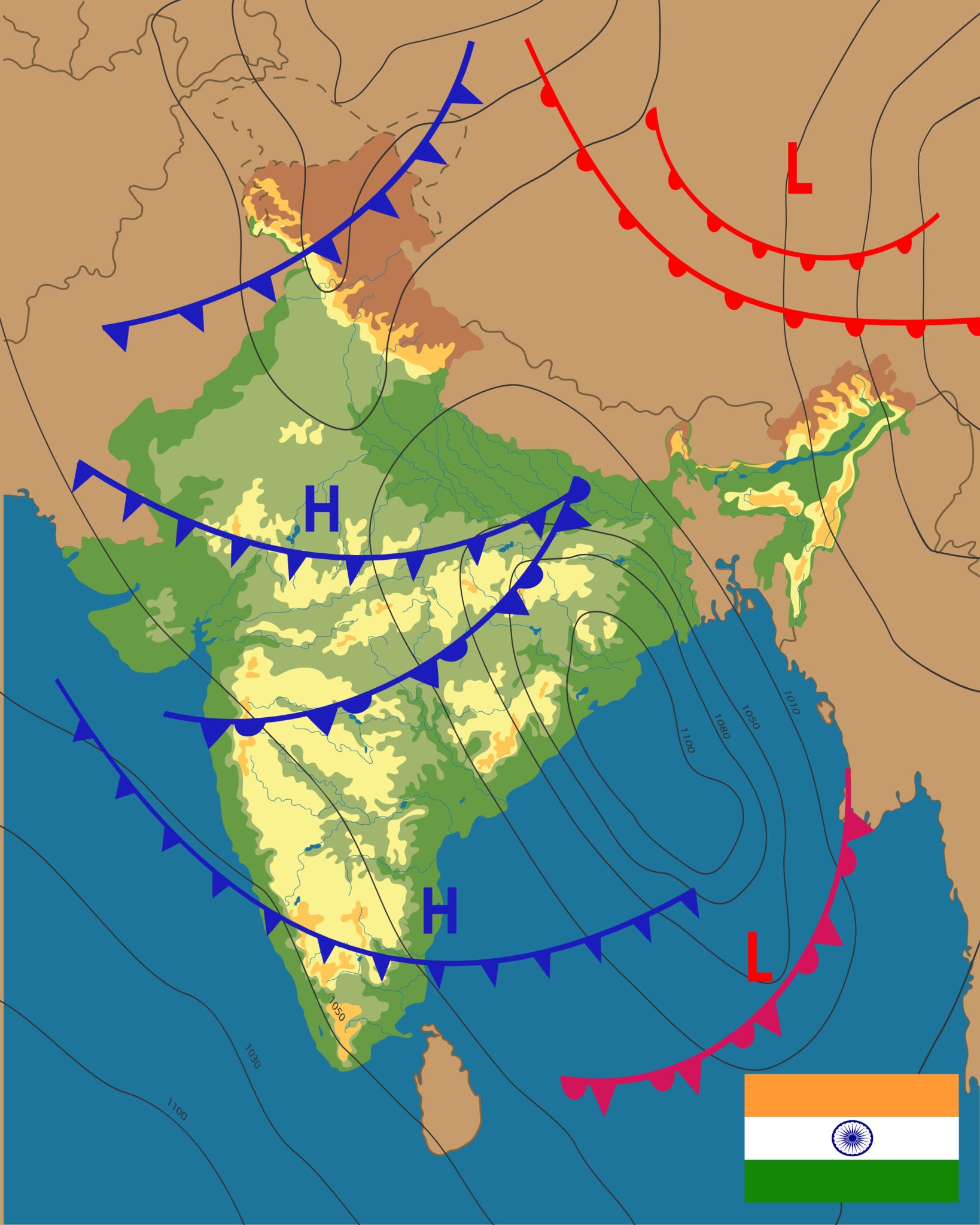
According to official weather bulletins verified by the India Meteorological Department (IMD), active monsoon conditions will prevail across the country on Sunday, July 26, 2026. The primary meteorological driver is a well-marked Low-Pressure Area over the Northwest Bay of Bengal, adjoining Gangetic West Bengal and North Odisha, alongside an active monsoon trough stretching from Jaisalmer across Central India into the Bay of Bengal.
As a result, Orange and Yellow alerts have been issued for multiple coastal, eastern, and western regions. Below is the verified city-by-city weather forecast, temperature projections, and regional risk alerts for July 26, 2026.
1. Metropolitan Cities Weather Forecast
1. Kolkata & Gangetic West Bengal (Orange / High Alert)
Forecast: Heavy to very heavy rainfall accompanied by isolated thunderstorms, intense lightning, and gusty winds (40–50 kmph).
Impact: The low-pressure system directly over the Northwest Bay of Bengal will cause waterlogging in low-lying areas of Kolkata, Howrah, Hooghly, and South 24 Parganas.
Temperature: 26 °C (Min) to 30 °C (Max).
2. Mumbai & Konkan Region (Yellow Alert)
Forecast: Fairly widespread to widespread light-to-moderate rain, with isolated heavy spells over Mumbai, Thane, Palghar, and Raigad. High sea waves and squally winds expected along the coast.
Impact: Intermittent traffic slowdowns near low-lying subway crossings; high tide warnings issued for coastal areas.
Temperature: 25 °C (Min) to 29 °C (Max).
3. Delhi / NCR (New Delhi, Gurugram, Noida)
Forecast: Generally cloudy sky with isolated to scattered light-to-moderate rain or thundershowers. Hot and humid conditions will persist during non-rainy hours.
Impact: Humidity levels remain elevated (75–90%); short spells of rain may cause localized traffic slow-downs during evening hours.
Temperature: 27 °C (Min) to 35 °C (Max).
4. Chennai & Northern Tamil Nadu
Forecast: Partly cloudy sky with strong surface winds (40–50 kmph) and isolated light rain/thunderstorms.
Impact: Warm and humid weather conditions overall; sea conditions remain choppy off the Coromandel coast.
Temperature: 27 °C (Min) to 36 °C (Max).
5. Bengaluru & South Interior Karnataka
Forecast: Passing light-to-moderate showers accompanied by gusty winds reaching 30–40 kmph.
Impact: Pleasant temperatures with mild breeze; no major flood threat in urban sectors.
Temperature: 20 °C (Min) to 28 °C (Max).
6. Hyderabad & Telangana
Forecast: Generally cloudy sky with isolated thunderstorms, lightning, and light-to-moderate rainfall.
Impact: Moderate relief from heat; dry spells interspersed with quick rain bands.
Temperature: 23 °C (Min) to 31 °C (Max).
2. Regional & State-Wise Weather Highlights
A. East & Northeast India (Odisha, Jharkhand, Assam, Meghalaya)
Odisha (Bhubaneswar, Cuttack): High alert for heavy to very heavy rainfall due to the Bay of Bengal low-pressure system. Flash flood warnings active in coastal rivers.
Northeast States (Guwahati, Shillong, Imphal, Aizawl): Isolated heavy rainfall with thunderstorms and lightning across Assam, Meghalaya, Nagaland, Manipur, Mizoram, and Tripura.
B. West & Central India (Gujarat, Maharashtra, Madhya Pradesh)
Gujarat State (Ahmedabad, Surat, Rajkot): Heavy to very heavy rainfall over Gujarat region and Saurashtra & Kutch as the monsoon trough interacts with western low-pressure pockets.
Madhya Maharashtra (Pune, Nashik): Heavy rainfall over Ghat areas.
Chhattisgarh & East Madhya Pradesh: Isolated heavy rain with lightning.
C. Western Himalayas & Northwest Plains (Himachal, Uttarakhand, Rajasthan)
Himachal Pradesh & Uttarakhand (Shimla, Dehradun): Isolated heavy rainfall in mid and lower hill districts. Landslide advisories remain active on major mountain highways.
Jammu & Kashmir: Light-to-moderate rain with isolated heavy spells.
Rajasthan (Jaipur, Jodhpur): Isolated heavy rain across East and West Rajasthan as the monsoon trough passes through Jaisalmer.
3. Master Weather Data Table for Key Cities (July 26, 2026)
| City | Expected Weather Condition | Temperature Range (°C) | IMD Alert Status |
|---|---|---|---|
| Kolkata | Heavy to Very Heavy Rain, Gusty Winds | 26 °C − 30 °C | Orange Alert |
| Mumbai | Moderate to Heavy Rain | 25 °C − 29 °C | Yellow Alert |
| New Delhi | Light to Moderate Showers, Humid | 27 °C − 35 °C | Yellow Watch |
| Chennai | Strong Surface Winds, Light Rain | 27 °C − 36 °C | Green / Wind Alert |
| Bengaluru | Passing Light Showers, Breezy | 20 °C − 28 °C | Green Alert |
| Ahmedabad | Heavy to Very Heavy Rain | 25 °C − 31 °C | Orange Alert |
| Bhubaneswar | Very Heavy Rainfall, Thunderstorms | 24 °C − 29 °C | Orange Alert |
| Dehradun | Heavy Mountain Rainfall | 22 °C − 29 °C | Yellow Alert |
🎓 High-Yield Academic Corner (For Competitive Examinations)
For civil services and academic aspirants, the weather dynamics of July 26, 2026 connect directly to physical geography and disaster management syllabi:
GS Paper 1: Physical Geography (Monsoon Synoptic Features)
- Monsoon Trough: An elongated low-pressure zone extending from the Heat Low over Pakistan to the Bay of Bengal. Its movement north or south dictates active vs. break monsoon phases in India.
- East-West Shear Zone: An atmospheric boundary layer in the mid-troposphere where opposing wind directions meet (e.g., easterly and westerly winds), creating intense convective clouds and heavy rainfall over Central and Western India.
GS Paper 3: Disaster Management & IMD Color Codes
- Green (No Action): Normal weather.
- Yellow (Be Updated): Moderately bad weather; local disruptions possible.
- Orange (Be Prepared): High risk of severe weather, waterlogging, or transportation delays.
- Red (Take Action): Extremely severe conditions posing threats to life and infrastructure.
5. Frequently Asked Questions (FAQ)
What is the primary weather system driving heavy rain across India on July 26, 2026?
A well-marked Low-Pressure Area over the Northwest Bay of Bengal, adjoining Gangetic West Bengal and North Odisha, alongside an active monsoon trough stretching from Jaisalmer across Central India.
Which Indian cities have Orange and Yellow alerts for July 26, 2026?
Kolkata, Bhubaneswar, and Ahmedabad are under Orange Alerts for heavy to very heavy rainfall, while Mumbai, New Delhi, Dehradun, and Shimla are under Yellow Watch advisories.
What do IMD color-coded weather alerts signify?
Green means No Action needed; Yellow means Be Updated on local disruptions; Orange means Be Prepared for severe weather and waterlogging; Red means Take Action for life-threatening conditions.
🚀 Master Physical Geography & Earth Sciences!
Access complete UPSC Geography notes, synoptic weather maps, and latest government job notifications on RRBCONTENTS.
Explore Meteorology Jobs Join @rrbcontents on Telegram