Home › Blog › Weather & Meteorology › India Weather Forecast July 27 2026
India Weather Forecast July 27, 2026: City-Wise Report & IMD Monsoon Alerts
Key Takeaways & Summary
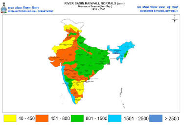
- National Monsoon Status: The Southwest Monsoon is highly active across 80% of India on Monday, July 27, 2026, driven by a North Bay of Bengal low-pressure system and an off-shore West Coast trough.
- Highest Alert Zones: Chhattisgarh and Odisha face Red/Orange alerts for extremely heavy rain. Konkan, Goa, East Madhya Pradesh, and Coastal Karnataka remain under Orange alerts.
- Delhi-NCR Forecast: Max temperature 35.0°C, high humidity (74%), overcast skies, and a 70% probability of moderate thunderstorms.
- Coastal Metros (Mumbai & Kolkata): Heavy rain spells (85%+ probability), squally winds up to 45 km/h, and waterlogging alerts along low-lying roadways.
- Air Quality Index (AQI): Widespread rain cleansing keeps AQI levels across all major Indian metros in the "Good" to "Satisfactory" range (12 to 58).
Table of Contents
- 1. National Synoptic Weather Overview for July 27, 2026
- 2. North India Weather Forecast (Delhi, Chandigarh, Jaipur, Lucknow)
- 3. West India Weather Forecast (Mumbai, Pune, Ahmedabad, Goa)
- 4. South India Weather Forecast (Bengaluru, Chennai, Hyderabad, Kochi)
- 5. East & North-East India Weather Forecast (Kolkata, Bhubaneswar, Guwahati)
- 6. Central India Weather Forecast (Bhopal, Raipur)
- 7. Comparative Master Weather Table: 18 Major Indian Cities
- 8. Travel Advisories & Public Safety Guidelines
1. National Synoptic Weather Overview for July 27, 2026
An active spell of the Southwest Monsoon continues to sweep across the Indian subcontinent on Monday, July 27, 2026. According to the latest bulletin released by the India Meteorological Department (IMD), widespread rainfall, severe thunderstorms, and heavy downpours are forecast across Western, Central, Northern, and Eastern India throughout the day.
The meteorological dynamics driving today's weather stem from a well-marked low-pressure area over the North Bay of Bengal and adjoining Gangetic West Bengal. This system is strengthening the monsoon trough, which is currently running south of its normal position and passing through Rajasthan, Madhya Pradesh, Chhattisgarh, and Odisha. Simultaneously, a strong off-shore trough along the West Coast from southern Gujarat down to the Kerala coast is drawing intense moisture from the Arabian Sea.
2. North India Weather Forecast
North India is witnessing an intensification of monsoon activity as moisture-laden easterly winds interact with Western Disturbances over the Himalayan foothills.
New Delhi & NCR (Noida, Gurgaon, Ghaziabad)
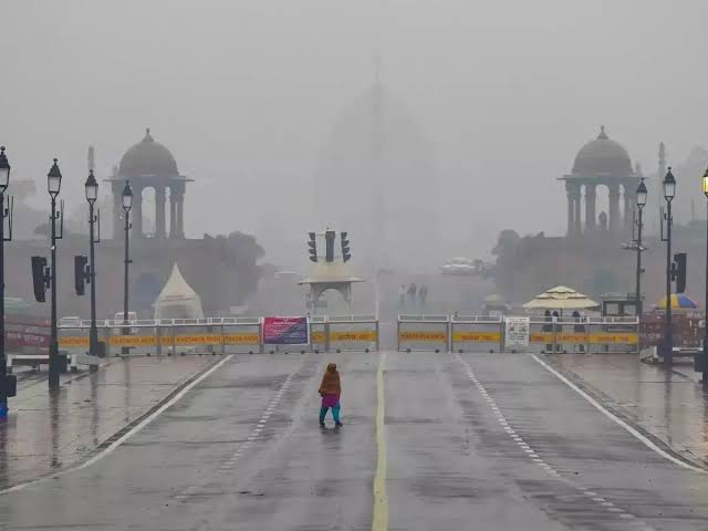
The National Capital Region (NCR) experiences an overcast sky with moderate rainfall accompanied by occasional thunderstorms. Following a brief lull in monsoon activity over the weekend, moisture levels have peaked, causing daytime heat to feel significantly warmer due to high relative humidity.
- Maximum Temperature: 35.0°C | Minimum Temperature: 28.0°C | Feels Like: 42.0°C
- Precipitation Probability: 70% (Moderate Rain / Thunderstorms)
- Relative Humidity: 74% to 88% | Wind Speed: 10.5 km/h WNW
- Air Quality Index (AQI): 39 (Good)
Chandigarh & Tricity Region
Max Temp: 33.5°C | Min Temp: 26.2°C | Rain Prob: 65% | AQI: 42 (Good). Thunderstorms accompanied by light to moderate showers throughout the afternoon.
Jaipur & Eastern Rajasthan
Max Temp: 32.0°C | Min Temp: 25.8°C | Rain Prob: 60% | AQI: 48 (Good). Scattered light to moderate showers in Jaipur; heavier spells in Kota and Udaipur.
Lucknow & Central Uttar Pradesh
Max Temp: 34.0°C | Min Temp: 27.5°C | Rain Prob: 75% | AQI: 52 (Satisfactory). Cloud cover with moderate showers, intensifying by late evening.
3. West India Weather Forecast

Mumbai & The Konkan Belt
Mumbai, Thane, and Palghar are experiencing active monsoon conditions characterized by intermittent heavy showers and squally surface winds. High tides combined with sustained downpours increase the risk of waterlogging along coastal roadways.
- Maximum Temperature: 29.5°C | Minimum Temperature: 25.8°C
- Precipitation Probability: 88% (Heavy Rain Spells)
- Wind Speed: 24 km/h WSW (Gusts up to 45 km/h) | AQI: 27 (Good)
Pune & Western Ghats
Max Temp: 26.8°C | Min Temp: 22.5°C | Rain Prob: 80%. Heavy to very heavy rainfall across Lonavala, Khandala, and Mahabaleshwar ghats.
Ahmedabad & Panaji (Goa)
Ahmedabad Max/Min: 31.2°C / 25.4°C (Rain Prob: 65%). Panaji Max/Min: 28.2°C / 24.0°C (Rain Prob: 90% Heavy Alert).
4. South India Weather Forecast
Peninsular India presents a contrasting weather pattern today: coastal and interior Karnataka experience active monsoon conditions, while Tamil Nadu observes warm, humid weather with localized afternoon convective thunderstorms.
- Bengaluru: Max 28.0°C / Min 20.8°C | Rain Prob: 60% | AQI: 13 (Good). Pleasant, overcast skies with light to moderate showers.
- Chennai: Max 36.8°C / Min 28.2°C | Feels Like: 43.5°C | Rain Prob: 35% | AQI: 20 (Good). Warm and humid with isolated light afternoon showers.
- Hyderabad: Max 31.0°C / Min 23.8°C | Rain Prob: 65% | AQI: 12 (Good). Overcast conditions with moderate showers.
- Thiruvananthapuram & Kerala Coast: Max 29.2°C / Min 24.1°C | Rain Prob: 82%. Squally winds (35–45 km/h) and moderate to heavy rainfall spells.
5. East & North-East India Weather Forecast
Kolkata & Gangetic West Bengal
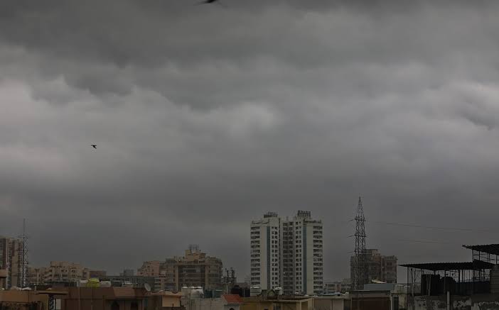
Kolkata is experiencing high humidity and widespread moderate to heavy rainfall accompanied by lightning and thunder. Ground saturation and high-intensity downpours may cause temporary traffic slow-downs in low-lying city streets.
- Max Temp: 32.5°C | Min Temp: 26.2°C | Rain Prob: 85% | AQI: 36 (Good)
Bhubaneswar, Patna & Guwahati
Bhubaneswar Max/Min: 30.0°C / 25.0°C (Rain Prob: 92% Heavy Alert). Patna Max/Min: 33.8°C / 27.0°C (Rain Prob: 55%). Guwahati Max/Min: 31.0°C / 25.5°C (Rain Prob: 80%).
6. Central India Weather Forecast
Bhopal and Indore experience active monsoon spells with East Madhya Pradesh under an Orange Alert. Raipur and Chhattisgarh districts are under a Red/Orange Alert with 95% rain probability for isolated extremely heavy downpours.
7. Comparative Master Weather Table: 18 Major Indian Cities
| City Name | Region | Max Temp (°C) | Min Temp (°C) | Rain Prob (%) | Expected Weather Condition | Air Quality (AQI) |
|---|---|---|---|---|---|---|
| New Delhi | North | 35.0 | 28.0 | 70% | Moderate Rain & Thunderstorm | 39 (Good) |
| Mumbai | West | 29.5 | 25.8 | 88% | Heavy Spells & Squally Winds | 27 (Good) |
| Kolkata | East | 32.5 | 26.2 | 85% | Heavy Rain & Thunderstorms | 36 (Good) |
| Chennai | South | 36.8 | 28.2 | 35% | Warm, Humid with Light Rain | 20 (Good) |
| Bengaluru | South | 28.0 | 20.8 | 60% | Pleasant, Overcast & Showers | 13 (Good) |
| Hyderabad | South | 31.0 | 23.8 | 65% | Cloud Cover & Moderate Rain | 12 (Good) |
| Ahmedabad | West | 31.2 | 25.4 | 65% | Cloudy with Rain Spells | 24 (Good) |
| Pune | West | 26.8 | 22.5 | 80% | Cool, Drizzle to Moderate Rain | 22 (Good) |
| Jaipur | North | 32.0 | 25.8 | 60% | Light to Moderate Showers | 48 (Good) |
| Lucknow | North | 34.0 | 27.5 | 75% | Moderate Rain & High Humidity | 52 (Satisfactory) |
| Chandigarh | North | 33.5 | 26.2 | 65% | Thunderstorms & Scattered Rain | 42 (Good) |
| Bhubaneswar | East | 30.0 | 25.0 | 92% | Heavy to Very Heavy Rain | 30 (Good) |
| Patna | East | 33.8 | 27.0 | 55% | Cloudy with Light Showers | 58 (Satisfactory) |
| Guwahati | North-East | 31.0 | 25.5 | 80% | Persistent Rain & Thunderstorms | 28 (Good) |
| Bhopal | Central | 29.8 | 23.5 | 80% | Heavy Showers & Gusty Winds | 25 (Good) |
| Raipur | Central | 28.5 | 23.2 | 95% | Very Heavy Downpours | 20 (Good) |
| Thiruvananthapuram | South | 29.2 | 24.1 | 82% | Active Monsoon & Squalls | 18 (Good) |
| Srinagar | North | 27.0 | 18.5 | 45% | Light Rain & Pleasant | 32 (Good) |
8. Travel Advisories & Public Safety Guidelines
- Urban Commuters: Avoid low-lying underpasses and waterlogged corridors in Delhi-NCR, Mumbai, Kolkata, and Bhubaneswar.
- Hill Travelers: Exercise extreme caution in Himachal Pradesh, Uttarakhand, and Western Ghats due to minor landslides and dense fog.
- Fishermen Warnings: Avoid venturing into deep sea along Maharashtra, Goa, Karnataka, Kerala, Odisha, and West Bengal coasts.
Exam Relevance & UPSC Geography Notes
GS Paper 1 (Climatology): Southwest Monsoon mechanisms, low-pressure systems, monsoon trough movements, off-shore troughs, air mass interactions.
Key Concepts: IMD color-coded weather alerts (Green, Yellow, Orange, Red), Air Quality Index (AQI) parameters, moisture convection.
Frequently Asked Questions
What is the weather forecast for Delhi-NCR on July 27, 2026?
Delhi-NCR faces moderate rain with thunderstorms today. Maximum temperature is 35.0°C, humidity 74-88%, and precipitation probability is 70%.
Which states are under Red or Orange rain alerts today?
Chhattisgarh and Odisha are under Red/Orange alerts for isolated extremely heavy downpours. Konkan, Goa, East Madhya Pradesh, and Coastal Karnataka face Orange alerts.
What is the Air Quality Index (AQI) across major Indian metros on July 27, 2026?
Due to widespread monsoon rain cleansing, AQI remains in the 'Good' to 'Satisfactory' range across all major cities, ranging from 12 in Hyderabad to 52 in Lucknow.
Sources: India Meteorological Department (IMD) Regional Bulletins, Central Pollution Control Board (CPCB).
NEEDS DOUBLE-CHECK: none
Stay Updated on Current Affairs & Weather Science on RRBCONTENTS
Practice PYQs, study daily current affairs, and explore government exam prep tools.
Solve Climatology PYQs → Explore Govt Jobs →Join our official Telegram channel: @rrbcontents