Home › Blog › Japan Earthquake and Tsunami News: July 2026 M7.1 Update
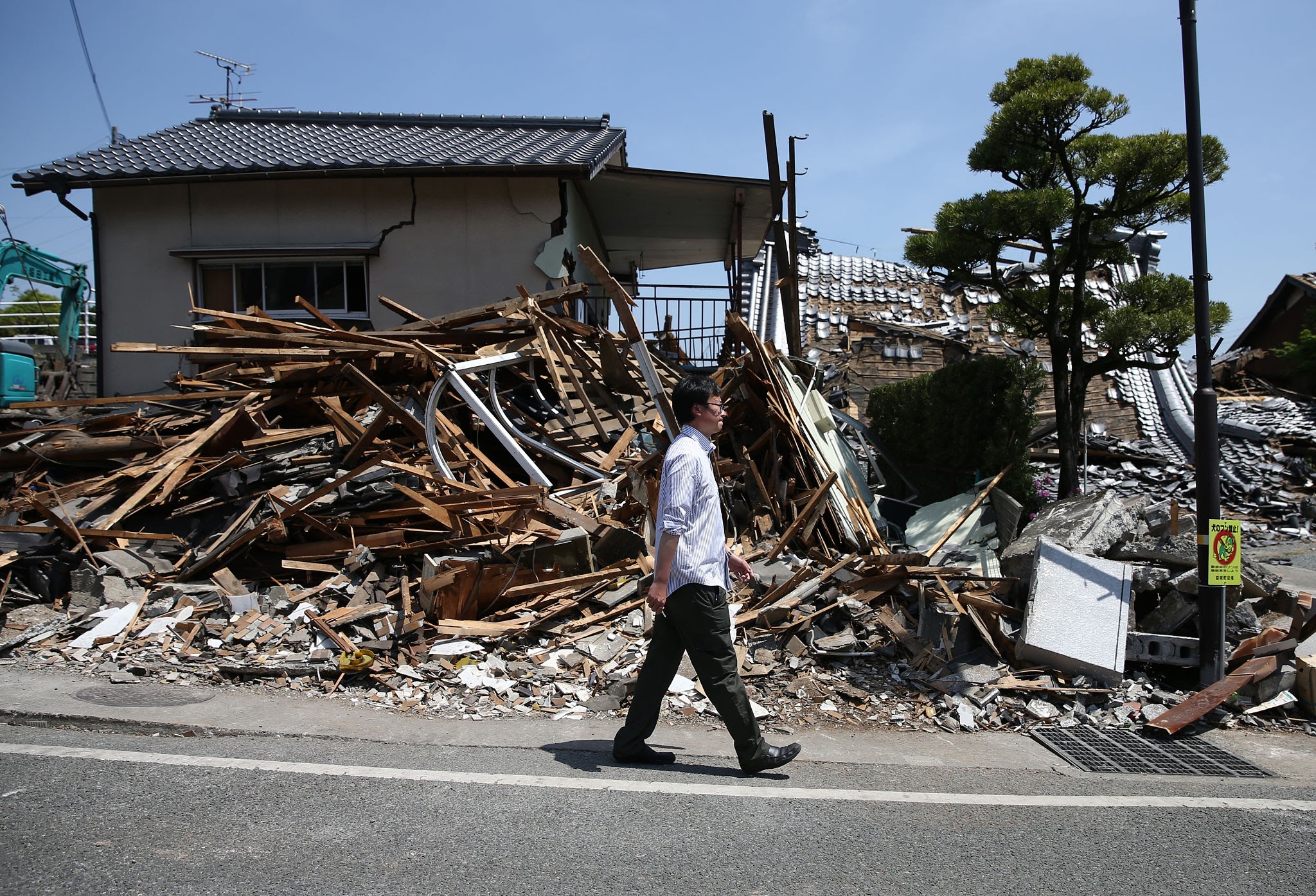
Japan Earthquake and Tsunami News: M7.1 Temblor Hits Kyushu, Triggering Evacuations and Tsunami Advisories
In the latest Japan earthquake and tsunami news, a powerful magnitude 7.1 earthquake struck Japan’s southern main island of Kyushu on the afternoon of Tuesday, July 28, 2026. The shallow crustal tremor centered in Kumamoto Prefecture shook cities across western Japan, triggering emergency tsunami advisories along the western coastlines, causing multiple structural collapses, and launching an immediate national military response.
According to official bulletins released by the Japan Meteorological Agency (JMA) and the United States Geological Survey (USGS), the earthquake struck at 16:27 JST (07:27 UTC) at a shallow depth of approximately 10 kilometers (6.2 miles). The intense shaking reached the maximum level of 7 on the JMA Seismic Intensity Scale (Shindo 7) in Uki and Hikawa, producing severe ground motion that derailed trains, triggered structural explosions, and knocked out electrical grids serving tens of thousands of homes.
Emergency crews, local fire brigades, and thousands of personnel from the Japan Self-Defense Forces (JSDF) are actively conducting search-and-rescue operations across urban and rural sectors of Kumamoto, Yatsushiro, and Kashima. Below is an exhaustive, fact-checked report delivering real-time casualty assessments, tsunami warnings, infrastructure audits, tectonic analyses, and a historical comparison of Japan's major seismic events.
1. Breaking Details: The July 28, 2026 Kumamoto M7.1 Earthquake
The seismic event unfolded suddenly during late afternoon hours, startling millions across southern Japan and triggering automated warnings on millions of smartphones via Japan’s J-Alert Emergency Early Warning system.
┌────────────────────────────────────────────────────────────────────────┐
│               2026 KUMAMOTO EARTHQUAKE: OFFICIAL PARAMETERS            │
├───────────────────────────────┬────────────────────────────────────────┤
│ Date & Time (Local)           │ July 28, 2026 at 16:27:15 JST          │
├───────────────────────────────┼────────────────────────────────────────┤
│ Magnitude                     │ M7.1 (JMA) / Mww 6.8 (USGS)            │
├───────────────────────────────┼────────────────────────────────────────┤
│ Focal Depth                   │ 10.0 kilometers (6.2 miles)            │
├───────────────────────────────┼────────────────────────────────────────┤
│ Epicenter Coordinates         │ 32.682°N, 130.722°E (Near Uto/Uki)     │
├───────────────────────────────┼────────────────────────────────────────┤
│ Fault Mechanism               │ Strike-Slip (Hinagu Fault System)      │
├───────────────────────────────┼────────────────────────────────────────┤
│ Maximum Intensity Recorded    │ JMA Shindo 7 (Uki & Hikawa)            │
└───────────────────────────────┴────────────────────────────────────────┘
Seismologists at the Earthquake Research Institute, University of Tokyo, reported that the earthquake resulted from a rapid rupture along the southern segment of the Hinagu Fault line. The bilateral fault slip extended northeast and southwest from the hypocenter over a duration of approximately 15 to 16 seconds, generating a maximum fault displacement of nearly 2 meters (6.6 feet) at shallow depths.
Ground acceleration sensors recorded extreme shaking forces across Kumamoto. The strong-motion seismograph network registered peak ground acceleration (PGA) values approaching 1.7 g, which caused unreinforced masonry and heavy wooden structures to fail rapidly.
The violent shaking was not confined to Kyushu alone. Tremors were clearly felt across neighboring Shikoku and Honshu islands, and even extended across the sea into parts of South Korea—where over 780 reports were filed in Busan—and caused disorienting motion in high-rise buildings in Shanghai and Ningbo, China.
2. Tsunami Advisory Status: Coastal Alerts and Marine Operations
Immediately following the mainshock, the Japan Meteorological Agency issued a Tsunami Advisory for coastal zones bordering the Ariake Sea and Yatsushiro Sea along the western shores of Kumamoto, Nagasaki, Fukuoka, and Saga prefectures.
┌────────────────────────────────────────────────────────────────────────┐
│                   TSUNAMI WARNING & ADVISORY TIMELINE                   │
├────────────────────────────────────────────────────────────────────────┤
│ 1. 16:29 JST (2 mins post-quake): JMA issues Tsunami Advisory for     │
│    waves up to 1 meter (3.3 feet) across Ariake & Yatsushiro Seas.     │
│                                  │                                     │
│                                  ▼                                     │
│ 2. 16:35 JST: Coastal municipal sirens sound across coastal Kumamoto;  │
│    residents in low-lying maritime ports urged to seek higher ground.  │
│                                  │                                     │
│                                  ▼                                     │
│ 3. 17:15 JST: Ocean-bottom pressure sensors and coastal tide gauges     │
│    record minimal sea-level fluctuations (<15 cm).                     │
│                                  │                                     │
│                                  ▼                                     │
│ 4. 18:10 JST: JMA officially cancels all coastal Tsunami Advisories;   │
│    confirms no further wave hazard exists from the mainshock event.    │
└────────────────────────────────────────────────────────────────────────┘
The decision to issue a prompt tsunami advisory was driven by the earthquake's shallow depth (10 km) and its proximity to inland sea basins. Coastal ports in western Kyushu quickly initiated emergency evacuation protocols, guiding fishermen and coastal residents to designated elevated evacuation towers.
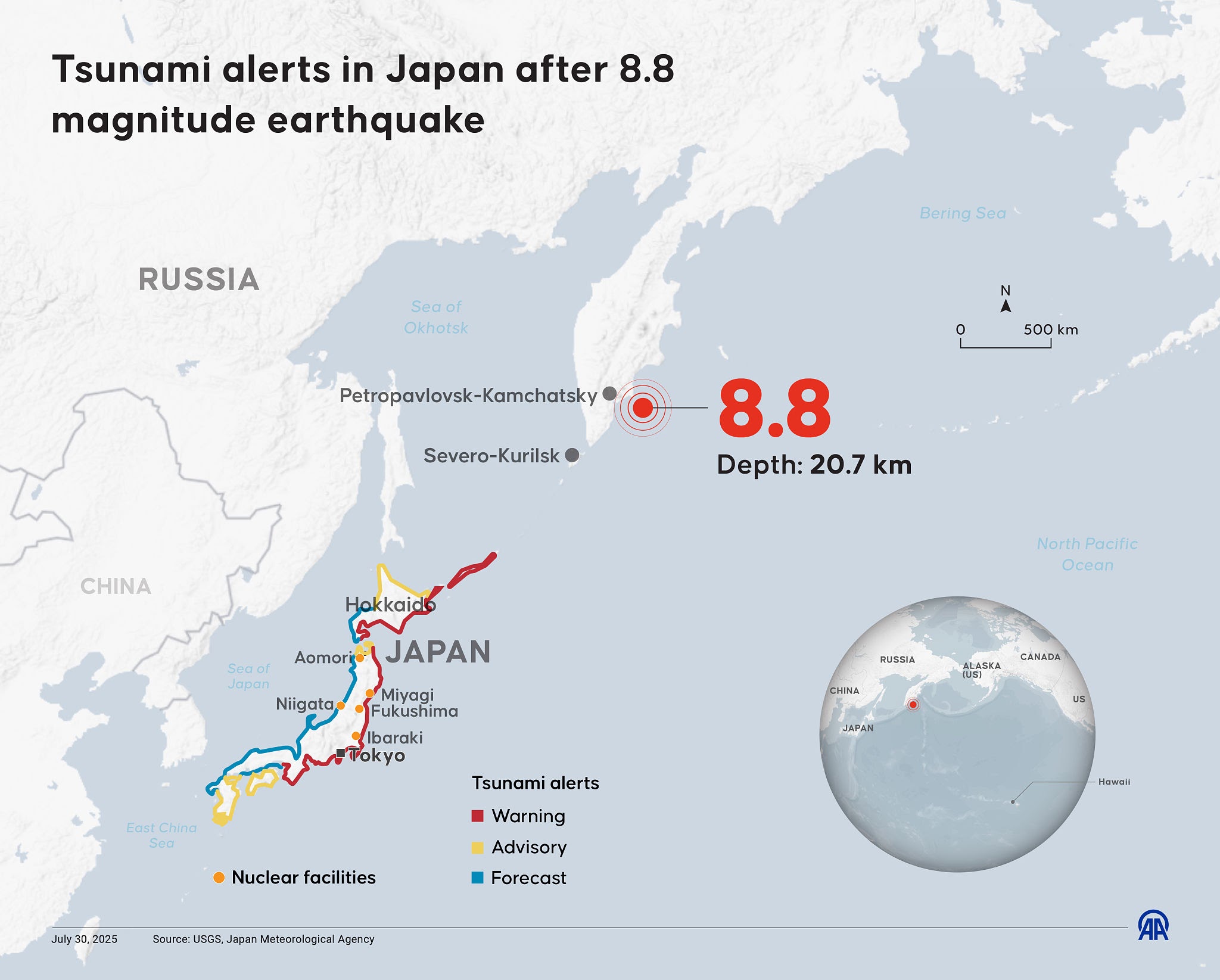
Why did this earthquake produce only minor ocean displacements rather than a devastating tsunami like the 2011 disaster?
“Because the July 28 temblor occurred primarily via horizontal strike-slip movement on an inland fault line rather than vertical thrust displacement on an ocean subduction trench, the displacement of the water column was minimal. However, JMA acted with total precaution.”
— Dr. Shinichi Sakai, Earthquake Research Institute, University of Tokyo
By 18:10 JST—roughly two hours after the mainshock—the JMA officially lifted all tsunami advisories after confirming that offshore tide gauges recorded negligible sea-level anomalies. Nevertheless, marine authorities continue to caution small boat operators against unpredictable tidal currents in narrow straits.
3. Structural Damage, Casualties, and Emergency Rescue Efforts
While the tsunami threat dissipated quickly, the land-based destruction across Kumamoto Prefecture has proven extensive, leaving public infrastructure severely damaged and municipal emergency services stretched to capacity.
A. The Aeon Mall Collapse and Explosion in Kashima
The most critical emergency scene unfolded in the town of Kashima, located just south of Kumamoto City.
During peak afternoon shopping hours, violent Shindo 6+ shaking caused the second floor of the Aeon Mall Kumamoto to collapse onto crowded lower retail levels.
Explosive Gas Leak: Moments after the initial ceiling collapse, a ruptured commercial gas line triggered a major explosion and fire inside the shopping complex.
Casualties & Trapped Victims: Emergency fire crews confirmed multiple fatalities inside the mall complex, including two women in their 20s. Over 55 shoppers sustained serious injuries, with dozens initially reported trapped beneath concrete slabs and heavy metal ductwork.
B. Industrial Failures and Residential Destruction
In the industrial port city of Yatsushiro, the shaking caused catastrophic structural failures:
Paper Mill Chimney Collapse: The heavy concrete smokestack of a large paper manufacturing factory operated by Nippon Paper Industries collapsed, killing two workers instantly and trapping nine others in debris.
Residential Home Collapses: Police departments across Kumamoto Prefecture confirmed that at least 12 homes collapsed entirely, with dozens more suffering severe wall fractures and foundation displacement.
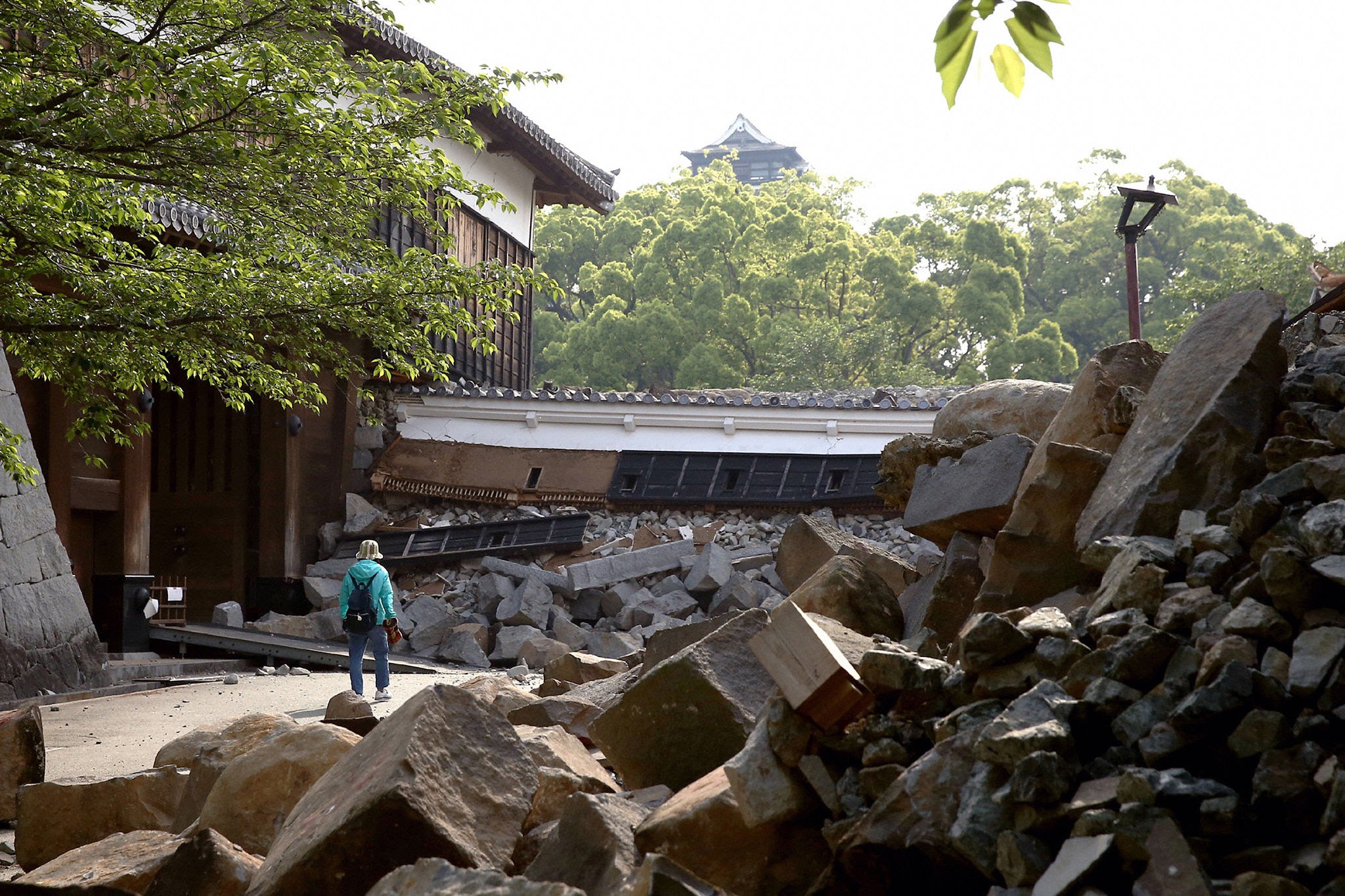
Heritage Damage at Kumamoto Castle: The centuries-old Kumamoto Castle—which underwent years of restoration following the 2016 earthquakes—suffered fresh damage when a section of its historical stone moat wall collapsed into the surrounding grounds.
C. Public Utilities and Transport Stoppages
The earthquake disrupted regional transport and power grids:
Power Outages: Kyushu Electric Power Company reported that over 45,000 households and commercial facilities lost electricity across Kumamoto and surrounding districts due to tripped substations and severed distribution lines.
Shinkansen Rail Suspensions: JR Kyushu immediately halted operations on all rail lines, including the Kyushu Shinkansen bullet train network between Hakata and Kagoshima-Chuo, to inspect track beds and overhead power gantries. A freight train derailed near Yatsushiro Station, though no crew injuries were reported.
D. National Government and JSDF Mobilization
Speaking from the Prime Minister’s Official Residence in Tokyo, Prime Minister Sanae Takaichi announced the immediate creation of an emergency cabinet task force.
The Ministry of Defense mobilized 3,600 personnel from the Japan Self-Defense Forces along with 20 reconnaissance aircraft and helicopters to conduct aerial damage assessments and support heavy urban search-and-rescue teams.
4. Tectonic Context: The Hinagu Fault and Kyushu’s Seismic Setting
To understand why Kumamoto experiences recurrent, damaging earthquakes, it is necessary to examine the complex tectonic framework of western Japan.
┌────────────────────────────────────────────────────────────────────────┐
│                   TECTONIC SETTING OF WESTERN KYUSHU                   │
├────────────────────────────────────────────────────────────────────────┤
│ 1. Major Tectonic Plates:                                              │
│    Eurasian Plate (Amurian Microplate) interacting with the encroaching │
│    Philippine Sea Plate subducting along the Nankai Trough to the east.│
│                                  │                                     │
│                                  ▼                                     │
│ 2. The Beppu-Haneyama Tectonic Depression:                             │
│    A major intra-arc rift zone stretching across central Kyushu,       │
│    housing active volcanic belts and major strike-slip faults.         │
│                                  │                                     │
│                                  ▼                                     │
│ 3. The Futagawa-Hinagu Fault Zone:                                     │
│    A continuous 100-kilometer fault system running from Aso Volcano   │
│    southwestward into the Yatsushiro Sea.                              │
└────────────────────────────────────────────────────────────────────────┘
Kyushu sits above a highly complex zone of continental extension and shear deformation. The island is sliced diagonally by the Beppu-Haneyama Tectonic Depression and the Futagawa-Hinagu Fault Zone, which absorb stress accumulating from the subduction of the Philippine Sea Plate.
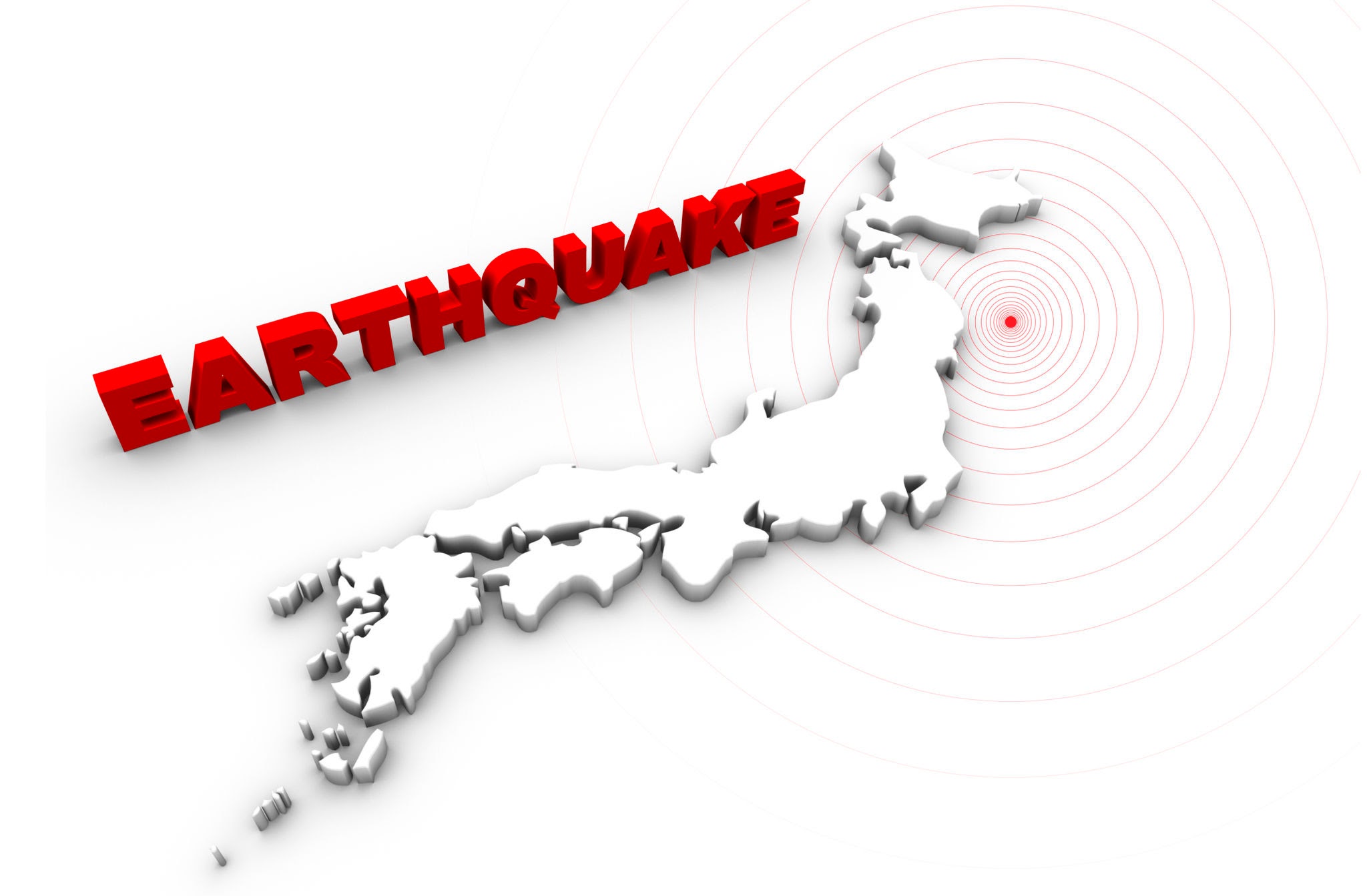
A. The 2016 Kumamoto Sequence Comparison
Local residents are intimately familiar with this fault network. In April 2016, the exact same fault system ruptured in an infamous foreshock-mainshock sequence:
April 14, 2016: A magnitude 6.2 foreshock struck the Futagawa-Hinagu fault zone.
April 16, 2016: A massive magnitude 7.3 mainshock struck 28 hours later, killing over 270 people and causing widespread destruction across Kumamoto and Aso.
The July 28, 2026 earthquake occurred on the southern extension of the Hinagu fault line, near Uki and Yatsushiro. Seismologists note that while the 2016 sequence ruptured the northern and central segments, the southern segment had retained accumulated strain—which was finally released in this latest M7.1 event.
5. Historical Analysis: Japan’s Major Earthquakes Over the Last 15 Years
Japan’s geographical position along the Pacific "Ring of Fire" makes it one of the most seismically active nations on Earth. Over the past 15 years, Japan has refined its engineering standards, early warning systems, and disaster response strategies following major earthquakes.
Master Comparison Matrix: Major Japanese Earthquakes (2011–2026)
| Date | Event Name | Magnitude | Max Intensity (Shindo) | Primary Cause / Fault | Key Impacts & Tsunami Details |
|---|---|---|---|---|---|
| March 11, 2011 | Great East Japan Earthquake | M9.0 | Shindo 7 | Japan Trench Subduction Zone | Massive 40m tsunami; 20,000 dead; Fukushima nuclear meltdown. |
| April 16, 2016 | Kumamoto Earthquakes | M7.3 | Shindo 7 | Futagawa-Hinagu Fault Zone | 270+ deaths; heavy destruction to Kumamoto Castle & roads. |
| September 6, 2018 | Hokkaido Eastern Iburi Quake | M6.7 | Shindo 7 | Intraplate Strike-Slip Fault | 40+ deaths; triggered island-wide blackout and massive landslides. |
| March 16, 2022 | Fukushima Off-Coast Quake | M7.4 | Shindo 6+ | Subduction Plate Boundary | 3 dead, 200+ injured; minor 30cm tsunami; power cuts in Tokyo. |
| January 1, 2024 | Noto Peninsula Earthquake | M7.6 | Shindo 7 | Reverse Fault (Sea of Japan) | 300+ dead; 6m uplift; widespread building & coastal damage. |
| August 8, 2024 | Hyuga-nada Sea Earthquake | M7.1 | Shindo 6- | Nankai Trough Boundary | Triggered Japan's first-ever "Nankai Trough Megaquake Advisory". |
| July 28, 2026 | Kumamoto Earthquake | M7.1 | Shindo 7 | Hinagu Fault System | 13+ dead; mall & factory collapses; 1m tsunami advisory lifted. |
6. Nuclear Safety Inspections and Power Grid Audits
Whenever a major earthquake strikes Japan, national attention immediately turns to the safety of the country’s nuclear power stations, reflecting the enduring legacy of the 2011 Fukushima Daiichi nuclear disaster.
A. Official Nuclear Regulation Authority (NRA) Report
Following the July 28 mainshock, Japan’s Nuclear Regulation Authority (NRA) conducted immediate physical audits across all nuclear facilities in Kyushu and neighboring western prefectures:
Sendai Nuclear Power Plant (Satsumasendai, Kagoshima): Located approximately 110 km south of the epicenter. Operating reactors Units 1 and 2 experienced ground shaking but reported zero operational abnormalities or coolant pressure drops.
Genkai Nuclear Power Plant (Genkai, Saga): Located northwest of the epicenter. All monitoring systems and spent fuel cooling pools continued normal operations.
Ehime & Ikata Plants (Shikoku): Monitored seismic sensors recorded minor shaking, with no radiation anomalies detected.
“No abnormalities in radiation monitoring or mechanical integrity were recorded at any nuclear power plant across Kyushu following the magnitude 7.1 tremor. Operating reactors continue to supply electricity safely to the regional grid.”
— Official Statement, Japan Nuclear Regulation Authority (NRA)
7. The Nankai Trough Threat: Why Seismologists Remain on High Alert
While the July 28 Kumamoto earthquake occurred on an inland active fault, geoscientists are closely evaluating whether crustal stress changes could influence neighboring subduction structures—most notably the Nankai Trough.
┌────────────────────────────────────────────────────────────────────────┐
│                   THE NANKAI TROUGH MEGAQUAKE PROFILE                   │
├────────────────────────────────────────────────────────────────────────┤
│ • Location: 800-km undersea trench running from Suruga Bay to Kyushu.   │
│ • Recurrence Interval: Great earthquakes (M8.0–M9.0) occur every       │
│   100 to 150 years (Last major events: 1944 Tonankai & 1946 Nankaido).   │
│ • Government Probability Estimate: 70% to 80% chance of an M8-M9       │
│   megaquake within the next 30 years.                                  │
│ • Projected Impact: Coastal tsunami waves exceeding 30 meters (100 ft) │
│   and potential loss of life exceeding 300,000 in worst-case scenarios. │
└────────────────────────────────────────────────────────────────────────┘
The memory of the August 8, 2024 Hyuga-nada earthquake (M7.1)—which prompted the JMA’s first-ever formal Nankai Trough Megaquake Advisory—remains fresh in Japan’s national emergency planning.
While JMA seismologists clarified that the July 28, 2026 Kumamoto event is an intraplate strike-slip quake rather than a subduction megathrust event, the agency urged residents across western Japan to maintain standard earthquake readiness kits over the coming week as strong aftershocks continue.
What You Need to Know: Key Takeaways
- The Event: A shallow M7.1 earthquake struck Kumamoto Prefecture in southern Japan at 16:27 JST on July 28, 2026.
- Maximum Shaking: Recorded the maximum Shindo 7 intensity in Uki and Hikawa, causing severe structural damage.
- Tsunami Status: A Tsunami Advisory for 1-meter waves was issued for Ariake and Yatsushiro seas, but was cancelled within two hours after negligible ocean displacement was observed.
- Casualties & Damage: At least 13 fatalities and hundreds of injuries reported. Major structural collapses occurred at the Aeon Mall Kumamoto in Kashima and a paper factory in Yatsushiro.
- Nuclear Safety: The Nuclear Regulation Authority confirmed zero abnormalities at the Sendai and Genkai nuclear power plants.
- Emergency Response: Prime Minister Sanae Takaichi’s government mobilized 3,600 JSDF military personnel and 20 aircraft for disaster relief operations.
For daily exam-oriented news analysis, current affairs, and comprehensive study notes, visit rrbcontents.com. Join our official Telegram channel @rrbcontents for daily updates and PDF downloads.
Master Current Affairs & World Events on RRBCONTENTS
Access structured study material, geography & polity notes, daily quizzes, and exam preparation resources.
Full Study Notes → Daily Current Affairs →Join our official Telegram channel for instant study resources: @rrbcontents