Home › Blog › Disaster Management › Nashik Godavari Flood
Nashik Godavari River Flood: First Major Inundation in 7 Years
Track Water Resources Department, Civil Defence, Fire & Emergency Services jobs on RRBCONTENTS Jobs Portal.
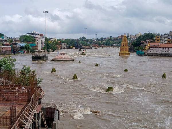
Key Takeaways & Summary
- 7-Year Flood Peak: Nashik experienced its first major flood event in 7 years following 193 mm downpours in Trimbakeshwar and Gangapur Dam discharge.
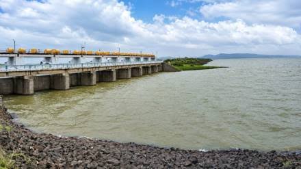
- Gangapur Dam Spill: Dam reached 98.26% capacity, discharging 14,407 cusecs into the Godavari, pushing city water flow to 24,000 cusecs.
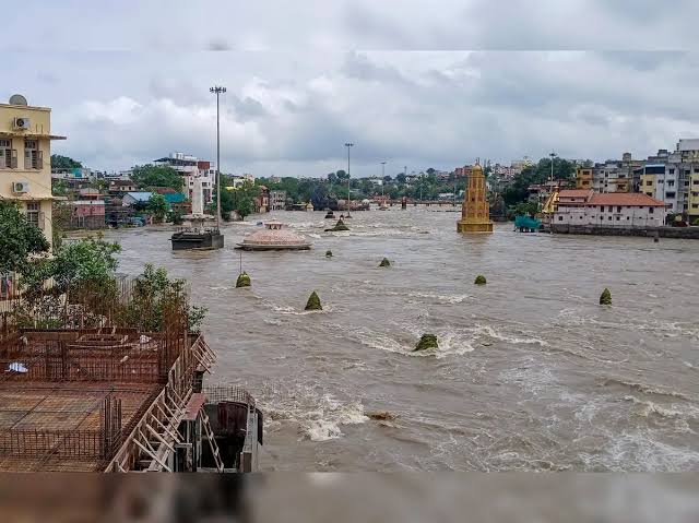
- Dutondya Maruti Benchmark: The traditional flood gauge idol at Ramkund was completely submerged under water for ~3 hours (3 AM to 6 AM).
- Rural Agriculture Impact: Crop submergence reported across Niphad, Saikheda, Chandori, with Nandur Madhmeshwar weir releasing 94,497 cusecs downstream.
Table of Contents
- 1. The Hydrological Triggers: Incessant Downpours & Catchment Saturation
- 2. The Dutondya Maruti Benchmark and Urban Inundation
- 3. Rural Inundation: Agricultural Losses and Cut-Off Villages
- 4. Disaster Governance, Casualties & Damage Analysis
- 5. Statistical Matrix: Nashik District Flood Data
- 6. High-Yield Exam Corner for Competitive Aspirants
- 7. Frequently Asked Questions (FAQ)
Swollen Godavari Crosses Danger Mark in Nashik: First Major Flood Event in 7 Years as Gangapur Dam Discharges Over 14,000 Cusecs
In a dramatic manifestation of the intense Indian monsoon season, the holy city of Nashik, Maharashtra, witnessed its first major riverine flood in seven years. Continuous torrential downpours across the Western Ghats and the upper catchment zones of the Godavari River basin forced dam authorities to open the floodgates of the Gangapur Dam, sending millions of cubic feet of surging water downstream into the heart of the city.
1. The Hydrological Triggers: Incessant Downpours & Catchment Saturation
2. The Dutondya Maruti Benchmark and Urban Inundation
In Nashik's cultural history, the Dutondya Maruti idol—a two-faced stone statue of Lord Hanuman located on the riverbed at Ramkund—serves as the city's informal, time-tested flood gauge.
Submergence of the Flood Gauge
Between 3:00 AM and 6:00 AM, the raging waters completely submerged the Dutondya Maruti idol. This marked the first time in seven years that the statue was entirely under water.
3. Rural Inundation: Agricultural Losses and Cut-Off Villages
In Niphad taluka, where the Godavari widens as it receives secondary streams, the water levels inundated key transportation infrastructure including Saikheda Bridge.
5. Statistical Matrix: Nashik District Flood Data
| Operational Parameter | Recorded Data / Official Figure |
|---|---|
| District 24-Hour Average Rainfall | 116 mm |
| Gangapur Dam Capacity & Water Discharge | 98.26% capacity; 14,407 cusecs released |
| Nandur Madhmeshwar Weir Discharge | 94,497 cusecs |
🎓 High-Yield Exam Corner for Competitive Aspirants (UPSC / State PSCs / SSC)
GS Paper 1: Physical Geography (Indian River Systems)
- Godavari River System: Originates at Trimbakeshwar (1,067 m) in Sahyadri range, Maharashtra. India's second longest river (1,465 km).
7. Frequently Asked Questions (FAQ)
What is the Dutondya Maruti in Nashik?
The Dutondya Maruti is a two-faced stone statue of Lord Hanuman located on the riverbed at Ramkund in Nashik that serves as the city's traditional informal flood level benchmark.
How much water was released from Gangapur Dam during the flood?
Authorities released 14,407 cusecs of water from Gangapur Dam as it reached 98.26% capacity, bringing the combined city river discharge to nearly 24,000 cusecs.
🚀 Master Physical Geography & Disaster Management!
Access complete UPSC Geography notes, river basin diagrams, and latest government job notifications on RRBCONTENTS.
Explore Jobs Portal Join @rrbcontents on Telegram