Home › Blog › Meteorology & Science › Typhoons vs Cyclones
Typhoons vs. Cyclones Explained: Atmospheric Science, Global Storm Basins, and Why Typhoon Noul Devastated Hong Kong
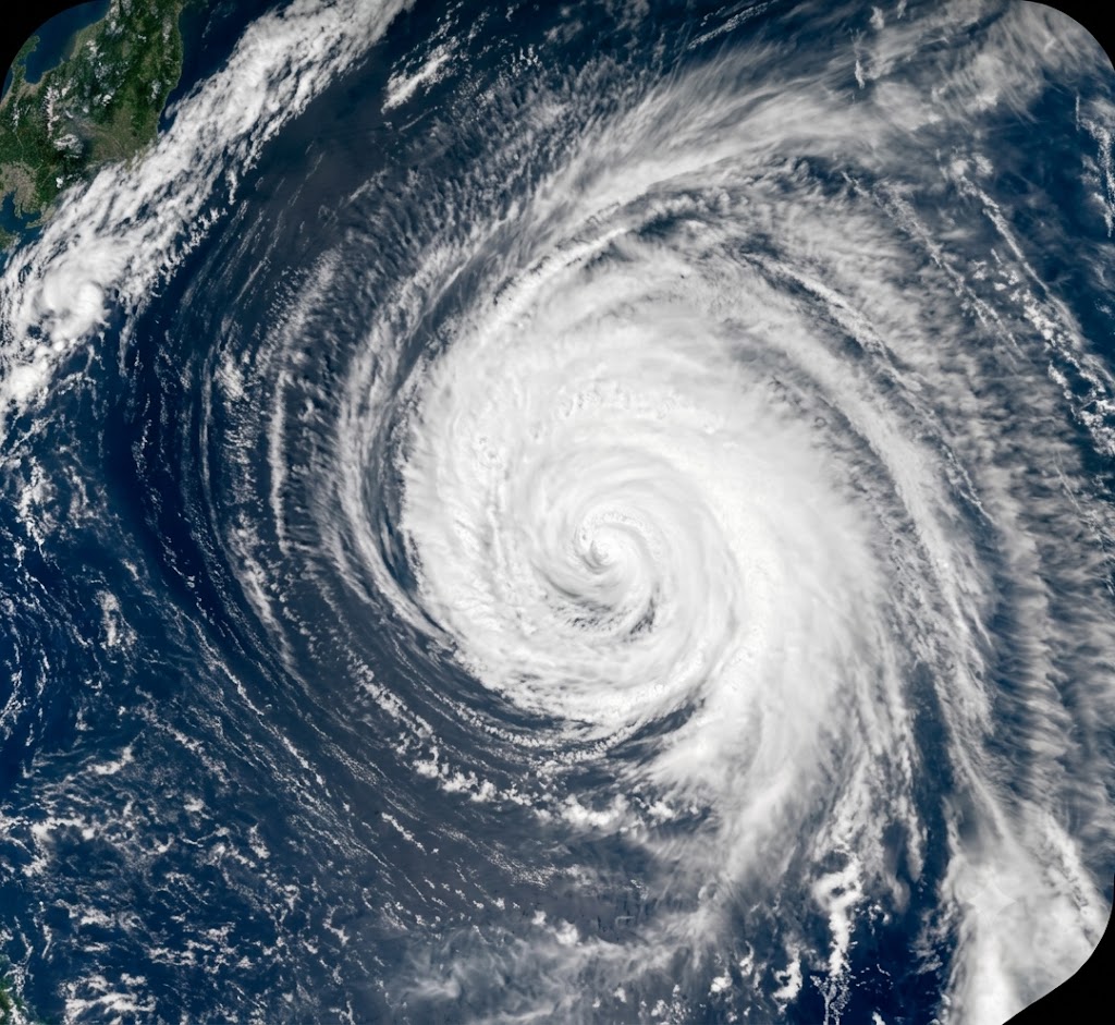
Key Takeaways & Summary
- Geographical Terminology: Typhoons, cyclones, and hurricanes are meteorologically identical tropical cyclones. Name differs solely by location: Typhoons (Northwest Pacific), Hurricanes (Atlantic/Northeast Pacific), Cyclones (Indian/South Pacific Oceans).
- Typhoon Noul Impact: In July 2026, Typhoon Noul swept past Hong Kong, forcing a No. 9 Signal alert, injuring 21 people, toppling 188 trees, causing 5 major floodings, and canceling 350 flights.
- Steering Mechanisms: Driven by a westward extension of the Western North Pacific Subtropical High (WNPSH) and warm South China Sea SSTs (>29.5°C).
- Mass Regional Evacuations: Over 801,000 people were evacuated across Guangdong province, China, to escape flash floods and mountain landslides.
Table of Contents
- 1. What Is a Typhoon? The Atmospheric Physics of Tropical Cyclones
- 2. Typhoon vs. Cyclone vs. Hurricane: What Is the Real Difference?
- 3. Master List of Recent Typhoons and Cyclones
- 4. Deep Dive: Why Did Typhoon Noul Strike Hong Kong?
- 5. Impact & Aftermath of Typhoon Noul on Hong Kong & Guangdong
- 6. Exam Relevance & UPSC Physical Geography Notes
1. What Is a Typhoon? The Atmospheric Physics of Tropical Cyclones
When severe tropical storms sweep across the ocean, they rank among the most powerful natural forces on Earth. In July 2026, Typhoon Noul swept through the South China Sea, forcing the Hong Kong Observatory (HKO) to issue high-level storm signals, injuring at least 21 people, toppling hundreds of trees, and stranding thousands of travelers at Hong Kong International Airport.
A typhoon is a mature, rapidly rotating tropical cyclone that forms in the Northwest Pacific Ocean. From a scientific standpoint, typhoons, cyclones, and hurricanes are the exact same meteorological phenomenon—a giant atmospheric heat engine driven by warm ocean waters.
How Tropical Cyclones Form
For a typhoon or tropical cyclone to form, several precise atmospheric and oceanic conditions must align simultaneously:
- Thermal Ocean Energy: Sea surface temperatures (SSTs) must exceed 26.5°C (80°F) down to a depth of at least 50 meters. Warm sea water evaporates rapidly, transferring latent heat into the atmosphere.
- Atmospheric Instability: The rising warm, moist air expands and cools, condensing into massive cumulonimbus clouds and releasing latent heat of condensation. This release of heat warms the surrounding air, making it lighter and causing it to rise further, which lowers atmospheric pressure at the ocean surface.
- Coriolis Force: The storm must develop at least 5° latitude away from the Equator (roughly 500 km north or south). The Earth's rotation creates the Coriolis effect, which imparts a spinning motion to the rushing air currents—counterclockwise in the Northern Hemisphere and clockwise in the Southern Hemisphere.
- Low Vertical Wind Shear: Vertical wind shear refers to changes in wind speed or direction at different altitudes. Low wind shear is required so that the storm’s vertical cloud column is not disrupted or torn apart.
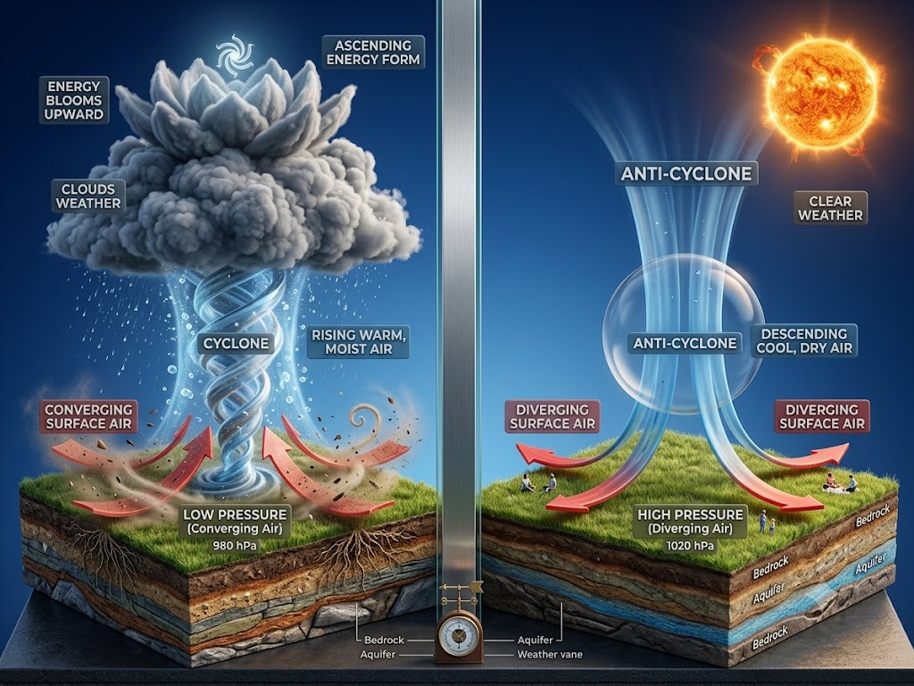
Anatomy of a Mature Typhoon
A fully developed typhoon consists of three distinct structural zones:
- The Eye: A circular zone of relative calm at the center of the storm, typically 30–65 km in diameter. Air slowly sinks inside the eye, keeping it clear of heavy clouds.
- The Eyewall: A ring of towering cumulonimbus clouds surrounding the eye. The eyewall contains the storm's most destructive winds, heaviest rainfall, and violent updrafts.
- Spiral Rainbands: Long bands of clouds and thunderstorms that dense outward from the eyewall, producing heavy rain, gusty winds, and localized tornadoes.
2. Typhoon vs. Cyclone vs. Hurricane: What Is the Real Difference?
The fundamental difference between a typhoon, a cyclone, and a hurricane comes down entirely to geography. They are localized names for the same phenomenon: a tropical cyclone with sustained wind speeds exceeding 119 km/h (74 mph).
Comparison Matrix: Basin, Terminology, and Monitoring Bodies
| Parameter | Typhoon | Cyclone / Tropical Cyclone | Hurricane |
|---|---|---|---|
| Primary Ocean Basin | Northwest Pacific Ocean (100°E to 180°E) | Indian Ocean & South Pacific Ocean | North Atlantic & Northeast Pacific Ocean |
| Regions Affected | Hong Kong, China, Japan, Philippines, Taiwan, Vietnam | India, Bangladesh, Sri Lanka, Australia, Madagascar | United States, Caribbean Islands, Mexico, Canada |
| Primary Monitoring Body | Japan Meteorological Agency (JMA) & JTWC | India Meteorological Department (IMD) / BoM | National Hurricane Center (NHC) |
| Peak Season | June to November (Year-round potential) | April–June & September–November (Indian Ocean) | June 1 to November 30 |
| Intensity Scale | JMA Scale / Super Typhoon (>185 km/h) | IMD Scale / Super Cyclonic Storm (>222 km/h) | Saffir-Simpson Scale (Category 1 to 5) |
| Rotation Direction | Counterclockwise (Northern Hemisphere) | Counterclockwise (North) / Clockwise (South) | Counterclockwise (Northern Hemisphere) |
3. Master List of Recent Typhoons and Cyclones
A. Northwest Pacific Basin (Typhoons)
- Typhoon Noul (July 2026): A powerful severe tropical storm that crossed the northern Philippines before sweeping through the South China Sea, forcing a No. 9 Signal alert in Hong Kong and making landfall in Guangdong, China.
- Typhoon Gaemi (2024–2025): A Category 4 equivalent super typhoon that produced extreme rainfall across Taiwan, the northern Philippines, and eastern China.
- Typhoon Ewiniar (Aghon): A severe tropical cyclone that hit the eastern Philippines before curving into the open waters of the North Pacific.
- Typhoon Bavi & Typhoon Maysak: Major East Asian typhoons that made historic landfalls along the Korean Peninsula and northeastern China.
- Typhoon Mawar (Betty): One of the strongest post-2020 super typhoons recorded in the Western Pacific, impacting Guam and the Philippine Sea.
B. North Indian Ocean Basin (Cyclones)
- Cyclone Senyar (2025): One of the deadliest and costliest tropical cyclones recorded in the North Indian Ocean, producing severe flooding across coastal regions.
- Cyclone Remal: A severe cyclonic storm that struck the Bay of Bengal coast between West Bengal (India) and Bangladesh, generating severe storm surges.
- Cyclone Tej & Cyclone Hamoon: Twin cyclonic systems that formed simultaneously over the Arabian Sea and the Bay of Bengal, impacting Yemen, Oman, and Bangladesh.
C. North Atlantic & South Pacific Basins (Hurricanes & Cyclones)
- Hurricane Melissa (2025): The most intense tropical system recorded globally in 2025, reaching a central minimum pressure of 892 hPa in the North Atlantic.
- Tropical Cyclone Grant (2025–2026): A long-tracked tropical system in the Australian and South Pacific regions, lasting 22 days.
- Tropical Cyclone Urmil (2026): A South Pacific cyclone recorded near American Samoa and neighboring island groups.
4. Deep Dive: Why Did Typhoon Noul Strike Hong Kong?
The trajectory of a tropical cyclone is governed by large-scale atmospheric steering winds. Typhoon Noul did not hit Hong Kong by accident; its path was determined by synoptic atmospheric drivers over the western Pacific and South China Sea.
The Western North Pacific Subtropical High (WNPSH)
The primary steering engine for typhoons in East Asia is the Western North Pacific Subtropical High (WNPSH)—a semi-permanent high-pressure system sitting over the Pacific. Clockwise winds around this high-pressure ridge act like a conveyor belt. In late July 2026, the southern flank of the WNPSH extended westward, creating a steering corridor that pushed Noul westward through the Luzon Strait directly into the South China Sea, putting Hong Kong, Macao, and Guangdong directly in its path.
Thermal Energy in the South China Sea
As Noul moved across the northern Philippines into the South China Sea, it encountered sea surface temperatures hovering between 29.0°C and 30.5°C. This thermal energy fueled thunderstorm development around the storm center, allowing Noul to reach peak intensity as a severe typhoon shortly before making its closest approach to Hong Kong.
5. Impact & Aftermath of Typhoon Noul on Hong Kong and Southern China
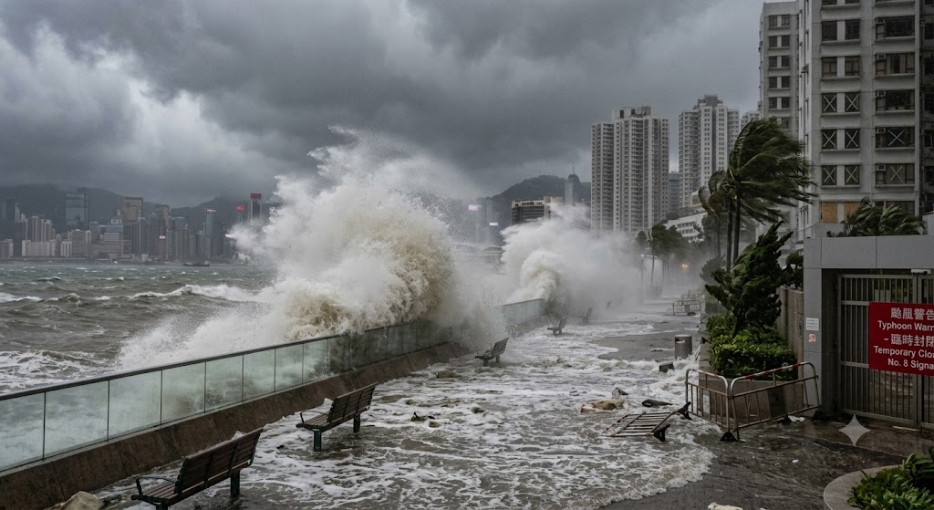
A. Escalation of Warning Signals by HKO
As Noul approached within 100 km of the city, the Hong Kong Observatory issued high-level emergency alerts:
- No. 9 Increasing Gale or Storm Signal: Raised as gale-force to storm-force winds swept across Hong Kong's offshore islands and elevated urban terrain.
- Downgrade to No. 8 and No. 3 Signals: As Noul made landfall in western Guangdong and moved inland, HKO downgraded the alert to Signal No. 8 at 7:10 AM, followed by Strong Wind Signal No. 3 at 12:40 PM.
B. Human Casualties and Injury Toll
According to emergency medical records released by the Hospital Authority, at least 21 people (including seven men and 11 women treated during initial hours) sustained storm-related injuries and required emergency hospital treatment across Hong Kong. The Home Affairs Department opened 29 temporary emergency shelters, providing safe accommodation for over 235 displaced residents.
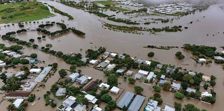
C. Infrastructure Damage, Tree Falls, and Flooding
- Toppled Trees: Emergency services received 188 reports of fallen trees, which blocked major roadways and damaged overhead power lines.
- Urban & Rural Flooding: The Drainage Services Department confirmed multiple serious flooding cases across the New Territories and urban sectors, deploying over 60 emergency response teams. Hard-hit zones included Sha Tau Kok Road near Tam Shui Hang, Fan Kam Road near On Po Village, Tung Tsz in Tai Po, Shek Wu Wai, and New Praya in Kennedy Town.
D. Transport and Aviation Disruption
The Hong Kong Airport Authority confirmed that approximately 350 flights were canceled, stranding more than 2,000 passengers at Hong Kong International Airport over the weekend. Maritime ferry services between Hong Kong, Macao, and mainland ports were suspended.
E. Broader Regional Impact: Guangdong and the Philippines
Chinese weather authorities evacuated and relocated more than 801,000 residents across Guangdong province to escape flash floods and mountain landslides. The National Development and Reform Commission allocated 100 million yuan ($14.8 million) in emergency recovery funds. In the Philippines, Noul's monsoon enhancement resulted in three fatalities and agricultural damage prior to entering the South China Sea.
6. Exam Relevance & UPSC Physical Geography Notes
UPSC & Competitive Exam Study Notes
GS Paper 1 (Geography): Tropical cyclone formation conditions (SST >26.5°C, Coriolis force, low wind shear), global ocean basins, atmospheric pressure systems (WNPSH steering).
GS Paper 3 (Disaster Management): Early warning alert systems, storm surge mitigation, evacuation protocols, Sendai Framework alignment.
Frequently Asked Questions
What is the primary difference between a typhoon, a cyclone, and a hurricane?
They are meteorologically identical tropical cyclones. The difference lies purely in geography: Typhoons form in the Northwest Pacific Ocean, Hurricanes in the Atlantic/Northeast Pacific, and Cyclones in the Indian Ocean and South Pacific.
Why did Typhoon Noul strike Hong Kong directly in July 2026?
A westward extension of the Western North Pacific Subtropical High (WNPSH) created a steering corridor that pushed Typhoon Noul across the South China Sea directly toward Hong Kong and Guangdong province.
What damage did Typhoon Noul cause in Hong Kong?
Typhoon Noul forced a No. 9 Signal alert, injured 21 people, toppled 188 trees, caused 5 major urban flooding events, stranded over 2,000 passengers with 350 canceled flights, and forced 801,000 relocations in Guangdong.
Sources: Hong Kong Observatory (HKO), Japan Meteorological Agency (JMA), Joint Typhoon Warning Center (JTWC), India Meteorological Department (IMD).
NEEDS DOUBLE-CHECK: none
Master Geography & Disaster Management on RRBCONTENTS
Practice past year questions, study mock papers, and explore comprehensive study guides.
Solve Geography PYQs → Explore Govt Jobs →Join our official Telegram channel: @rrbcontents